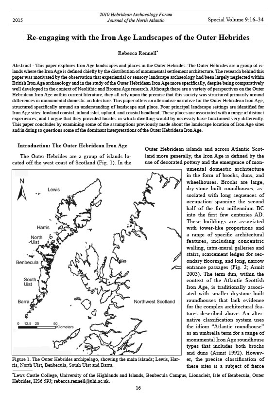
Journal of the North Atlantic
16
R. Rennell
2015 Special Volume 9
Introduction: The Outer Hebridean Iron Age
The Outer Hebrides are a group of islands located
off the west coast of Scotland (Fig. 1). In the
Outer Hebridean islands and across Atlantic Scotland
more generally, the Iron Age is defined by the
use of decorated pottery and the emergence of monumental
domestic architecture
in the form of brochs, duns, and
wheelhouses. Brochs are large,
dry-stone built roundhouses, associated
with long sequences of
occupation spanning the second
half of the first millennium BC
into the first few centuries AD.
These buildings are associated
with tower-like proportions and
a range of specific architectural
features, including concentric
walling, intra-mural galleries and
stairs, scarcement ledges for secondary
flooring, and long, narrow
entrance passages (Fig. 2; Armit
2003). The term dun, within the
context of the Atlantic Scottish
Iron Age, is traditionally associated
with smaller drystone built
roundhouses that lack evidence
for the complex architectural features
described above. An alternative
classification system uses
the idiom “Atlantic roundhouse”
as an umbrella term for a range of
monumental Iron Age roundhouse
types that includes both brochs
and duns (Armit 1992). However,
the precise classification of
these sites is a subject of fierce
Re-engaging with the Iron Age Landscapes of the Outer Hebrides
Rebecca Rennell*
Abstract - This paper explores Iron Age landscapes and places in the Outer Hebrides. The Outer Hebrides are a group of islands
where the Iron Age is defined chiefly by the distribution of monumental settlement architecture. The research behind this
paper was motivated by the observation that experiential or sensory landscape archaeology had been largely neglected within
British Iron Age archaeology and in the study of the Outer Hebridean Iron Age more specifically, despite being comparatively
well developed in the context of Neolithic and Bronze Age research. Although there are a variety of perspectives on the Outer
Hebridean Iron Age within current literature, they all rely upon the premise that this society was structured primarily around
differences in monumental domestic architecture. This paper offers an alternative narrative for the Outer Hebridean Iron Age,
structured specifically around an understanding of landscape and place. Four principal landscape settings are identified for
Iron Age sites: lowland coastal, inland islet, upland, and coastal headland. These places are associated with a range of distinct
experiences, and I argue that they provided locales in which dwelling would by necessity have functioned very differently.
This paper concludes by examining some of the assumptions previously made about the landscape location of Iron Age sites
and in doing so questions some of the dominant interpretations of the Outer Hebridean Iron Age.
Special Volume 9:16–34
2010 Hebridean Archaeology Forum
Journal of the North Atlantic
*Lews Castle College, University of the Highlands and Islands, Benbecula Campus, Lionacleit, Isle of Benbecula, Outer
Hebrides, HS6 5PJ; rebecca.rennell@uhi.ac.uk.
2015
Figure 1. The Outer Hebrides archipelago, showing the main islands; Lewis, Harris,
North Uist, Benbecula, South Uist and Barra.
Journal of the North Atlantic
R. Rennell
2015 Special Volume 9
17
debate, and remains as yet unresolved (Armit 1997a,
Harding 2004, Sharples 2006, Sharples and Parker
Pearson 1997, Sharples et al. 2004). Across Orkney,
a number of simple, thick-walled roundhouse
structures, associated with Early Iron Age dates
(ca. 800 BC–400 BC), have been interpreted as native
precursors to the broch tradition (Ballin-Smith
1994, Hedges 1987, Renfrew 1979, Sharples 1984).
However, the Early Iron Age remains fairly elusive
within the Outer Hebrides, and here the emergence
of monumental domestic architecture appears to be a
largely Middle Iron Age phenomenon (ca. 200 BC–
AD 400) (Armit 1990a, 1991). Both brochs and duns
are found widely across Atlantic Scotland, while
wheelhouses have a more discrete distribution, as
yet identified only in the Outer Hebrides and Shetland.
Wheelhouses are also drystone built roundhouses,
but are characterized by radial piers which
sub-divide the interior roundhouse space into small
bays, set around a central area (Fig. 3). The majority
of wheelhouses were revetted into the ground so that
they would have been occupied as semi-subterranean
buildings. Although not externally monumental
in the manner of the broch or dun, their elaborate
internal architecture suggests that wheelhouses were
also impressive, monumental buildings of their time.
There are examples of wheelhouses built into earlier
broch-type structures, both in the Outer Hebrides
(Armit 1998) and in Shetland (Hamilton 1956),
suggesting that wheelhouses replaced brochs as the
primary form of Iron Age dwelling. However, radiocarbon
sequences continue to extend the dates associated
with wheelhouse occupation from perhaps as
early as the 4th century BC (Barber 2003) into the 5th
centuries AD (Sharples 2012). Although questions
remain over the reliability of the earliest dates in this
sequence (ibid.), it has become apparent that there
was a significant degree of overlap between brochs
and wheelhouses in the Outer Hebrides, where they
are perhaps best viewed as broadly contemporary
Middle Iron Age settlements (Parker Pearson and
Sharples 1999:359).
The construction of brochs, duns, and wheelhouses
marks a change in attitudes to the home
and domestic architecture and is the culmination of
a process whereby monumental expression shifts
from more overtly “ritual” contexts to increasingly
“domestic” spheres of life (Armit and Finlayson
1992:670). A similar trend towards elaborate and
conspicuous Iron Age settlements can be identified
Figure 2. Dun Carloway, Lewis. A “classic” Iron Age broch..
Journal of the North Atlantic
18
R. Rennell
2015 Special Volume 9
within wider narratives of British prehistory (Haselgrove
and Pope 2007). Traditionally, brochs have
been interpreted as defensive structures (Childe
1935:204), a view still popularly held (Blythe
2005). However, over the last twenty years, purely
defensive explanations for these sites have been
increasingly challenged (Parker Pearson and Sharples
1999:350), reflecting wider trends within the
discipline (Fitzpatrick 1997; Hill 1989, 1995; Parker
Pearson 1996), and it is now more readily suggested
that the monumentality of these sites would have
represented social power, over and above the need to
defend territory (Armit 1997b:249), perhaps legitimized
through associations with earlier monumental
styles of architecture (Hingley 1996, 1999, 2005;
MacDonald 2008). Environmental change (Sharples
2006), population pressures (Armit 1990a), and economic
intensification (Dockrill 2002) have all been
cited as potential catalysts for this sudden desire for
monumental displays of power.
Largely as a consequence of the visual dominance
and impressive monumentality associated
with Middle Iron Age settlements, research in the
Outer Hebrides has tended to view and interpret Iron
Age society primarily through these buildings. Furthermore,
alternative interpretations of the relationship
between broch and wheelhouse communities
hinge largely upon debates about site classification
and associated problems of chronology. For example,
where sites are defined by a restricted number of
characteristics (MacKie 2006), the number of “true”
brochs remains small, leading to the interpretation
that these were elite residences, in comparison with
the more lowly wheelhouses (Parker Pearson and
Sharples 1999). Conversely, a more inclusive site
typology suggests that broch-type architecture may
have represented a fairly standard Iron Age dwelling
(Armit 2002). The Outer Hebrides offer unique
preservation conditions, which provides great scope
for reconstructing details of Iron Age life. For example,
extensive analysis of faunal and floral remains
(Bond 2002, Smith and Mulville 2004) and ceramic
residues (Campbell 2000, Campbell et al. 2004)
provide invaluable insight into Iron Age subsistence
and food-consumption practices. However, when the
data for the Outer Hebrides is considered as a whole,
Figure 3. One of the wheelhouses at The Udal, North Uist.
Journal of the North Atlantic
R. Rennell
2015 Special Volume 9
19
as yet there remains no clear distinction between
brochs, duns, and wheelhouses in this respect, and
instead these analyses point more readily towards
regional differences rather than site-type trends.
Nevertheless, the idea that differences in architecture
imposed the primary, underlying order to Iron
Age society persists, and frequently other forms of
material culture are forced to fit these predefined
categories.
Additionally, there has been a lack of interpretations
driven by an understanding of the archaeological
landscape. Notable exceptions include Scott’s
(1947) seminal paper “The problem of the brochs”,
Noel Fojut’s (1982) work on brochs in Shetland,
and Sharples and Parker Pearson’s (1997) discussion
of Iron Age landscapes across South Uist. What
remains absent, however, are specifically engaged
studies of sensory landscapes and the types of
landscape approach that are increasingly common
to other periods of British prehistory. While studies
of architectural space have begun to explore
the meaning and underlying structure of Iron Age
roundhouse dwellings (Foster 1989; Hingley 1984,
1995; Giles and Parker Pearson 1999; Parker Pearson
and Richards 1994; Parker Pearson and Sharples
1999:16–21), these buildings remain detached from
their landscape context. In fact, the view that Iron
Age dwelling constitutes the creation of meaningful
and symbolic spaces has not yet extended much beyond
the roundhouse wall. The scale and presence of
these sites demonstrate a considerable investment in
the Iron Age house, many in use over several generations.
Although rarely considered, this also involved
significant investment in place and the creation of
wider social landscapes. Occasionally, references
are made to the experiential qualities of Iron Age
site locations; the locations of Iron Age sites have
been described as “liminal” (Parker Pearson et
al. 2004:39) as well as “extreme” and “dramatic”
(Branigan and Foster 2002:84). In the absence of any
comprehensive study, however, it becomes problematic
when assertions about the experiential qualities
of place are used to reinforce arguments about the
structure of Iron Age society. In light of these observations,
my research set out to systematically
investigate Iron Age places and landscapes across
the Outer Hebrides, from a specifically experiential
landscape approach.
An Experiential Landscape Approach
The term experiential landscape archaeology
is used here to refer to research that explores the
experiential characteristics and sensory qualities
of archaeological landscapes and landscape locales
(or places). As an approach, experiential landscape
archaeology is grounded in social and spatial theories
that emphasize the importance of human scales
of experience. Although experiential approaches
tend to focus on more explicitly ritual or ceremonial
contexts (for example, Cummings and Whittle
2004, Cummings et al. 2011, Noble 2007), more
recently the relevance of this approach to everyday
or domestic settings has been increasingly explored
(Hamilton and Whitehouse 2006a, b; see also Rennell
2008). The importance of place and landscape in
the structuring of everyday life are ideas well developed
in Pierre Bourdieu’s (1977) Theory of Practice
and are encompassed in the term “dwelling” (Ingold
2000). Also of relevance is the work of sociologist
Anthony Giddens (1984) and the social geography
of Allen Pred (1984), both of whom develop upon
Hagerstrand’s theory of “Time-geography” and his
concern with the spatio-temporal character of daily
life. These ideas also articulate with a range of
phenomenological approaches within archaeology
(Tilley 1994, 2004) in which it is emphasized that
people come to know, understand, and act in the
world through their very physical experience of “being-
in-the-world” (Merleau-Ponty 1962).
Importantly, an interest in everyday experience
in the Outer Hebrides also requires that serious
thought is given to the island nature of these landscapes.
Despite a well-developed body of theory
relating to the archaeology of islands (Broodbank
2000, Noble et al. 2008, Rainbird 2007), these ideas
have yet to be fully integrated into our understanding
of the Outer Hebridean Iron Age. In the context
of my research, adopting an island approach meant
thinking about the way in which islands are defined,
perceived, and experienced and critically analyzing
the appropriateness of the island or group of islands
as a region of study (Rennell 2010a).
These arguments about place, landscape, and
islands informed the theoretical and methodological
framework for my research, which combined subject-
centered landscape survey and the use of GIS.
The subject-centered field survey involved engaging
with the Outer Hebridean landscape and investigating
and recording sensory qualities of Iron Age
places via a number of exploratory field practices.
In order to shift the emphasis away from architectural
typologies, the survey was not restricted to any
particular type of Middle Iron Age site, but explored
the full suite of monumental roundhouses associated
with this period: brochs, duns, and wheelhouses
(Fig. 4). An initial field survey was undertaken to
gather information about landscape location. This
Journal of the North Atlantic
20
R. Rennell
2015 Special Volume 9
approach included recording detailed descriptions
of the local topography, underlying geology, soil,
and vegetation, and an on-site assessment of environmental
changes that might have occurred over
the last two thousand years. As well as documenting
details about site location, records were made about
specific experiential qualities of place, in order to
test some of the assertions made within the archaeological
literature about the location of Iron Age sites.
This data included observations about visibility of
the sea, (Armit 1990b), the visibility of various environmental
zones (Cunliffe 1978; Parker Pearson et
al. 2004a, b), and scales of landscape visibility (Fojut
1982). A sub-sample of eight sites was then selected
for more detailed survey work. This follow-up effort
included field experiments designed to assess inter-
visibility and inter-audibility within these landscapes
and between Iron Age sites. GIS was used
as a subsequent means of mapping these places and
modelling aspects of visual experience.1 Continuous
viewshed models were generated as a method of
characterizing the potential visual experiences associated
with site locales. Continuous viewshed models
show the percentage of an area visible from all
locations within that area (Llobera 2003). In effect,
these models, based upon topographic data, provide
information on the visual qualities one is afforded
while moving throughout a specific landscape. A
series of cumulative viewshed models (Lake et al.
1998, Wheatley 1995) and heightened viewshed
models were generated to investigate the visibility of
roundhouse sites and the visibility from roundhouse
sites, using a series of hypothetic building heights.
When assessing the visibility of Iron Age sites in
the field, these experiments were restricted by the
preservation of each roundhouse, which in most
cases survived as mounds containing a few courses
of stone walling. Consequently, the field-based
research was unable to inform about the impact of
these buildings as specifically monumental structures.
Therefore, the purpose of the heightened and
cumulative view models was to explore how the potential
monumentality of these
buildings affected visual experience
within the landscape.
The overall methodology was
deliberately experimental, designed
to explore and develop
methods for experiential landscape
archaeology and, more
specifically, the potential for
combining subject-centered
field survey practices with the
use of GIS (for a more detailed
discussion of the experimental
methodology used, see Rennell
2009:Chapter 5, 2012).
By including the full range
of Iron Age sites from across
the Outer Hebrides, another
unique element of this research
was its geographical
breadth. Similar coverage of
the Iron Age material across
the Outer Hebrides has been
lacking since Ian Armit’s
(1992) publication of later
prehistoric settlement types
and in relevant chapters of his
later publication The Archaeology
of Skye and the Western
Isles (Armit 1996). Since these
publications, a large number
of excavations and survey projects
have been published that
contribute significantly to our
Figure 4. Distribution map showing the location of known broch, dun and wheelhouse
sites throughout the Outer Hebrides.
Journal of the North Atlantic
R. Rennell
2015 Special Volume 9
21
data indicates a decline in native woodland across
the islands from the early Holocene, with arboreal
species rapidly replaced by heathland vegetation
and the formation of peat (Birks and Masden 1979;
Bohncke 1988; Edwards and Brayshay 1996, 2000;
Edwards et al. 2000; Fossit 1996). By the Iron Age,
the island interior would have been defined by fairly
barren peat-based moorlands, dotted with small
lochs, giving way to more mountainous and rocky
areas on the east coast. In terms of these broad environmental
zones, the Iron Age landscape was similar
to the islands we find today (Fig. 5).
From as early as 400 BC, Iron Age communities
began building monumental roundhouses across
these island environments, creating a nexus of domestic
places that formed an integral part of the social
landscape. A large section of the Iron Age community
established their homes along the low-lying
coastal machair, an area that had been densely
occupied since the Late Bronze Age (Sharples et al.
2004). Iron Age communities also built roundhouses
within the island interior, on islets within inland
lochs. Increasing investigation suggests that islets
had been important places during the Neolithic,
which may have provided precedence for the establishment
of Iron Age settlements in these locations.
At the same time, a small number of monumental
roundhouses were built within upland landscapes or
on high coastal headlands. This range of locations
provided locales with distinctly different experiential
and sensory parameters, and dwellings in the
different types of locations would have functioned
in markedly different ways. In the following section,
I will describe some of the results of this research,
with reference to three of the case-study landscapes:
the Vallay Strand, a lowland coastal landscape in
North Uist (Fig. 6); Dun Bharabhat, an inland islet
site at Bhaltos, Lewis (Fig. 7); and the wheelhouse at
Cleitreabhal, within the upland landscapes of North
Uist (Fig. 8).
Lowland Coastal Landscape
Within lowland coastal landscapes, Iron Age
houses were built into the machair grasslands or
were located on islets within the lagoons or machair
lochs. In these parts of the landscape, houses tended
to be built in close proximity to one another, as at
the Vallay Strand. The Vallay Strand is a low-lying
area of coastal machair on the north coast of North
Uist, fronting a large area of inter-tidal sand flats
that separate the island of Vallay from North Uist
at high tide. During the Iron Age, however, this
inter-tidal zone was probably defined by expansive
understanding of the Outer Hebridean Iron Age.
To date, these projects have been largely discussed
within the context of smaller island regions: South
Uist (Parker Pearson and Sharples 1999), Barra and
associated islands (Branigan and Foster 2002), and
the Bhaltos peninsula, Lewis (Armit 2006, Harding
and Dixon 2000, Harding and Gilmour 2000). Based
upon my own research, and drawing upon this vast
dataset, the following section of this paper outlines
an alternative narrative for the Outer Hebridean Iron
Age structured around an understanding of place and
landscape.
A Landscape Narrative
The Iron Age environment in the Outer Hebrides,
forming the underlying skeleton to the social landscape,
was comprised of three distinct zones: rocky
coasts defined by thin acidic soils and sparse heathland
vegetation, coastal machair, and interior zones
of comparatively inhospitable peat-based moorland.
The machair is a unique type of ecological environment,
formed from wind-blown calcareous sands
and comprising a number of different landscape
elements, including dunes, grasslands, lagoons, and
hill machair (Angus 2001). The machair systems
probably began to take shape approximately 8000
years ago, formed through processes of erosion
and deposition caused by strong oceanic winds and
an excess of sand following deglaciation (Ritchie
1979). During the Iron Age, the machair defined
large parts of the west and northern coasts of the
islands and would have been the focus of agricultural
activity. However, since the Iron Age, erosion
and sea-level rise have caused extensive areas of
machair grasslands to flood and the coastline and
dunes to move progressively inland.
Evidence for sea-level rise (Ritchie 1966, 1979,
1985) suggest that during the Iron Age some current
islands, such as the islands of Uist, would have
been connected for large periods of the tidal cycle,
while others may have been linked by permanent
land-bridges. As has been widely acknowledged,
the island unit, although convenient for archaeologists,
does not necessarily correlate with the way in
which island communities interact with the spaces
around them and their experiences of island life.
This perspective is particularly pertinent in studies
of prehistoric communities. Instead, physical barriers
within the landscape are more likely to take the
form of mountain ranges, such as the mountains that
separate Harris from Lewis or the large hills on the
east coast of Uist, and large inland water systems,
such as Loch Be, also in South Uist. Pollen-core
Journal of the North Atlantic
22
R. Rennell
2015 Special Volume 9
Figure 5. Key environmental
zones across the Outer Hebrides
based on SNH landscape character
sssessment data.
Figure 6. Cumulative Viewshed model for Vallay Strand. Maps A and B show the location of the Vallay Strand and the
distribution of Iron Age roundhouses within this area. Map C shows the percentage of the surrounding landscape visible
from each location.
Journal of the North Atlantic
R. Rennell
2015 Special Volume 9
23
machair grasslands that have since flooded due to
rising sea levels and erosion of the coast. Along the
modern coastline of the strand are the remains of
three wheelhouses inserted into the remains of earlier
dun-type structures: Eilean Maleit, Garry Iochdrach,
and Cnoc a’Comdhalach. These sites were all
investigated by the antiquarian Erskine Beveridge
(1911) in the early part of the 20th century. In addition,
Eilean Maleit was partially excavated during
the 1990s, confirming Beveridge’s interpretation
of the site (Armit 1998). Pottery comparable with
material from wheelhouses at Cnip on Isle of Lewis,
Figure 7. Cumulative Viewshed model for Dun Bharabhat. Maps A and B show the location of the Bhaltos Peninsular and
the distribution of Iron Age roundhouses within this area. Map C shows the percentage of the surrounding landscape visible
from each location within this area.
Figure 8. Cumulative Viewshed model for Cleitreabhal. Maps A and B show the location of the Cleitreabhal and the distribution
of Iron Age roundhouses within this area. Map C shows the percentage of the surrounding landscape visible from
each location within this area.
Journal of the North Atlantic
24
R. Rennell
2015 Special Volume 9
the public and communal character of large parts
of these landscapes (Fig. 9A). Alternatively, the
closeness and lack of privacy may have meant that
boundaries between communities required strong
social expressions and concepts of territory, and land
ownership might have been emphasized in ways that
do not survive archaeologically. The continuous
viewshed models strengthen the interpretation of
these landscapes based upon field-survey data alone,
indicating fairly high visibility of the surrounding
landscape but also fluctuating and therefore
variable scales of visibility (Fig. 9). Hypothetical,
GIS-generated models of roundhouse visibility indicate
that within these low-lying landscapes there
was immense potential for increasing the visibility
of these sites by building outwardly monumental
roundhouses.
Tidal cycles would have dictated any shorebased
subsistence practices, such as the collection
of shellfish, shore-based fishing, and the collection
of seaweed for improving machair soils. Constant
sand movement, deflation and accretion, and the
general instability of coastal dunes would have been
major concerns. The importance of agricultural land
and the threat to these areas through longer-term
environmental changes would have increased competition
and claims to land between communities.
Seasonal cycles affecting the weather would also
have imprinted themselves on these places. Excavations
of several lowland coastal sites have indicated
that windblown sand was a persistent problem for
Allasdale on Isle of Barra, and Sollas on Isle of
North Uist point to occupation during the first few
centuries AD (ibid.). A possible wheelhouse is also
located further north still along the Vallay Stand
coastline, on the small headland at Geiriscleit. This
area also contains the remains of a number of earlier
prehistoric and later historic sites, including a
severely eroded Neolithic burial cairn located on
the edge of the current high-water mark (Dunwell
et al. 2003), a burnt mound and associated cellular
structures at Ceann nan Clachan (Armit and Braby
2002), as well as the remnants of numerous walls
and structures relating to an abandoned post-medieval
settlement.
Experiments in the field suggest that lowland
coastal landscapes, like the Vallay Strand, would
have been noisy and busy places to live. The sound
of people tending to nearby crops, animals, and children
and also the sound of the sea would have filled
these landscapes. From outside the roundhouse,
people would have been able to see other members
of the community working on the machair; tending
to crops, perhaps bringing animals back home for
slaughter. The sounds of people and their animals
at neighboring houses would have been heard on all
but the windiest of days and if not audible, then activities
around these places would have been highly
visible. There would have been limited privacy for
the occupants of these landscapes, and daily experiences
of these places would have strengthened the
strong social links between people, emphasizing
Figure 9. Panoramic photographs from: (A) Cnoc a’Comhdhalach, Vallay Strand, North Uist; (B) Dun Bharabhat, Bhaltos
Peninsular, Lewis; and (C) Cleitreabhal, North Uist.
Journal of the North Atlantic
R. Rennell
2015 Special Volume 9
25
have necessitated traversing a causeway, using a
boat, or wading through the water—very physical
experiences of the nature of separation from the
wider landscape. Although not the case at Bhaltos,
many islet settlements were remote or peripheral
to the more densely occupied lowland coastal landscapes,
and instead these places would have been
dominated by moorland environments. Proximity
to these environments suggest that communities
living on islets were likely to have been involved in
pastoral activities over other subsistence practices
that we associate with the Iron Age. The machair,
coast, and sea at the majority of islet sites would
have been some distance away and may well have
been regarded as peripheral, existing on the margins
of visual and audible communication. Therefore,
cultivation and care for these landscapes may not
have been principal concerns for the occupants
of islet sites. Hypothetical models of roundhouse
visibility indicate that these buildings would only
have marginally increased their visibility within the
surrounding landscape by constructing monumental
proportions, and in comparison with the machair
landscapes, there was limited potential for creating
visually impressive sites.
As with lowland coastal places, islet dwelling
would have encompassed dynamic characteristics—
excavation at Dun Bharabhat indicated that
the occupants regularly rebuilt the site in order
to combat the rising water levels (Harding and
Dixon 2000). Similar evidence was found at the
Neolithic islet site of Eilean Dòmhnuil in North
Uist (Armit 1996), indicating that these conditions
have persisted throughout prehistoric occupation
of these locales. Water levels will have changed as
a consequence of fluctuating periods of heavy rain
or drought, either on a seasonal basis or following
exceptional weather conditions. These transformations
would have affected the nature of these places
profoundly. The roundhouse may have been cut-off
from the shore for some if not lengthy periods of the
time, accentuating separation and removal from the
surrounding landscape. Water-based communications
were also potentially an intimate part of islet
dwelling in these parts of the landscape. Elsewhere
in the highlands, there is considerable evidence
for the use of log boats during this period (Mowat
1996), and given the suitability of these vessels to
the Outer Hebridean environment (McGrail 2001),
the lack of direct evidence should not preclude
discussions of the social implications of boat travel
within this island-based community (Farr 2006:90).
If the Iron Age occupants of these roundhouses had
access to log boats or other water-borne vessels, then
the occupants of these sites. At Cnip, the excavators
believe that adaptations to the original wheelhouse,
including an extended entrance passage and guard
cell, were modifications motivated by the need to
combat accumulating sands within the house (Armit
2006). Similarly, at The Udal, Crawford (ND) comments
on the problems of sand incursion at wheelhouse
B. Iron Age occupants of these lowland coastal
landscapes would therefore have been accustomed
to the dynamic nature of living in these places, and
this changing environment would have established
a particular tempo and series of concerns central to
living in these fragile machair locations.
Interior Islet Landscapes
By contrast, islet sites found within the island’s
interior would have been characterized by the restricted
nature of landscape visibility and experiences
of enclosure and isolation. Lochs within the island
interior, with their substantially defined banks, differ
from those on the coastal machair, which are often
more temporary bodies of water. The islet settlement
within Loch Bharabhat is a good example of this type
of site. This site was excavated during the 1980s as
part of an Edinburgh University-led research project
focusing on Later Prehistoric occupation at Bhaltos
(Armit and Harding 1990). This project included the
excavation of a broch at Loch na Beirigh (Harding
and Gilmour 2000), the wheelhouses at Cnip (Armit
2006), and the dun within Loch Bharabhat (Harding
and Dixon 2000). Another wheelhouse has been
identified on the Traigh na Berigh machair, and a
possible dun is located on the southern coast of the
peninsula (Fig. 7).
Although a number of broadly contemporary
Iron Age sites were built in fairly close proximity
to Dun Bharabhat, these other sites would not have
been visible from the islet, and the sound of people
at the nearby broch or wheelhouses, or people working
on the machair would not have been audible
(Fig. 9B). Similarly, the islet and the dun would have
been concealed or hidden from the surrounding landscape,
and people working in the wider landscape or
approaching this place would be invisible, beyond
the banks of the loch. The continuous viewshed
models generated for Dun Bharabhat highlight the
predominance of very low general visibility within
the landscape surrounding the islet (Fig. 7). Sounds
emanating from the roundhouse itself, even people
shouting, would have been contained within
the banks of the loch, echoing around the site and
further accentuating an impression of isolation and
seclusion. Access to areas beyond the islet would
Journal of the North Atlantic
26
R. Rennell
2015 Special Volume 9
this would have had a profound effect upon their
experiences, knowledge, and understanding of these
places and the wider landscape. The possibility that
islet dwellers were using boats also demands that we
review the concept of islet sites as detached or cutoff
from the surrounding landscape. Instead of experiencing
these places as physically or experientially
isolated, Iron Age people may well have regarded
these places as highly connected and dynamic locations.
These locations might also have provided Iron
Age occupants with links to other parts of the landscape
through the complex inland water systems that
would have dominated these Iron Age environments.
These alternative experiences and knowledge of
the landscape may well have reaffirmed differences
within the community between islet-dwelling and
lowland coastal-dwelling sections of this Iron Age
society.
Upland and Coastal Headland Sites
While the majority of the Iron Age community
appear to have created domestic places within lowland
coastal landscapes or on inland lochs, some
monumental architecture of this period was placed
within upland environments and on high coastal
headlands. These places shared a number of experiential
qualities that would have contrasted markedly
with places on the low-lying coastal machair zone
and the inland islets. For example, the wheelhouse
at Cleitreabhal is located on the slopes of a large hill,
providing extensive and uninterrupted views of the
wider landscape, as well as extensive views out to
sea (Fig. 9C). However, despite these visual qualities
and immediate proximity, these would not have
been places from where the sea was easily accessed.
The cumulative viewshed model for Cleitreabhal
highlights limited visibility of the local landscape
in contrast with the extensive views of regional and
distant locales (Fig. 8).
These fairly anomalous locations present the possibility
that these sites functioned in very different,
perhaps non-domestic, ways despite apparent similarity
in architecture. The relationship between the
wheelhouse at Cleitreabhal and the earlier chambered
cairn (Scott 1935) perhaps indicates that this site had
a special meaning or function with Iron Age society.
Discussion
The narrative presented above has attempted to
convey how Iron Age people might have engaged
with the landscapes and places that they inhabited.
I have offered an additional schema for investigating
the structure of Iron Age society based on the
sensory qualities of Iron Age places and landscapes
and argue that these places provided locales in
which dwelling would by necessity have functioned
very differently. The results of the field survey and
GIS-based modelling are summarized in Tables 1
and 2. The results of this research also questions
some of the assumptions previously made about the
landscape location of Iron Age sites and offers an
alternative perspective on this Iron Age society.
Iron Age sites, environment, and subsistence
practices
Parker Pearson and Sharples (1999:363) suggest
that wheelhouse-based communities were closely
tied to arable cultivation. In contrast, they envisage
a broch-dwelling elite living in comparatively
“marginal” areas of the landscape and engaged more
immediately with pastoralist practices. Currently,
however, there is an absence of evidence for brochs,
Table 2. Summary of GIS results by landscape location.
Lowland Coastal Islet Upland Coastal Headland
Continuous viewshed models
General landscape visibility High Low to mod Low High
Variation in landscape visibility Mod to high Low to mod Low High
Heightend viewshed models Significant Limited N/A Moderate
Cumulative viewshed models Significant Limited N/A Significant
Table 1. Summary of field survey results by landscape location.
Lowland Coastal Inland Islet Upland Coastal Headland
Inter-visibility between Iron Age site and surrounding landscape (>5 km) Mod Low Low Mod
Inter-audibility between Iron Age site and surrounding landscape (>5 km) High Low Low Low
Inter-visibility with nearby sites (>5 km) High Low N/A Mod
Inter-audibility with nearby sites (>5 km) High Low N/A Low
General description of landscape locale (>5 km) Local scale views, Intimate, Divided Open, exposed
variable experiences hidden
Journal of the North Atlantic
R. Rennell
2015 Special Volume 9
27
other complex roundhouses, duns, or wheelhouses
differing in terms of the scale of agricultural activities.
Wheelhouses, it is rightly observed, tend to be
located on the machair, which would have provided
the most suitable soils for cultivation; historically,
the machair has been the focus of agriculture across
the islands (Boyd and Boyd 1990, Lawson 2004) and
was also likely the prime location for agricultural
activities from as early as the Neolithic (Armit and
Finlayson 1992, Mills et al. 2004). However, brochs
and duns are also closely associated with these types
of landscape, and across the Outer Hebrides as a
whole, a direct correlation between architectural
typology and environmental/economic landscape
zones was not found to be the case. In fact, a principal
outcome of this research is the observation that
types of place and landscape cross-cut architectural
classification systems (Table 3). The types of place
identified as “lowland coastal” tended to be sites established
in close proximity to fertile machair grasslands,
suggesting that agricultural practices would
have been important to the subsistence practices of
these communities. My research also highlighted
strong sensory relationships between roundhouses
in these areas and what would have been cultivatable
machair surrounding these places. Many Iron Age
houses (e.g., wheelhouses) were constructed so that
they were physically embedded in the machair soil.
Perhaps similarly, at Dun Mhulan midden material
was allowed to accumulate outside the doorway of
the broch, eventually reaching up to 2m in height
(Parker Pearson and Sharples 1999). Midden material
from these houses was almost certainly used
to fertilize and improve the soils. These practices
would have emphasized the conceptual links between
the home and the agricultural potential of the
surrounding landscape.
In contrast, sites located on inland islets would
have been distant from the focal points of Iron Age
agriculture and in this respect would have been relatively
remote and isolated from these other areas
of occupation. Instead, it is likely that the occupants
of these sites would have focused on pastoral subsistence
practices—moving cattle and sheep among
grazing land and perhaps bringing them into the islet-
dwelling for winter byre or slaughter as suggested
by some excavations (Harding and Dixon 2000,
Parker Pearson and Sharples 1999). Historically,
islets have been used to segregate sections of grazing
herds at certain times of year, hence place names
within the Outer Hebrides such as “Soay”, meaning
“Goat Island” (Lawson 2004), and this nomenclature
suggests other ways in which islet landscapes might
have served a pastoral-based community. Alternatively,
the occupants of these sites would have had
stronger links with the moorland and potentially,
via interconnecting waterways, with the east coast
and moorland areas even further afield. Living in
these different parts of the landscape, the tempo and
catalysts for environmental change would have been
profoundly different to those affecting communities
dwelling within the lowland coastal landscapes.
These different subsistence practices and environmental
concerns would have distinguished these
communities and may have encouraged the development
of distinct senses of identity. Importantly,
this research suggests that differences within Iron
Age society were not necessarily structured solely
around choices in architecture, but also potentially
related to the types of landscapes in which people
made their homes and carried out their daily lives.
Although Parker Pearson and Sharples’ (1999) interpretation
represents an accurate assessment of the
Iron Age landscape across South Uist, this model of
Iron Age society is far less convincing when transposed
to neighboring island regions, such as North
Uist and Lewis. In particular, across North Uist, the
west coast distribution of sites is not as emphasized
as it is in South Uist, and here the distribution of
brochs and wheelhouses does not betray this distinct
relationship with these environmental zones.
Although wheelhouses have not been identified on
inland islets, they are found in the uplands as well as
low-lying coastal landscapes, while brochs and duns
were built in all of the four types of landscape location,
suggesting that subsistence practices cross-cut
existing classifications of Iron Age site types.
Island landscapes
As well as affording specific associations with
the various environmental zones across the Outer
Hebrides, the locations of Iron Age sites also likely
Table 3. Experience of place according to landscape location.
Uninterrupted views Good visibility
No. of sites of the sea and of local Sense of Atlantic roundhouse
surveyed wider landscape context landscape enclosure Broch Dun Wheelhouse
Upland 16 X X X X
Coastal headland 10 X X X -
Lowland coastal 32 - X X X X
Inland islet 94 - - X X X -
Journal of the North Atlantic
28
R. Rennell
2015 Special Volume 9
presumably focused towards more local concerns.
Both interpretations can be reconciled within this
study of place and landscape, suggesting that Iron
Age society was complex and potentially incorporated
varying social perspectives, identities, and social
practices.
The contrast between occupation of the low-lying
Atlantic coasts and dwelling within the more
easterly, island moorlands adds a further dimension
to Iron Age settlement patterns. A prevailing characteristic
of the Outer Hebridean island geography is
the vital contrast between the Atlantic west coast and
the Minch coast on the east and the potential these
areas of the island landscape would have afforded
Iron Age communities. Generally, the east coast
would have provided the principal areas for sheltered
and safe anchorage and thus the opportunity
for seafaring practices, perhaps relating to subsistence
such as deep-sea fishing, although evidence
for this is largely absent from the archaeological
record, or as means of communicating and accessing
wider areas for social reasons. In contrast, the west
coast of the Outer Hebrides would have provided
minimal opportunities for accessing the sea by boat,
but greater potential for a range of shore-based subsistence
activities such as collecting shellfish and
gathering seaweed and driftwood. The east and west
coasts would also have afforded distinctly different
opportunities for sensory experience. Across the Atlantic,
there is little between the Outer Hebridean islands
and the American continent, and this setting in
combination with a prevailing westerly wind, makes
for a distinctively exposed and windswept western
coastline. In comparison, while the landscape of
the east coast is far more rugged, the sea across the
Minch is less volatile, and this coastline is significantly
more sheltered. The major townships across
the islands—Castlebay, Lochboisdale, Lochmaddy,
Tarbet, and Stornoway—are all located on the east
coast. Today, these places function as important harbors
for the fishing industry as well as serving the
major ferries between the islands and the mainland.
In light of these differences, the density of Iron
Age occupation on the western coastline, within
what has been defined as lowland coastal landscapes,
prompts a number of questions. These sites
appear not to have been located in places where
people could easily view or monitor the sea. Neither
were these places associated with natural bays or
harbors, and it is unlikely then that experiences of
living in these landscapes provided an intimate link
with the sea, beyond the shore and coastline. Nevertheless,
the sea and coast would have been within
accessible distances. People would have been able
to hear the sea as well as sea birds, and the smell of
conveyed distinct experiences and relationships
with the wider island landscape. In particular, there
appears to have been a contrast between Iron Age
places dominated by views of the immediate locality
and with an inward/landward focus (primarily
lowland coastal and islet sites) and a minority of
places with views of the regional and distant landscapes
and specifically outward/seaward looking
perspectives (coastal headland and upland sites) (Table
4). In the case of the former, we might envisage
a specifically local understanding and knowledge of
landscape, with everyday experiences reinforcing
local, perhaps intra-island identities. Similarly, daily
activities might have been increasingly focused
within the immediate landscape, perhaps relating to
increasing investment in the immediate locality and
the intensification of localized subsistence practices.
In comparison, a smaller section of this Iron Age
society, living in places with wider views of the regional
landscape and perhaps extensive views out to
sea, might have associated themselves with a larger
social group—perhaps through seafaring activities
developing inter rather than intra-island concerns
and identities. Within coastal headland and upland
landscapes, daily activities had the possibility of
taking place within a wider area, perhaps involving
subsistence practices taking place further afield or
the procurement or movement of materials from
“other” places. Similarly contrasting interpretations
have been drawn from more traditional analysis
of Iron Age material. For example, both decorated
ceramics and monumental domestic architecture
indicate a high degree of cultural contact between
the Outer Hebrides and other island regions within
Atlantic Scotland during this period. Henderson
describes how contact enabled this area to become a
“recognisable zone, prone to simulating itself, (and)
creating broad similarities over long distances”
(Henderson 2000:150), suggesting an active relationship
between island communities and perhaps
a sense of shared inter-island regional identity. Alternatively,
Armit comments on the relative dearth
of imported Iron Age items, pottery or otherwise,
within the Outer Hebrides and highlights distinct
sequences in the development of monumental architectures
that distinguishes the Outer Hebrides from
wider Iron Age processes, as indicative of a progressively
“inward looking island people” (Armit 1996)
Table 4. Contrasting scales of island experience.
Local experiences Regional experiences
Land Sea
Intra-island identity Inter-island identity
Local material culture Regional material culture
Journal of the North Atlantic
R. Rennell
2015 Special Volume 9
29
to the themes raised in association with an “Island
Approach”, it appears that islet sites, like islands
more generally, can be understood to combine elements
of isolation and connectivity. These locations
might also have provided Iron Age occupants of
these sites with links to other parts of the landscape
through the complex loch and sea-loch systems that
would have dominated these Iron Age environments.
These alternative experiences and knowledge of the
landscape may well have reaffirmed differences between
islet-dwelling and lowland coastal-dwelling
sections of this Iron Age society.
Monumental architecture and place
This investigation into place and landscape experience
also questions some assumptions frequently
made about how Iron Age communities engaged
with monumental architecture. While brochs were
constructed to be highly visible and imposing from
the outside, wheelhouse sites were comparatively
modest buildings in this respect, yet similarly monumental
when viewed (or experienced) from within. It
has therefore been suggested, with reference specifically
to the location of Iron Age sites on the Bhaltos
peninsula, that wheelhouse sites were hidden within
the landscape, while Atlantic roundhouses were built
within more prominent places (Armit 2006:256).
However, my research suggests that the locations of
Iron Age sites provided quite different experiences.
Wheelhouse sites, predominantly located within
lowland coastal landscapes, were not found to be
within “hidden” locales. Instead the field survey
indicates that these places were highly communal,
easily accessible, and relatively exposed places in
the landscape. Brochs were found within a wider
variety of locales; however, sites built on islets within
freshwater lochs, such as Dun Bharabhat on the
Bhaltos peninsula, tended to be concealed within the
landscape. Analyzing the visibility of roundhouses
using varying height models within a GIS suggests
that even built to a height of 10 m (unlikely dimensions,
given the small diameter of Dun Bharabhat)
these places would still not have achieved the prominence
that has hitherto been described. This finding
suggests that brochs, when built on islets like Dun
Bharabhat for example, did not always function as
visually imposing sites. In contrast, brochs built
within lowland coastal and coastal headland settings
would have had much greater potential for visual
prominence. If the establishment of monumental domestic
architecture during the Iron Age is regarded
as a symbolic means of legitimizing rights to land,
demonstrating ownership, and local identity (Armit
1997b), how do these interpretations of place further
inform our understanding of Iron Age society? Perseaweed
and salt in the air would have been a constant
reminder of the sea’s proximity. Shell middens
associated with lowland coastal sites produce high
proportions of whelk (winkle) and limpet shells that
could have been collected by Iron Age communities
from these westerly shores. Evidence for deep-sea
fish is minimal across all Iron Age sites. The fish
bone assemblages from the Middle and Late Iron
Age sites at Dun Mhulan and Bornais, for example,
are dominated by small saithe, suggesting smallscale
subsistence fishing practice, probably carried
out largely from the shore (Cerón-Carrasco 1999,
Ingrem 2012). However, a general lack of fish-bone
analysis and minimal strategies for fish-bone retrieval
during excavation, mean that these results require
some further attention. On the basis of location,
however, it is unlikely that these communities had an
intimate relationship with the sea, beyond the confines
of the shore. In contrast, communities located
on the east coast would have had greater potential
for accessing the sea, involvement in sea-based as
opposed to shore-based subsistence practices, and
contact with mainland communities. Table 5 summarizes
some of the contrasting experiences, concerns,
and activities associated with east and west island
settlement.
Water-based communications were also potentially
an intimate part of islet dwelling in these parts
of the landscape. Little consideration has previously
been given to the use of boats in association with
these sites, perhaps on the basis that causeways precluded
their necessity. However, access to log boats
or other water-borne vessels by Iron Age occupants
of these roundhouses would have had a profound effect
upon their experiences, knowledge, and understanding
of these places and the wider landscape via
the complex maze of inland lochans, sea lochs, and
the sea itself. The possibility that islet dwellers were
using boats also demands that we review the concept
of islet sites as separated or cut-off from the surrounding
landscape. Instead of experiencing these
places as physically and experientially isolated, Iron
Age people might well have regarded these places as
highly connected and dynamic locations. Returning
Table 5. Contrasting experiences of east and west coast dwelling.
West East
Atlantic Minch
Land/coast Sea/Water
Agriculture Pastoralism
Shore collection Deep sea fishing?
Machair Moorland
Lowland coastal Islets
Public Private
Links with mainland
Journal of the North Atlantic
30
R. Rennell
2015 Special Volume 9
reuse of available stone. The fact that the entrance
to the chamber is maintained in the construction
of this site supports this interpretation. Crawford
(2002:127–128) has proposed that wheelhouse sites
had specifically “religious” as opposed to domestic
functions within Iron Age society. He draws attention
to evidence for votive deposits and to specific
elements of their architecture that he describes as
analogous to church or amphitheatre structures. Yet
wheelhouse excavations clearly demonstrate that
these sites were domestic buildings, occupied over
long periods of time, associated with a range of
recognizable “domestic” practices, albeit alongside
distinctively “ritual” behavior (Armit 2006, Barber
2003, Campbell 1991, Parker Pearson and Zvelebil
2014, Rennell 2010b, Sharples 2012). However, it
may well transpire that not all wheelhouse sites were
used primarily for domestic purposes and that different
uses of these buildings may have been deemed
more appropriate in certain landscape settings.
Conclusions
This paper has presented some alternative approaches
to interpreting Iron Age society in the
Outer Hebrides. I have identified a number of
different ways in which Iron Age sites were positioned
in the landscape and have explored the
variation of Iron Age experiences associated with
these places. I have suggested that differences in
the everyday experience of these places provided
alternative perspectives on the wider landscape. I
have also pointed out different ways in which monumental
architecture might have been experienced,
suggesting that creating visually imposing settlements
was not always a primary concern. In conclusion,
I argue that people’s everyday experiences
and perspective of the wider social landscape were
as important to Iron Age communities as similarities
or differences in the use of architectural styles.
Furthermore, these differing experiences affected
the manner in which communities identified themselves,
played out their day-to-day lives, and structured
social relationships.
Acknowledgments
This paper is based on research carried out as part of
my doctoral thesis at the Institute of Archaeology, University
College London. This research was funded by the
AHRC and the Graduate School at the University College
London. I would like to thank my supervisors Professor
Sue Hamilton and Dr. Mark Lake for helping me develop
this research. I would also like to thank the two anonymous
reviewers for their valuable feedback and constructive
comments.
haps certain Iron Age communities sought to actively
harness these senses and experiences of isolation
associated with islet locations in order to separate
themselves from other parts of the community and
to reinforce and maintain their identity. Therefore,
the creation of domestic places within certain parts
of the landscape might have been a strategy, alongside
the establishment of distinctively elaborate and
monumental architecture, for demonstrating local
power.
The relationship between Iron Age sites and earlier
monuments may also have played a role in the
establishment of monumental architecture during
the Iron Age. There is growing evidence to suggest
that Iron Age communities across Atlantic Scotland
had a particular fascination and interest with these
ancestral landscapes (Hingley 1996, 1999, 2005;
MacDonald 2008; Sharples 2006). In particular, the
conspicuous chambered cairn monuments of Early
Neolithic communities may have had a particular
significance for Iron Age people. Across Orkney,
at least three recently excavated Maes-Howe type
tombs revealed Early Iron Age roundhouses built
within the Neolithic structures (MacDonald 2008).
Elsewhere in the Outer Hebrides, two Neolithic
burial tombs were reused as locations for Iron Age
roundhouses, and there is evidence that a number of
tombs were disturbed and perhaps re-used during
this period (Hingley 1996, 1999; Sharples 2006). In
fact, it has been argued that Iron Age monumental
domestic roundhouses across Atlantic Scotland,
brochs in particular, were built with direct reference
to the architectural forms of Early Neolithic burial
monuments, using links with the past to legitimize
a new social order (MacDonald 2008). Iron Age
places were obviously created within a landscape
that was already embedded with places of meaning,
significance, and culture. The burial monuments of
Early Neolithic communities, for example, would
have been prominent visual markers in the Iron Age
landscape. Similarly, the islet settlements of very
early island communities such as Eilean Dòmhnuill
and Eilean an Tighe, both on North Uist, were also
perhaps recognizable places within the Iron Age
landscape and may well have acted as templates for
Iron Age islet settlements.
The wheelhouse at Cleitreabhal is another example
that points to a relationship between Iron Age
sites and earlier landscape features. The uniqueness
of the landscape location of this wheelhouse and
the sensory qualities, landscape associations, and
removal from other areas of Iron Age settlement,
suggest that the re-use of the early chambered cairn
was a deliberate and defining factor in the construction
of this roundhouse rather than a fortuitous
Journal of the North Atlantic
R. Rennell
2015 Special Volume 9
31
Beveridge, E. 1911. North Uist: Its Archaeology and
Topography (Paperback edition 2001). Birlinn, Edinburgh,
UK.
Birks, H.J.B., and B.J. Madsen. 1979. Flandrian vegetational
history of Little Loch Roag, Isle of Lewis,
Scotland. Journal of Ecology 67:825–842.
Blythe, I. 2005. A military assessment of the defensive
capabilities of brochs. Pp. 246–253, In V.E. Turner,
R.A. Nicholson, S.J. Dockrill, and J.M. Bond (Eds.).
Tall Stories? 2 Millennia of Brochs. Shetland Amenity
Trust, Lerwick, UK.
Bohncke, S.J. 1988. Vegetation and habitation history
of the Callanish area, Isle of Lewis, Scotland. Pp.
445–461, In H.J. Birks, et al. (Eds.). The Cultural
Landscape: Past, Present, Future. Cambridge University
Press, Cambridge, UK.
Bond, J.M. 2002. Pictish pigs and celtic cowboys: Food
and farming in the Atlantic Iron Age. Pp. 177–184, In
B. Ballin Smith and I. Banks (Eds.). In the Shadow
of the Brochs: The Iron Age in Scotland. Tempus,
Stroud, UK.
Bourdieu, P. 1977. Outline of a Theory of Practice. Cambridge
University Press, Cambridge, UK.
Boyd, J.M., and I.L. Boyd. 1990. The Hebrides: A Natural
History. Collins, London, UK.
Branigan, K., and P. Foster. 2002. Barra and the Bishop's
Isles: Living on the Margin. Tempus, Stroud, UK.
Broodbank, C. 2000. An Island Archaeology of the Early
Cyclades. Cambridge University Press, Cambridge,
UK.
Campbell, E. 1991. Excavations of a wheelhouse and
other Iron Age structures at Sollas, North Uist by
Aitkinson in 1957. Proceedings of the Society of Antiquaries
of Scotland 121:117–173.
Campbell, E. 2000. The raw, the cooked, and the burnt.
Archaeological Dialogues 72(2):184–198.
Campbell, E., R. Housley, and M. Taylor. 2004. Charred
food residues from Hebridean Iron Age pottery:
Analysis and dating. Pp. 65–85, In R. Housley and
G. Coles (Eds.). Atlantic Connections and Adaptations:
Economies, Environments, and Subsistence in
Lands Bordering the North Atlantic. Oxbow, Oxford,
UK.
Cerón-Carrasco, R. 1999. “The fish remains from Dun Vulan,
South Uist”. Pp. 118–134, In M. Parker-Pearson
and N. Sharples (Eds.). Between Land and Sea: Excavations
at Dun Vulan, South Uist. Sheffield Academic
Press, Sheffield, UK.
Childe, V.G. 1935. The Prehistory of Scotland. Kegan
Paul, London, UK.
Crawford, I.A. No date. The West Highlands and Islands,
a View of 50 Centuries: The Udal (N. Uist) Evidence.
Great Auk Press, Cambridge, UK.
Crawford, I. 2002. The wheelhouse. Pp. 274–281, In B.
Ballin Smith and I. Banks (Eds.). In the Shadow of the
Brochs: The Iron Age in Scotland. Tempus, Stroud,
UK.
Cummings, V., and A. Whittle. 2004. Places of Special
Virtue: Megaliths in the Neolithic landscapes of
Wales. Oxbow, Oxford, UK.
Literature Cited
Angus, S. 2001. The Outer Hebrides: Moor and Machair.
White Horse Press, Cambridge, UK.
Armit, I. 1990a. Monumentality and elaboration: A case
study in the Western Isles. Scottish Archaeological
Review 7:84–95.
Armit, I. 1990b. Brochs and Beyond in the Western Isles.
Pp. 41–70, In I. Armit (Ed.). Beyond the Brochs:
Changing Perspectives on the Atlantic Scottish Iron
Age. Edinburgh University Press, Edinburgh, UK.
Armit, I. 1991. The Atlantic Scottish Iron Age: Five levels
of chronology. Proceedings of the Society of Antiquaries
of Scotland 121:181–214.
Armit, I. 1992. The later prehistory of the Western Isles
of Scotland. British Archaeological Reports. Archaeopress,
Oxford, UK.
Armit, I. 1996. The Archaeology of Skye and the Western
Isles. Edinburgh University Press, Edinburgh, UK.
Armit, I. 1997a. Architecture and household: A response
to Sharples and Parker Pearson. Pp. 254–265, In C.
Haselgrove and A. Gwilt (Eds.). Reconstructing Iron
Age Societies. Oxbow (Monograph 71), Oxford, UK.
Armit, I. 1997b. Cultural landscapes and identities: A case
study in the Scottish Iron Age. Pp. 248–254, In C.
Haselgrove and A. Gwilt (Eds.). Reconstructing Iron
Age Societies. Oxbow (Monograph 71), Oxford, UK.
Armit, I. 1998. Re-excavation of an Iron Age wheelhouse
and earlier structure at Eilean Maleit, North Uist.
Proceedings of the Society of Antiquaries of Scotland
128:255–271.
Armit, I. 2002. Land and freedom: Implications of Atlantic
Scottish settlement patterns for Iron Age land-holding
and social organisation. Pp. 15–26, In B. Ballin Smith
and I. Banks (Eds.). In the Shadow of the Brochs: The
Iron Age in Scotland. Tempus, Stroud, UK.
Armit, I. 2003. Towers in the North: The Brochs of Scotland.
Tempus, Stroud, UK.
Armit, I. 2006. Anatomy of an Iron Age Roundhouse:
The Cnip Wheelhouse Excavations, Lewis. Society of
Antiquaries of Scotland, Edinburgh, UK.
Armit, I. and A. Braby. 2002. Excavation of a burnt mound
and associated structures at Ceann nan Clachan,
North Uist. Proceedings of the Scoiety of Antiquaries
132:229–258.
Armit, I., and B. Finlayson. 1992. Hunter-gatherers transformed:
The transformation to agriculture in North-
West Europe. Antiquity 66:604–676.
Armit, I., and D.W. Harding. 1990. Survey and Excavation
in West Lewis. Pp. 71–107, In I. Armit (Ed.).
Beyond the Brochs: Changing perspectives on the Atlantic
Scottish Iron Age. Edinburgh University Press,
Edinburgh, UK.
Ballin Smith, B. 1994. Howe: Four millenia of Orkney prehistory.
Excavations 1978–1982. Society of Antiquaries
of Scotland Monograph Series Number 9. Society of
Antiquaries of Scotland, Edinburgh, UK.
Barber, J.W. 2003. Bronze Age farms and Iron Age farm
mounds of the Outer Hebrides. Scottish Trust for Archaeological
Research (Monograph 4). Edinburgh, UK.
Journal of the North Atlantic
32
R. Rennell
2015 Special Volume 9
Hamilton, S., and R. Whitehouse. 2006a. Three senses of
dwelling: Beginning to socialise the Neolithic ditched
villages of the Tavoliere, southeast Italy. Iberian Archaeology
8:159–184.
Hamilton, S., and R. Whitehouse. 2006b. Phenomenology
in practice: Towards a methodology for a “subjective”
approach. European Journal of Archaeology
9(1):37–71.
Harding, D.W. 2004. The Iron Age in Northern Britain.
Routledge, London, UK.
Harding, D.W., and T.N. Dixon. 2000. Dun Bharabhat,
Cnip, an Iron Age settlement in West Lewis. Calanais
Research Series No. 2. University of Edinburgh, Edinburgh,
UK.
Harding, D.W., and S. Gilmour. 2000. The Iron Age
settlement at Beirgh, Riof, Isle of Lewis: Excavations
1985–1995. Calanais Research Series No. 1. University
of Edinburgh, Edinburgh, UK.
Haselgrove, C., and R. Pope. 2007. Characterising the
Earlier Iron Age. Pp. 1–23, In C. Haselgrove and R.
Pope. (Eds.). The Earlier Iron Age in Britain and Beyond.
Oxbow, Oxford, UK.
Hedges, J.W. 1987. Bu, Gurness ad the Brochs of Orkney.
BAR Series, Oxford, UK.
Henderson, J. 2000. Shared traditions? The drystone settlement
records of Atlantic Scotland and Ireland: 700
BC to AD 200. Pp. 117–154, In J. Henderson (Ed.).
The Prehistory and Early History of Atlantic Europe.
Proceedings of the 4th European Association of Archaeologists
Annual Meeting. British Archaeological
Reports, Oxford, UK.
Hill, J.D. 1989. Re-thinking the Iron Age. Scottish Archaeological
Review 6:16–24.
Hill, J.D. 1995. Ritual and Rubbish in the Iron Age of
Wessex. Archaeopress, Oxford, UK.
Hingley, R. 1984. The archaeology of settlement and the
social significance of space. Scottish Archaeological
Review 1:16–23.
Hingley, R. 1995. The Iron Age in Atlantic Scotland:
Searching for the meaning of the substantial house. Pp.
184–194, In J.D. Hill and G. Cumberpatch (Eds.). Different
Iron Ages: Studies on the Iron Age in Temperate
Europe, British Archaeological Reports, International
Series 602. Archaeopress, Oxford, UK.
Hingley, R. 1996. Ancestors and Identity in the Later
Prehistory of Atlantic Scotland: The re-use and reinvention
of Neolithic monuments and material culture.
World Archaeology 28:232–243.
Hingley, R. 1999. The creation of later prehistoric landscapes
and the context of reuse of Neolithic and
Earlier Bronze Age monuments in Britain and Ireland.
Pp. 233–242, In B. Bevan (Ed.). Northern Exposure:
Interpretive Devolution and the Iron Age in Britain.
University of Leicester, Leicester, UK.
Hingley, R. 2005. Brochs as markers in time. Pp. 97–105,
In V.E. Turner, R.A. Nicholson, S.J. Dockrill, and
J.M. Bond (Eds.). Tall Stories? 2 Millennia of Brochs.
Shetland Amenity Trust, Lerwick, UK.
Cummings, V., C. Henley, and N. Sharples. 2011. The
Chambered cairns of South Uist. Pp. 118–134, In M.
Parker Pearson (Ed.). From Machair to Mountains:
Archaeological Survey and Excavation in South Uist.
Sheffield Environmental and Archaeological Research
Campaign in the Hebrides. Volume 4. Sheffield University
Press, Sheffield, UK.
Cunliffe, B. 1978. Iron Age Communities in Britain, 2nd
Edition. Routledge, London, UK.
Dockrill, S.J. 2002. Brochs, Economy, and Power. Pp.
153–162, In B. Ballin Smith and I. Banks (Eds.). In
the Shadow of the Brochs: The Iron Age in Scotland.
Tempus, Stroud, UK.
Dunwell, A., M. Johnson, and I. Armit. 2003. Excavations
at Geirisclett chambered cairn, North Uist, Western
Isles. Proceedings of the Society of Antiquaries of
Scotland 113:1–33.
Edwards, K., and B. Brayshay. 1996. Late glacial and Holocene
vegetational history of of South Uist and Barra.
Pp. 13–26, In D.D. Gilbertson, M. Kent, and J. Grattan
(Eds.). The Outer Hebrides: The Last 14,000 Years.
Sheffield Academic Press, Sheffield, UK.
Edwards, K., and B. Brayshay. 2000. The vegetational
history of Barra. Pp. 310–318, In K. Branigan and P.
Foster (Eds.). From Barra to Berneray: Archaeological
Survey and Excavation in the Southern Isles of the
outer Hebrides. Sheffield Academic Press, Sheffield,
UK.
Edwards K.J., Y. Mulder, T.A. Lomax, G. Whittington,
and K.R. Hirons. 2000. Human environmental interactions
in prehistoric landscapes: The example of
the Outer Hebrides. Pp. 13–32, In D. Hooke (Ed.).
Landscape: The Richest Historical Record. Society
for Landscape Studies, Supplementary Series 1.
Available online at http://www.landscapestudies.com/
index_files/HistoricalRecord.htm.
Farr, H. 2006. Seafaring as social action. Journal of Maritime
Archaeology 1:85–99.
Fitzpatrick, A.P. 1997. Everyday life in Iron Age Wessex.
Pp. 73–86, In A. Gwilt and C. Haselgrove (Eds.). Reconstructing
Iron Age Societies. Oxbow, Oxford, UK.
Fojut, N. 1982. Towards a geography of Shetland brochs.
Glasgow Archaeological Journal 9:38–91.
Fossit, J.A. 1996. Later Quaternary vegetation history
of the Western Isles of Scotland. New Phytologist
132:171–196.
Foster, S. 1989. Analysis of spatial patterns in buildings
as an insight into social structure. Antiquity 63:40–50.
Giddens, A. 1984. The Constitution of Society: Outline
of the Theory of Structuration. Blackwell Publishers,
Oxford, UK.
Giles, M., and M. Parker Pearson. 1999. Learning to live
in the Iron Age: Dwelling and praxis. Pp. 217–232,
In B. Bevan (Ed.). Northern Exposure: Interpretive
Devolution and the Iron Ages in Britain. Leicester
Archaeology Monographs. Leicester, UK.
Hamilton, J.R.C. 1956. Excavation at Jarlshof, Shetland.
Her Majesty’s Stationery Office (HMSO), Edinburgh,
UK.
Journal of the North Atlantic
R. Rennell
2015 Special Volume 9
33
Ingold, T. 2000.The Perception of the Environment: Essays
in Livelihood, Dwelling, and Skill. Routledge,
London, UK.
Ingrem, C. 2012. Resource exploitation: The sea. Pp.
157–158, In N.A. Sharples (Ed.). Norse Farmstead in
the Outer Hebrides: Excavations at Mound 3, Bornais,
South Uist. Oxbow Books, Oxford, UK.
Lake, M., P. Woodman, and S. Mithen. 1998. Tailoring
GIS software for archaeological applications: an
example concerning viewshed analysis. Journal of
Archaeological Science 25:27–38.
Lawson, B. 2004. North Uist in History and Legend. John
Donald Publishers, Edinburgh, UK.
Llobera, M. 2003. Extending GIS-based analysis: The
concept of visualscape. International Journal of Geographic
Information Science 1(17):1–25.
MacDonald, K. 2008. The role of the past in the Bronze
and Iron Ages of the northern and western islands of
Scotland. Unpublished Ph.D. Thesis. Sheffield University,
Sheffield, UK.
MacKie, E. 2006. The roundhouses, brochs, and wheelhouses
of Atlantic Scotland c. 700 BC–AD 500: Architecture
and material culture. British Archaeological
Reports. Archaeopress, Oxford, UK.
McGrail, S. 2001. Boats of the World from the Stone Age to
Medieval times. Oxford University Press, Oxford, UK.
Mills, C.M., I. Armit, K.J. Edwards, P. Grinter, and Y.
Mulder. 2004. Neolithic land-use and Environmental
Degradation: a study from the Western Isles of Scotland.
Antiquity 78:886–895.
Merleau-Ponty, M. 1962. Phenomenology of Perception.
Routledge, London, UK.
Mowat, R.J.C. 1996. The Logboats of Scotland. Oxbow
Books, Oxford, UK.
Noble, G. 2007. Harnessing the waves: Monuments and
ceremonial complexes in Orkney and beyond. Journal
of Maritime Archaeology 1:100–117.
Noble, G., T. Poller, J. Raven, and L. Verrill (Eds.). 2008.
Scottish Odysseys: The Archaeology of Islands. Tempus,
Stroud, UK.
Parker Pearson, M. 1996. Food, fertility, and front doors
in the first millennium BC. Pp. 17–132, In T. Champion
and J.R. Collis (Eds.). The Iron Age in Britain and
Ireland: Recent Trends. Sheffield University Press,
Sheffield, UK.
Parker Pearson, M., and C. Richards. 1994. Ordering the
world: Perceptions of architecture, space, and time.
Pp. 1–37, In M. Parker Pearson and C. Richards (Eds.).
Architecture and Order: Approaches to Social Space.
Routledge, London, UK.
Parker Pearson, M., and N. Sharples. 1999. Between Land
and Sea: Excavations at Dun Vulan. Sheffield University
Press, Sheffield, UK.
Parker Pearson, M., N. Sharples, and J. Symonds. 2004a.
South Uist: Archaeology and History of a Hebridean
Island. Tempus, Stroud, UK.
Parker Pearson, M., N. Sharples and J. Symonds. 2004b.
The archaeological landscape of South Uist. Pp. 28–
47, In Atlantic Connections and Adaptations: Economies,
environments and subsistence in land bordering
the North Atlantic. Oxbow Books, Oxford, UK.
Parker Pearson, M., and M. Zvelebil. 2014. Excavations at
Cill Donnain: A Bronze Age Settlement and Iron Age
Wheelhouse in South Uist. Oxbow Books, Oxford,
UK.
Pred, A. 1984. Place as historically contingent process:
Structuration and the time-geography of becoming
places. Annals of the Association of American Geographers
74(2):279–297.
Rainbird, P. 2007. The Archaeology of Islands. Cambridge
University Press, Cambridge, UK.
Renfrew, C. 1979. Investigations in Orkney. Reports of
the Research Committee of the Society of Antiquaries
of London No. 38. The Society of Antiquaries of
London, London, UK.
Rennell, R. 2008. Exploring “everyday” places in the Iron
Age landscapes of the Outer Hebrides. Pp. 43–60,
In O. Davis, N. Sharples, and K. Waddington (Eds.).
Changing Perspectives on the First Millennium BC:
Proceedings of the Iron Age Research Student Seminar
2006. Oxbow, Oxford, UK.
Rennell, R. 2009. Exploring places and landscapes of everyday
experience in the Outer Hebridean Iron Age: A
study of theory, method, and application in experiential
landscape archaeology. Unpublished Ph.D. Thesis.
University College London, London, UK.
Rennell, R. 2010a. Islands, islets, experience, and identity
in the Outer Hebridean Iron Age. Shima: The
International Journal of Research into Island Cultures
4(1):47–64.
Rennell, R. 2010b. 2010 excavation of a wheelhouse at
Sloc Sabhaidh, Baile Sear. Unpublished SCAPE Report.
Available online at http://www.scapetrust.org.
Rennell, R. 2012. Landscape, experience, and GIS:
Exploring the potential for methodological dialogue.
Journal of Archaeological Method and Theory
19(4):510–525.
Ritchie, W. 1966, The post-glacial rise in sea level and
coastal changes in the Uists. Transactions of the Institute
of British Geography 39:79–86.
Ritchie, W. 1979. Machair development and chronology
in the Uists and adjacent islands. Proceedings of the
Royal Society of Edinburgh 77:107–122.
Ritchie, W. 1985. Inter-tidal and sub-tidal organic deposits
and sea-level changes in the Uists, Outer Hebrides.
Scottish Journal of Geology 21:161–176.
Scott, W.L. 1935. The chambered cairn of Clettraval,
North Uist. Proceedings of the Society of Antiquaries
of Scotland 69:480–536.
Scott, W.L. 1947. The problem of the brochs. Proceedings
of the Prehistoric Society 13:1–37.
Sharples, N. 1984. Excavations at Pierowall Quarry,
Westray, Orkney. Proceedings of the Society of Antiquaries
of Scotland, 114:75–125.
Sharples, N. 2006. The First (permanent) Houses: An interpretation
of the monumental domestic architecture
of Iron Age Orkney. Journal of Iberian Archaeology
8:281–305.
Sharples, N. 2012. A late Iron Age farmstead in the Outer
Hebrides: Excavations at Mound 1, Bornais, South
Uist. Oxbow Books, Oxford, UK.
Journal of the North Atlantic
34
R. Rennell
2015 Special Volume 9
Sharples, N., and M. Parker Pearson. 1997. Why were
brochs built? Recent studies in the Iron Age of Atlantic
Scotland. Pp. 254–265, In A. Gwilt and C. Haselgrove
(Eds.). Reconstructing Iron Age Societies. Oxbow,
Oxford, UK.
Smith, H., and J. Mulville. 2004. Resource management
in the Outer Hebrides: An assessment of the faunal and
floral evidence from archaeological investigations. Pp.
48–64. In R.A. Housley and G. Coles (Eds.). Atlantic
Connections and Adaptations: Economies, Environments,
and Subsistence in Lands Bordering the North
Atlantic. Oxbow Books, Oxford, UK.
Tilley, C. 1994. Phenomenology of Landscape: Places,
Paths, and Movement. Berg, Oxford, UK.
Tilley, C. 2004. The Materiality of Stone: Explorations in
Landscape Phenomenology. Berg, Oxford, UK.
Wheatley, D. 1995. Cumulative Viewshed Analysis: A
GIS-based method for investigating intervisibility,
and its archaeological application. Pp. 171–186, In
G.R. Lock and Z. Stancic (Eds.). Archaeology and
Geographical Information Systems: A European Perspective.
Taylor and Francis, London, UK.
Endnotes
1The viewshed models were generated in GRASS GIS
using a 10-m resolution DEM (www.edina.co.uk/digimap)
as base data for the topographic defined line-ofsight
calculations. The continuous viewshed models and
cumulative viewshed models were generated using the
command-line program r.cva (see Lake et al. 1998 for
description). For the continuous viewsheds, view point
and target mask were set to a 1500-m zone around each
site, and the viewing distance to 3000 m, reflecting the
maximum distance between cells within the local landscape
area. Viewer height was set to 1.7 m. These models
have been previously termed total viewsheds and have
been applied within archaeology specifically by Llobera
(2003). For the cumulative viewshed models the -f flag
was used within the r.cva program, in order to specify
visibility to (rather than from) the identified site locations.
Binary maps of site locations were used as a target mask
and a region 1500 m around the site was used as the viewpoint
mask. Viewer height was set to 1.7 m. The heighten
viewsheds were generated using the command-line program
r.los, using viewer heights of between 1.7 m and
10 m above the ground surface.