Journal of the North Atlantic
T. Cowie and M. MacLeod Rivett
2015 Special Volume 9
99
Introduction
Machair Bharabhais is a sandy, shoreline plain
west of the post-mediaeval crofting settlement of
Barabhas, on the western coast of the Isle of Lewis
in the Outer Hebrides, off
the west coast of Scotland
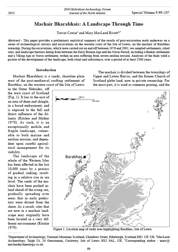
(Fig. 1). It lies to the east of
an area of dune and shingle,
in a broad embayment, and
is exposed to the full and
direct influence of the Atlantic
(Ritchie and Mather
1970). As such, it is an
exceptionally mobile and
fragile landscape, vulnerable
to both marine and
aeolian erosion, and dependent
upon careful agricultural
management for its
stability.
The landscape of the
whole of the Western Isles
has been affected in the last
10,000 years by a process
of gradual sinking, resulting
in a relative rise in sea
level. The sands of the machair
have been pushed inland
ahead of the rising sea,
gradually spreading over
areas that in early prehistory
were distant from the
shore. As a result, sites that
are now in a machair landscape
may originally have
been located in a very different
environment (Ritchie
1979).
The machair is divided between the townships of
Upper and Lower Barvas, and the former Church of
Scotland glebe land, now in private ownership. For
the most part, it is used as common grazing, and the
Machair Bharabhais: A Landscape Through Time
Trevor Cowie1 and Mary MacLeod Rivett2,*
Abstract - This paper provides a preliminary analytical summary of the results of post-excavation work underway on a
series of archaeological surveys and excavations on the western coast of the Isle of Lewis, on the machair of Barabhas
township. During the excavations, which were carried out on and off between 1976 and 2001, we sampled settlements, ritual
sites, and landscape features dating from between the Early Bronze Age and the Norse Period, including a Beaker settlement
and a Viking Age or Norse settlement, within an area suffering from severe aeolian erosion. Analyses of the finds yield a
picture of the development of the landscape, both ritual and subsistence, over a period of at least 2500 years.
Special Volume 9:99–107
2010 Hebridean Archaeology Forum
Journal of the North Atlantic
1Department of Archaeology, National Museums Scotland, Chambers Street, Edinburgh, Scotland EH1 1JF, UK. 2MacLeod
Archaeology, Taigh Ur, 24 Gearrannan, Carloway, Isle of Lewis HS2 9AL, UK. *Corresponding author - mary@
macleodarchaeology.co.uk.
2015
Figure 1. Location map of study area highlighting Barabhas, Isle of Lewis.
Journal of the North Atlantic
100
T. Cowie and M. MacLeod Rivett
2015 Special Volume 9
areas of greatest archaeological interest are under
permanent grass; from the point of view of conservation,
this is the most desirable situation. However,
aeolian erosion, exacerbated by severe rabbit infestations
and previously high livestock levels, has
caused huge areas of bare sand to be exposed. This
fragile surface suffers acutely from deflation, runoff,
and poaching by stock. It is a source of blown sand,
which causes problems elsewhere in the machair as
the vegetated surface becomes buried under winddeposited
sand.
During the first three quarters of the 20th century,
the machair was both cultivated and grazed. The
light, alkaline shell-sand–based soil was traditionally
fertilized using dung and seaweed, adding organic
material and peat to produce a more stable, neutral,
cultivable soil. The most common crops were oats,
potatoes, and brassicas, particularly swedes/turnips,
and a season of cultivation was normally followed
by a number of years of fallow, during which the
land was grazed in winter.
Following the Second World War, a shift from
the use of seaweed to chemical fertilizers led to a
rapid increase in wind erosion (Margaret MacLeod,
Barabhas, Isle of Lewis, UK, pers. comm.). This was
exacerbated by a decline in the hunting of rabbits for
food, following infection of the rabbit population
by myxomatosis, which led, ironically, to periodic
increases in the rabbit numbers, and damage to the
turf cover. From this time onwards, as stray finds
began to emerge, it became evident that the area had
been a focus of prehistoric and mediaeval settlement
(CnES 2010).
For the last two or three decades, the machair
has been used almost exclusively for grazing. Depending
upon the degree of control exercised over
both the rabbits and the grazing, erosion has ebbed
and flowed within the area. As the overlying turf is
broken through, deflation removes loose sand until
the more compact level of an underlying old ground
surface is exposed. As a result, extensive areas of
archaeological landscape have periodically been
uncovered, revealing buildings, field walls, ritual
monuments, and stray finds of every period from
the Neolithic to the 16th century, only to gradually
disappear as a result of either further erosion or stabilization.
The extent of active erosion was probably at its
maximum in the late 1980s and early 1990s, when
it threatened the local cemetery, which includes
the site of the medieval church of the Virgin Mary
(Cladh Mhuire, SMR no. 323; CNES 2010). From
that time onwards, strenuous community efforts
have been made to improve the situation through
grazing management and rabbit control, and large
areas of the exposed archaeological landscapes
are now stabilized and accreting, with vegetation
trapping blown sand during the winter storms and
covering the exposed remains. It is in this context
of community concern, active erosion, and management
efforts that much of the archaeological work on
the machair has taken place.
Archaeological Projects
From the 1970s onwards, a number of archaeological
projects have taken place on this area of machair.
These have included two major erosion surveys, and
a mapping exercise, which together with aerial photographs
of the area, allow tracking of the extent and
area of erosion over the last five decades.
The first survey, funded by the Scottish Development
Department, was carried out under the direction
of T. Cowie in 1978 as part of a wider rapid survey
of the coastline of Lewis and Harris carried out
with the intention of locating, assessing, and as far
as possible, dating archaeological sites in areas of
known coastal erosion (Cowie 1979). The outcome
was a gazetteer of grid-referenced site descriptions,
dated where possible by surface collections of pottery
sherds and other chance finds. This and similar
surveys mark the beginning of the process of assessment
of the problem of erosion of archaeological
sites around the coastline of Scotland; a similar rapid
assessment of sites in the Uists and Benbecula was
carried out by the late Ian Shepherd (Shepherd and
Shepherd 1978a, b).
As a result of this work, Cowie carried out sample
excavations in 1979 on two sites on the machair
which appeared to be at severe risk: site B1, which
was dated by pottery to the Late Bronze Age/Early
Iron Age, and B2, also pottery-dated, but to the Late
Viking–Norse period (Cowie 1979, n.d.).
In 1986–1987, this work was followed up by
excavation of a Beaker Period structure and midden
deposits (Cowie 1987, Cowie et al. 1986), located
following exposure by the wind of skeletal remains,
which proved to be one of four crouched inhumations
inserted into an earlier building.
During the following years, two further inhumations
were exposed by coastal erosion at the edge of
the area, excavated by Richard Langhorne, curator
of Museum nan Eilean (unpubl. data), and Eland
Stuart (1997) for GUARD. In the absence of any associated
artifacts, these burials remain undated, but
human skeletal analysis and radiocarbon dating are
being undertaken as part of the overall publication
project now in hand.
Journal of the North Atlantic
T. Cowie and M. MacLeod Rivett
2015 Special Volume 9
101
As part of a country-wide
project, funded by Historic Scotland,
and addressing the impact
of coastal erosion on the archaeological
resource, Machair
Bharabhais was again surveyed
in 1996, by Christopher Burgess
and Michael Church (1997). This
effort resulted in an additional
gazetteer of sites and a small assemblage
of surface finds. It highlighted
the very severe state of
erosion of the area at the time, and
the large number of exposed sites
of all periods. As a result of this
survey, Historic Scotland funded
a mapping survey of the area in
1999, carried out by Murray Cook
(1999) for AOC Scotland. This
survey defined two major archaeological
landscapes, separated
by the Handay River (Fig. 2).
To the north, lies an area of field
walls and structures, which has
produced evidence of settlement
ranging in date from the late Neolithic,
to the Norse/Mediaeval
period. To the south, on the Cnoc
Mor is an agricultural landscape,
focused around a rectangular
building, which has consistently
produced stray finds of Medieval
and Early Modern date.
In 2000–2001, a team of local
volunteers and professional
archaeologists, directed by the
then Regional Archaeologist, Mary
MacLeod, carried out a series
of small, targeted excavations to
address the more immediate archaeological
problems (Bannon et
al. 2001, MacLeod 2001). These
included an Iron Age, long-cist
burial, stone settings, and two
eroding structures, one certainly
Iron Age, and the other probably
Late Bronze Age in date.
All this work remains unpublished
and is presently being
brought together by the writers in
a project funded by Historic Scotland.
Although individually smallscale
and undertaken in reaction
to specific problems posed by the
Figure 2. Area map showing principal sites, based on survey by AOC (Cook 1999)
Note that this map omits most of the features recorded during the erosion surveys
(see Cook 1999 for gazetteer). Key to map:
1. Machair Bharabhais- EBA structure and burials (Cook 1999: survey no. 13;
Cowie 1987: site B3).
2. Machair Bharabhais- LBA/EIA structures (Cowie 1979: site B1).
3. Machair Bharabhais- LBA/EIA occupation (Cook 1999: survey no .24;
MacLeod 2001).
4. Loch Mor Bharabhais - IA structures (Ponting and Ponting 1979; Cook 1999:
survey no. 1).
5. Machair Bharabhais- IA structures/cemetery (Cook 1999: survey no. 16;
MacLeod 2000–2001).
6. Tol Mor - Norse/Medieval settlement (Cowie 1979: site B2).
7. Cnoc Mor - Late Medieval/Early Modern structures / field system (Cook 1999:
survey nos. 28 and 36).
8. Rudh a’Bhiogair - undated burials (Cook 1999: survey no. 30; Stuart 1996).
Journal of the North Atlantic
102
T. Cowie and M. MacLeod Rivett
2015 Special Volume 9
cycles of erosion on the machair, the various episodes
of fieldwork combine to provide a wider picture of the
development of this landscape through time.
Settlement of the Machair
The earliest excavated evidence comes from site
B3 (Fig. 2: site 1), investigated in 1986–1987. This
find comprised the truncated remains of an oval
or sub-rectangular building, approximately 5 m x
4 m internally, which had been occupied and altered
over a period of time (see Fig. 3). There appear
to have been at least two major structural phases.
In the secondary phase, an entrance passage and
T-shaped porch were inserted at the eastern end of
the structure. At this point, the external surface was
significantly higher than the internal floors, and the
passage sloped downwards towards the interior of
the building. However, it is not clear whether the
building was originally dug down into the machair
sand, or whether the difference of levels was caused
by the accumulation of blown sand around the walls
of a free-standing structure.
Although excavation went no lower than this
building, the lowest recorded deposits, including
a hearth and an apparent floor level, clearly relate
stratigraphically to an underlying structure, and not
to this one, as they extend below the construction
level of the walls of the building.
The main occupation of the site is currently dated
to the later second millennium BC by the presence
of domestic Beaker pottery. The deposits associated
with the structures produced a sizeable assemblage
of worked quartz, including several barbed and
tanged arrowheads.
Following a period of abandonment, a secondary,
much smaller building, measuring approximately
1.6 m x 2 m, was inserted into the oval building. This
Figure 3. Photo of B3 structure, with inserted secondary structure and porch.
Journal of the North Atlantic
T. Cowie and M. MacLeod Rivett
2015 Special Volume 9
103
structure reused parts of the earlier walls, and was
much less robustly constructed. Given its small size,
and slight build, it is tempting to interpret this as a
temporary or seasonally occupied shelter.
Inserted into the remains of these buildings and
their associated spreads of midden, after a further
period of disuse, were four crouched burials. All
had been placed in shallow, oval scoops or pits. It is
clear from their relationships with the remains of the
buildings that the position of the various walls was
still easily discernable at the time of the burials; in
one case, an orthostat forming part of the northern
wall of the structure had been removed to accommodate
the burial. Two of the burials were covered
by slabs of stone that may have been visible on the
ground surface.
It was the chance discovery of eroding human
remains in 1986 that initially prompted the investigation
of this site. This first burial was excavated in
1986. It was extremely tightly flexed, in a position
that could only have been held by the very tight
binding of the corpse, or by the burial of the body at
a point in time when it was sufficiently decomposed
to hold this position. The other three burials were
investigated in 1987, during the excavation of the
structure. In the case of one of the other burials, the
head appeared to have been removed and placed,
unanatomically, resting on its mandible at the top
of the neck (Fig. 4). This burial was also missing its
lower right arm and hand, and a part of the left hand,
apparently at the time of burial. A plain pottery vessel
had been placed over the legs. The remaining two
burials were loosely crouched, one of them under a
cover slab.
The burial practices indicated by the hyperflexed
and possibly reworked burials fit clearly into
a context of diverse Hebridean Bronze Age burial
practices as recorded at, for example, Cladh Hallan
in South Uist (Parker Pearson et al. 2005) and Cnip
in Uig, Lewis (Lelong 2009). Full analysis and radiocarbon
dating of the human skeletal assemblage
is underway as part of the overall post-excavation
project.
Two sites of the Late Bronze Age to Early Iron
Age were sampled. Both were located on mounds
formed by the selective deflation of the surrounding
ground surface; the more compact archaeological
deposits had resisted erosion. The first of these was
excavated in 1979 (site B1; Fig. 2: site 2) and was
a structure of indeterminate original size and form,
very badly damaged by rabbit burrowing. Patchily
surviving floor deposits indicated that it measured
at least 5 m by 4 m, while the one surviving arc of
orthostats suggested that it was an oval structure, with
turf and stone walling. However, the degree of rabbit
disturbance frustrated the recovery of any meaningful
Figure 4. Photo of burial with detached head.
Journal of the North Atlantic
104
T. Cowie and M. MacLeod Rivett
2015 Special Volume 9
which proved also to date to the Iron Age. The most
significant of these was a long cist capped by an
eroded cairn of beach pebbles. The cist contained
an extended, prone, female inhumation accompanied
by an iron ring, probably a bracelet (Fig. 5).
Although surface indications had strongly suggested
the presence of graves, another four features proved
not to contain burials. Instead, they proved to consist
of narrow, parallel stone settings (Fig. 6), enclosing
multiple, small, refilled scoops containing fragments
of animal bone. The function of these enigmatic features
is unknown.
Partial excavation in 2001 of an adjacent structure,
a 5-m x 4-m oval building, showed it to have
had multiple phases of use, the latest of which had
no hearth and was therefore possibly non-domestic.
Its association with the curious stone settings and
picture of the internal furnishings. The building had
been affected by erosion in antiquity prior to a second
phase of occupation, but the material culture associated
with it remained unchanged, and it seems likely
that the occupation of the site was of relatively short
duration. The finds included numerous sherds of plain
bucket-shaped pottery vessels, a small quantity of
worked bone and antler, worked quartz, and a range
of worked stone (Cowie and MacLeod Rivett 2010a).
A further mounded site with apparently similar
material culture was sampled during the summer of
2001 (Fig. 2: site 3). However, this site proved to be so
damaged by aeolian erosion that only a central hearth
with fragmentary floor levels along with loose finds
survived from it. The finds included the sherds of a
large cordoned vessel, whose stratigraphic position,
however, was uncertain due to the damage to the site
(Bannon et al. 2001).
The three large-scale surveys which
covered the area, in 1978 (Cowie 1978,
unpubl. data), in 1996 (Burgess and
Church 1997), and in 1999 (Cook 1999)
all located the remains of a site on the
northern edge of Loch Mor Bharabhais
(survey no. 01; Fig. 2: site 4), which was
intermittently exposed at low water. Collection
of surface finds over this site and
excavation of small trial trenches by local
amateur archaeologists (Ponting and Ponting
1979, Ponting et al. 1984) provided a
broadly Iron Age date for the remains of
an oval building, approximately 5 m x 4
m, with at least one associated hearth.
The level of Loch Mor Bharabhais is
controlled by sluices at the seaward opening
of the loch. Local informants (Kenny
Matheson, Comunn Eachdraidh Bharabhais
agus Bhru) suggest that the level of
the loch was raised in the first half of the
19th century to enhance local fisheries. It
is reasonable to assume that the shoreline
of the loch was significantly lower in the
Iron Age; at that time, its level may well
have been partially determined by the then
lower coastline to the west of the loch.
Surveys in 1996 and in 1999 had also
highlighted an area (survey no. 16; Fig.
2: site 5) with large amounts of structural
remains, including two oval buildings and
a number of possible funerary features,
and concentrations of scattered human
remains, particularly teeth. Excavations
in 2000 and 2001 (Bannon et al. 2001,
MacLeod 2001) concentrated primarily on
this area and the eroding funerary features, Figure 5. Photo of Barabhas bracelet in situ.
Journal of the North Atlantic
T. Cowie and M. MacLeod Rivett
2015 Special Volume 9
105
currently undated, these finds suggest a significant
continuity of use of the agricultural landscape from
the Bronze Age through to the Iron Age.
During the 1978 coastal erosion survey, diagnostically
Viking Age/Norse sherds were recovered
from an eroding mound of midden debris located
within a deep deflation hollow set among the massive
dunes which formerly lay west of the cemetery
(and chapel site) at Cladh Mhuire. Trial excavations
carried out in 1979 (Site B2: Fig. 2: site 6) revealed
portions of two rectilinear buildings separated by
an area of paving, set in the upper part of a mound
of midden deposits that almost certainly concealed
earlier structures. This site, which was higher than
the other sampled sites, had been constructed and
occupied prior to the development of blown-sand
deposits in the area; the dunes which surrounded it
were clearly post-Norse in date.
Mammal bones studied from the midden
deposits between the two buildings
revealed a mixed agricultural economy,
with the slaughter of neonatal calves to
allow intensive dairying contrasting with
the longer life of sheep and lambs, clearly
valued for a broader range of products including
meat and wool (Mary Harman and
Dale Serjeantson, in Cowie and MacLeod
Rivett 2010b). Pig, horse, and red deer
bones were present in small amounts. Fish
bones constituted over half the weight of
bone retrieved from the site, and of those
which were identifiable as to species, over
98% were of the cod family, many of them
very large fish, indicating offshore fishing.
Other, smaller and less common species,
for example, ballan wrasse, rockling, and
smaller specimens of flat fish, may have
been caught by shore fishing (Sarah Colley
and Clive Denby, in Cowie and MacLeod
Rivett 2010b), but these apparently
formed only a small part of the catch.
Pending the results of radiocarbon
dating, the dating of this site is dependent
on the finds. A significant proportion
(>10%) of the ceramics from this site
(Alan Lane, in Cowie and MacLeod Rivett
2010b) consisted of the diagnostic platter
ware first identified at the site of the Udal
(Lane 2007:4–5). The precise dating of
this distinctively Hebridean ceramic form
remains uncertain, but in the light of excavations
at a number of Norse period sites
in the Western Isles, including Bornais and
Cille Pheadair (Lane 2007:11–13), both
in South Uist, the presence of unabraded
with the long cist burial suggests that the building
itself may have had a ritual function, perhaps forming
the focus for the activity around it. Beneath, and
immediately to the southeast of it, were the remains
of an earlier building, oval or circular, of which only
a small area was uncovered.
The survey placed this group of structures within
what was probably a very extensive field system (survey
no. 20; Fig. 2), marked by walls of large stones,
themselves the focus of linear clearance cairns in
some areas. At least one of these field walls extended
westwards from the area of the late prehistoric ritual
focus, beneath uneroded machair to the west, through
which it was intermittently visible in deflation hollows,
up to and seemingly respecting the earlier focus
of activity at site B3, the Beaker Period building excavated
in 1986–1987. Although the field walls are
Figure 6. Photo of stone setting from BMP 2000–2001.
Journal of the North Atlantic
106
T. Cowie and M. MacLeod Rivett
2015 Special Volume 9
platter sherds in some quantity at site B2 provisionally
suggests a date in the 11th to 12th century for
occupation of the settlement at Bharabas.
Late Mediaeval to Early Modern settlement is
represented by the remains of a building (survey
no. 36; Fig. 2: site 7), probably a corn-drying kiln,
surrounded by a system of linear fields, on the Cnoc
Mor, to the south of the Handay River. Although the
site is unexcavated, surface erosion in this area has
consistently produced local ceramics probably dated
to the late 15th or early 16th century. These finds are
paralleled on the excavations at the fortified site of
Dun Eistean in Ness (Barrowman 2002, 2003).
In addition to the relatively closely dated excavations
and survey information, rescue excavation
also took place at Rudh a’ Bhiogair (survey no. 30;
Fig. 2: site 8) in the 1990s, on two eroding burials.
Both of these were disarticulated, and although the
area of excavation in both cases focused tightly
around the remains themselves, there was, nonetheless,
no evidence of the graves having been marked
in any way. The skeletons were not complete; in
one case only 30% of the bones were present (Stuart
1997). Although the missing parts may have
been a result of the erosion that exposed them,
given the partially disarticulated state of the skeletons
it is also possible that these finds might have
been burials or reburials of decomposed and partial
remains, for example washed up on the shoreline,
analogous to those excavated at Aiginis, Isle of
Lewis (McCullagh 1989, 1990).
Conclusion
Excavation over the years at Barabhas Machair
has been piecemeal, and has taken place in response
to specific problems posed by erosion events on the
machair. Despite the lack of a unified and planned
campaign of research, a picture of the development
of the landscape has emerged over time that emphasizes
the importance of this location, one of the
largest areas of machair in Lewis.
A number of interesting themes emerge from
the results of the survey and excavation of the area.
Most obvious of these is the degree of continuity of
use of the machair as a domestic, agricultural, and
also ritual landscape. Underlying this is certainly an
element of pragmatism; the relatively light, sandbased,
alkaline soils are easily cultivated, either by
spade or plough, and easily fertilized using local materials.
However, in addition to this, the reuse of the
Beaker Period domestic building (Fig. 2: site 1) for
burial in a slightly later period, and the reuse of an
Iron Age, likely domestic, building (Fig. 2: site 5) as
the focus of a group of ritual structures and a burial,
makes evident the degree to which sites continued to
be an active part of the social memory and landscape
use of the people living here. Clearly, the end of the
occupation of a building did not mean the abandonment
of a site.
Despite this wider continuity, the evidence suggests
continual movement of settlement foci within
the landscape, around stone boundary structures that
were probably field walls (shown on Fig. 2). Settlement
persisted at each site for long enough to build
up a mound of archaeological remains interleaved
with blown sand, but there were shifts between
the Early and Late Bronze Age, and the Iron Age
and Viking periods, with the earlier sites being at
lower elevations, and nearer the present coastline.
The suggestion of a move away from the coast and
higher up may, at least partially, reflect the impact of
the gradual rise in sea level and periods of machair
erosion on the local environment, but it should be
emphasized that the excavated evidence indicates
that all of the sites, including the earliest, were built
and occupied in a machair environment.
Much remains to be understood about the Barabhas
Machair. There are numerous known unexcavated
sites here, and more will undoubtedly emerge
over time. The ongoing post-excavation project
will go some way to establishing the archaeological
significance of this area, and will provide a model
for the wider understanding of the archaeological
development of machair areas in the northern islands
of the Western Isles.
Acknowledgments
The various Barabhas Machair projects have been
supported by the Department of the Environment and
Historic Scotland, Comhairle nan Eilean Siar (including
Western Isles Archaeology Service and Museum nan Eilean),
Comunn Eachdraidh Bharabhais agus Bhru, Lews
Castle College UHI, and numerous paid and volunteer
archaeologists over many years. We are grateful to all of
them, institutions and individuals, for their enthusiasm
and patience, without which none of the work could have
been accomplished.
Literature Cited
Bannon, R., D.L. Brown, M.A. MacLeod, and A. Mora-
Ottomano. 2001. Barvas Machair Project 2001, data
structure report. Unpublished Report for Historic
Scotland, Western Isles SMR, UK.
Barrowman, C.S. 2002. Dun Eistean, Lewis GUARD
unpublished structures report 716.2 and 716.3. University
of Glasgow, Glasgow, UK.
Barrowman, C.S. 2003. Dun Eistean, Lewis GUARD
unpublished structures report 716.4. University of
Glasgow, Glasgow, UK.
Journal of the North Atlantic
T. Cowie and M. MacLeod Rivett
2015 Special Volume 9
107
Ponting, G., and M. Ponting. 1979. Loch Mor Barvas.
Discovery and Excavation in Scotland 1979:46–47.
Ponting, M., M. MacRae, E. Collinson, and L. Jones.
1984. Loch Mor Barvas. Discovery and Excavation in
Scotland 1984:43.
Ritchie, W. 1979. Machair development and chronology
in the Uists and adjacent islands. Proceedings of the
Royal Society of Edinburgh 77B:107–122.
Ritchie, W., and A. Mather. 1970. Beaches of Lewis and
Harris. Department of Geography, University of Aberdeen,
for the Countryside Commission for Scotland.
Reprinted 2004 by Scottish Natural Heritage as Commissioned
Report No. 088. Aberdeen, UK.
Shepherd, I., and A. Shepherd. 1978a. Hougharry Machair.
Discovery and Excavation in Scotland 1978:35.
Shepherd, I., and A. Shepherd. 1978b. Paible. Discovery
and Excavation in Scotland 1978:35.
Stuart, E. 1996. Rubh a’Bhiogair, Barvas, Lewis. Discovery
and Excavation in Scotland 1996:104.
Stuart, E. 1997. Barabhas Excavation, Isle of Lewis.
GUARD, Glasgow, UK.
Burgess, C., and M. Church. 1997. Report of the coastal
erosion assessment of Lewis, Western Isles. Unpublished
report for Historic Scotland, Western Isles
SMR, UK.
Comhairle nan Eilean Siar (CnES). 2010. Western Isles
sites and monuments record. Available online at www.
cne-siar.gov.uk/smr/. Accessed 30 January 2012.
Cook, M. 1999. Machair erosion survey of Barvas Sands,
Isle of Lewis, the Outer Hebrides. AOC Archaeology
Group. Unpublished report for Historic Scotland,
Western Isles SMR, UK.
Cowie, T. No date. Account of survey and excavation at
Barvas Sands, Unpublished summary of the excavation
and survey results. Available from the author.
Cowie, T. 1979. Barvas Machair. Discovery and Excavation
in Scotland 1979:47.
Cowie, T. 1987. Barvas Sands. Discovery and Excavation
in Scotland 1987:62.
Cowie, T., and M. Macleod Rivett. 2010a. A Bronze Age
settlement at Barvas (Barabhas) Machair, Isle of Lewis,
Barabhas 1 DSR. Unpublished report for Historic Scotland,
Western Isles SMR, UK.
Cowie, T., and M. Macleod Rivett. 2010b. A Norse/Medieval
settlement at Barvas (Barabhas) Machair, Isle
of Lewis, Barabhas 2 DSR. Unpublished report for
Historic Scotland, Western Isles SMR, UK.
Cowie, T., and G. Ritchie. 1991. Bronze Age burials at
Cairneybank, Kinross-shire, Proceedings of the Society
of Antiquaries of Scotland 121:95–109.
Cowie, T, M. Ponting, and P. McFarlane. 1986. Barvas
Sands. Discovery and Excavation in Scotland
1986:52–53.
Harding, D., and I. Armit. 1990. Survey and Excavation in
West Lewis. Pp. 10–107, In I. Armit (Ed.). Beyond the
Brochs. Edinburgh University Press, Edinburgh, UK.
Kilpatrick, M.C. 2010. Cnip Headland, Uig, Isle of Lewis
skeletal report. Human Remains Call-Off Contract,
GUARD Unpublished Skeletal Report 2820. Western
Isles SMR, UK
Lane, A. 2007. Ceramic and cultural change in the Hebrides
AD 500–1300. Cardiff Studies in Archaeology
Specialist Report 29, Cardiff, UK.
Lelong, O. 2009. Cnip Headland, Uig, Isle of Lewis.
Human Remains Call-Off Contract, GUARD Unpublished
Data Structure Report 2803. Western Isles
SMR, UK
MacLeod, M.A. 2001. Excavations on Barvas Machair
2000. Unpublished Data Structure Report for Historic
Scotland, Western Isles SMR, UK.
McCullagh, R. 1989. Broad Bay, Aiginish (Stornoway
parish), mass graves. Discovery and Excavation in
Scotland 1989:71.
McCullagh, R. 1990. The investigation of a post-medieval
mass grave at Braighe, Lewis. Historic Scotland, Archaeological
Operations and Conservation, Annual
Report 1989. Pp. 26–28. Edinburgh, UK.
Parker-Pearson, M, A. Chamberlain, O. Craig, P. Marshall,
J. Mulville, H. Smith, C. Chenery, M. Collins,
G. Cook, G. Craig, J. Evans, J. Hiller, J. Montgomery,
J.L. Schwenninger, G. Taylor, and T. Weiss. 2005.
Evidence for mummification in Bronze Age Britain.
Antiquity 79:529–546.