2007 NORTHEASTERN NATURALIST 14(4):589–604
Hydrogeomorphic and Compositional Variation Among
Red Maple (Acer rubrum) Wetlands in
Southeastern Massachusetts
Richard D. Rheinhardt*
Abstract - Sixteen Acer rubrum (red maple)-dominated wetlands in three hydrogeomorphic
settings (depressional, riverine, seepage slope) were sampled in
southeastern Massachusetts. Quantitative data of vegetation from fi ve strata were
compared with soil-chemistry measurements using detrended correspondence analysis
(DCA) to determine if hydrogeomorphic (HGM) setting was related to species
composition. Although all sampled wetlands were dominated or co-dominated by
red maple, DCA-differentiated stands according to HGM setting, i.e., riverine fl oodplain
wetlands separated from depressional (kettle) wetlands and slope wetlands on
the DCA ordination. Further, species richness was lowest in depressional wetlands
and highest in riverine wetlands, refl ecting differences in soil chemistry and soil
type, ultimately determined by hydrogeomorphic setting. Depressional swamps
overwhelmingly dominated by red maple and those with Chamaecyparis thyoides
(Atlantic white cedar [AWC]) were very similar in understory composition, soil
chemistry and type, and ordination position, suggesting that many of the red maple
depressions were probably once AWC swamps. Post-colonial forest-management
practices such as repeated cutting of stands, fi re suppression, draining for conversion
to cranberry bog, and subsequent abandonment have degraded and fragmented AWC
swamps throughout southeastern Massachusetts and extensively reduced their areal
extent. However, recent abandonments of cranberry bogs have provided opportunities
for restoring AWC wetlands to a portion of their original habitat.
Introduction
Acer rubrum (red maple) is ubiquitous in forested wetlands (swamps)
throughout North America (Burns and Honkala 1990). In deciduous swamps
of glaciated portions of the Northeast, red maple dominates the canopy in a
variety of hydrogeomorphic settings (Golet et al. 1993). Dominance ranges
from greater than 90% of the canopy to some lesser value with a mixture
of other hydrophytic species (see Golet et al. 1993 for a comprehensive
review). Some of these variations in composition may be controlled by
the major source of water to, and dynamics within, a given swamp. That
is, hydrogeomorphology (sensu Brinson 1993) affects water chemistry by
infl uencing the timing, duration, and frequency of soil saturation, the development
of microsite variation, and the chemistry and redoximorphic status
of soils, which in turn controls species composition (Erhenfeld and Gulick
1981, Huenneke 1982, Menges and Waller 1983, Rheinhardt 1992).
*Department of Biology, East Carolina University, Greenville, NC 27858; rheinhardtr@
ecu.edu.
590 Northeastern Naturalist Vol. 14, No. 4
Despite a great deal of information on red maple wetlands in the glaciated
Northeast, there is less information on the infl uence of soil chemistry on
composition of vegetation (Golet et al. 1993) or direct quantitative comparisons
among swamps from different hydrogeomorphic settings. In addition,
no studies have examined the soil chemistry relationships between red maple
swamps and Chamaecyparis thyoides (Atlantic white cedar [AWC]) swamps
occupying similar geomorphic positions.
This study was designed to quantitatively characterize the composition
of forested wetlands dominated or co-dominated by red maple among several
hydrogeomorphic settings in southeastern Massachusetts: kettle depressions,
riverine fl oodplains, and a seepage slope. The objective was to obtain
quantitative data from all vegetation strata, to determine if compositional
differences could be attributed to hydrogeomorphic setting and thus provide
a framework for classifying red maple swamps.
One useful way to compare composition among stands is via ordination
diagrams (Barbour et al. 1980, Gauch 1982, Van der Maarel 1980). However,
ordination algorithms used to help classify vegetation types cannot be used
for all strata at once because input data have to be in the same form and different
methods are used for sampling various strata (e.g., basal area used for
canopy trees, density for shrubs, cover for herbs, etc.). In this study, we used
an estimate of total cover for each woody stratum to convert conventional
measurements of woody life-forms to a derived cover value based on percent
cover of each stratum. In this way, woody strata and the herbaceous stratum
of sampled stands could be ordinated using one data set.
Study area
The area of study was located in Plymouth and Bristol counties in
southeastern Massachusetts (Fig. 1), near the terminus of the Wisconsinan
Glaciation, which began receding about 11,000 years BP (Koteff and Pessel
1981). This glacial epoch left behind highly permeable tills that comprise
much of the surficial geology of the region. Numerous large and small
kettle depressions formed throughout low areas in the regional landscape
where ice buried in glacial drift melted in place (Flint 1971, Larson 1982).
Although small streams may flow through or drain from kettle depressions,
their hydrologic regimes are mostly influenced by a combination of regional
water-table fluctuations, groundwater discharge from surrounding areas
of higher elevation, and in the larger depressions, by precipitation (Rheinhardt
and Hollands, 2007). The open-water depressions are called kettle
ponds and the saturated ones support forested wetlands (swamps), which
can be quite extensive (>3000 ha). Other, less extensive forested wetlands
occur along stream corridors and on seepage slopes of permeable glacial
moraines (Rheinhardt and Hollands, 2007).
Southeastern Massachusetts (exclusive of Cape Cod) is in a transitional
climate zone with conditions characteristic of both humid marine
and humid continental climates. The mean annual maximum temperature
2007 R.D. Rheinhardt 591
is approximately 21.8 °C (71.3 oF) in July and -2.8 °C (27 oF) in January
(Ruffner 1985). Precipitation averages 116 cm/year (45.7 inches).
Methods
Field measurements
The Massachusetts Natural Heritage and Endangered Species Program
(NHESP) provided topographic maps and high-resolution aerial photographs
marking locations of 16 forested wetlands that had been identifi ed in earlier
inventories, for which NHESP desired quantitative vegetation data. The topographic
maps and aerial photos were used to pre-classify identifi ed wetlands
by hydrogeomorphic (HGM) type (sensu Brinson 1993). Hydrogeomorphic
position was used to initially classify the wetlands because HGM position
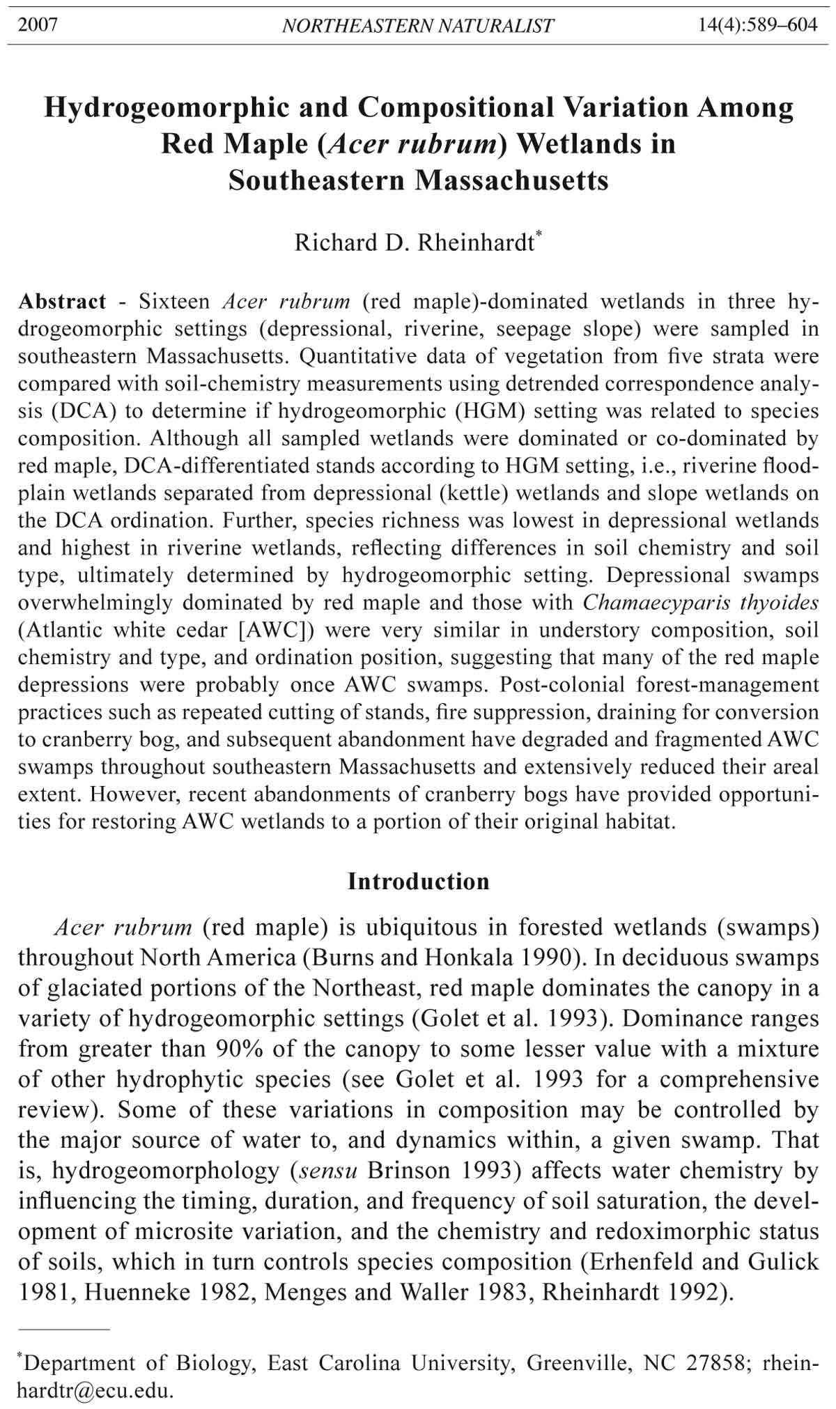
Figure 1. Study area in southeastern Massachusetts (MA). The study area in Bristol
and Plymouth Counties occur in two EPA Level-IV ecoregions: the Southern
New England Coastal Plains and Hills (medium gray) and the Cape Cod Atlantic
Coastal Pine Barrens (light gray). Map derived from Griffith et al. (2007), modified
with permission.
592 Northeastern Naturalist Vol. 14, No. 4
ultimately determines the potential sources and fate of water fl owing to and
from wetlands (Brinson 1993; Rheinhardt and Hollands, 2007). From maps
and photos, 12 of the 16 sites were identifi ed as depressional wetlands, three
as riverine, and one as a slope wetland.
The best access points for each wetland were determined from the aerial
photographs. After arriving at each wetland, some ground reconnaissance
was conducted to make sure that the area to be sampled was relatively homogenous
in cover. However, some wetlands were much too large (>300
ha) and dense to walk entirely. The aerial photographs were also used to
verify that the area chosen for sampling represented a large portion of the
wetland. Once homogeneity of an area was established, 100 paces (about
80 m) were taken in a randomly chosen direction to locate the first sampling
point (details below). Additional points were placed approximately
50 paces (40 m) from the previous points. For smaller wetlands (slopes
and riverine sites), paces were taken in a direction that would insure that
all sampled points would remain within the wetland and not overlap previously
sampled points.
In each stand, vegetation from the following strata were sampled:
(1) canopy (stems ≥10-cm dbh [diameter at 1.5 m above ground]), (2) saplings
(stems of potential canopy trees ≥1 m tall and <10 cm dbh), (3) subcanopy
(shrubs and understory trees [species not adapted to a canopy existence]
≥1 m tall and <10 cm dbh), (4) vines ≥1.5 m tall climbing canopy trees, and
(5) herbaceous plants.
At each sampling location within a stand, canopy trees were tallied in
2–4 plots, by species, using the Bitterlich plotless technique (Grosenbaugh
1952, Lindsey et al. 1958). These measurements provided basal area (in m2/
ha) for each species. The number of tree sample plots measured in a stand
was determined by the species richness of the canopy. Many stands had so
few tree species that 2–3 plots were suffi cient to characterize the canopy
composition of the site.
In a 10-m radius plot centered on each Bitterlich point, canopy trees were
also tallied by species to obtain tree density in stems/ha. The base of each
canopy tree in the 10-m radius plots was examined for the presence of vines
climbing more than 1.5 m up the tree. Each vine that met this criterion was
tallied by species to obtain vine density in stems/ha. Sapling and subcanopy
stems were counted in 5-m radius plots centered on each Bitterlich point
(smaller or larger plots were used if density was extremely high or extremely
low, respectively).
For all woody strata, total cover for each stratum was estimated
as falling into one of the following ten cover categories for which the
midpoint of the class (in parentheses) was recorded: 0% (0), 0–1 (0.5),
1–5% (3), 5–25% (15), 25–50% (37.5), 50% (50), 50–75% (62.5), 75–95%
(85), 95–100% (97.5), 100% (100). Cover of each herbaceous species and
Sphagnum spp. (collectively called groundcover) were tallied in ten 1-m2
quadrats placed along transects between Bitterlich points. The same cover
2007 R.D. Rheinhardt 593
categories and midpoint values defined above were used for estimating
groundcover. Groundcover could be >100%, particularly for plots with
high Sphagnum spp. and herb cover.
In each stand, a 10-cm diameter soil core was extracted with a Dutch
auger to a depth of at least 50cm. The soil profi le was then examined for pronounced
changes in color (Munsell Color 1994) and type. Soil texture was
determined for each identifi ed soil horizon using “texture-by-feel analysis”
(Thein 1979). Approximately one liter of soil was collected from the top 20
cm and placed in a plastic sealable bag for analysis of soil chemistry.
Data analysis
Soils were sent to the University of Massachusetts Soil and Plant tissue
lab for chemical and nutrient analyses (mg/kg). Nutrient and micronutrients
included P, K, Ca, Mg, NH4, N03, Bo, Mn, Zn, Cu, Fe, Pb, Ni, Cd, Cr, and
Al. Percent organic matter and pH were also analyzed.
Absolute basal areas of canopy trees were converted to relative basal area
for each species by dividing each species’ absolute basal area by total canopy
basal area. Absolute densities of canopy trees were converted to relative densities
by dividing absolute density of each species by total tree density. An
importance value (IV) for each tree species was derived by averaging relative
basal area and relative density (maximum canopy IV = 100). Absolute
density of saplings, subcanopy species, and vines were converted to IVs by
dividing the absolute stem density of each species by the total stem density
of the stratum to which it belonged.
All IVs for species within a stratum were multiplied by the percent cover
estimated for the species’ stratum to obtain a derived cover value (DCV) for
each species within a stratum. For example, if red maple’s IV were 50 and
total canopy cover were estimated to be 90%, then red maple’s DCV would
equal 45 (50 x 0.90). The DCV for groundcover species was obtained directly
by averaging the midpoint estimates of percent cover (defi ned above)
across all ten 1-m2 plots within a stand.
DVC values for each species in each stand was applied to a detrended
correspondence analysis (DCA) algorithm in PC-ORD (McCune and
Medford 1999) to help differentiate stands by compositional attributes
and to relate soil-chemistry measurements to compositional patterns.
DCA is an often-used, indirect ordination technique that has the advantage
of removing the artificial arch effect often observed in principle
components analysis and similar ordination techniques. Because DCA
is an indirect technique, the locations of sites in the DCA ordination
diagram are related only to differences in composition among samples. A
separate file of environmental variables (in this case, soil data) are then
compared with the ordination positions. A joint plot is produced, which
shows the direction and relative strengths of environmental gradients on
the ordination, originating from the centroid of all factors (McCune and
Medford 1999).
594 Northeastern Naturalist Vol. 14, No. 4
An indicator analysis algorithm in PC-ORD (Dufrene and Legendre
1997) was applied, using Monte Carlo simulation, to determine which
species would be the best indicators for the identified HGM subtypes identified
by interpreting the ordination. The results of the analysis provides
a probability for each species’ affinity with a given community type. The
indicator analysis was run twice; once using all HGM subtypes except
the slope subtype (because there was only one site) and once using only the
two depressional subtypes identified in the ordination (see results), to determine
if there were any species that would differentiate the two subtypes
from one another.
Results
Hydrogeomorphology and soils
The depressional wetlands were associated with kettle depressions of
glacial outwash plains. Their soils were histosols (organic, peat soils). In
most depressional sites, the upper 20 cm was composed of slightly (fibric)
or moderately (hemic) decomposed organic matter. Hummock and
hollow microtopography were also prevalent throughout, suggesting that
the depressional swamps were saturated for long periods. Water marks on
trees suggested that depressions flooded to a depth of not more than 15
cm. Soils were also saturated in most of the depressions when they were
sampled in late summer, further suggesting that soils rarely dry out.
Soil profiles below 20 cm in depressional swamps were mostly composed
of highly decomposed organic matter (sapric or muck soils), indicative
of long periods of saturation. All soils in depressions were acidic,
ranging in pH from 2.9–4.5. In three of the depressional swamps, a sandy
layer occurred at 64–80 cm depth. One of these stands was located within
100 m of a high sandy ridge that jutted into the swamp. One stand was
located about 100–200 m from a kettle pond, which the swamp bordered.
Another stand was a very small depression in an area with many kettle
ponds. Two stands were located near small streams that flowed through
the depressions.
Two riverine wetlands had loamy soils; one had an alluvial floodplain,
the other a colluvial floodplain. The stream of the third site, initially classified
as riverine, flowed out of a large (>4750 ha) kettle depression. Its
soil was peaty, and its microtopography and soil chemistry resembled the
other depressional wetlands sampled. It was later determined, for reasons
explained below, that this site should have been classified as a depressional
wetland.
Soils of the slope wetland had so many large boulders that only the
uppermost part of the profile could be thoroughly examined. Soils of the
upper 5–10 cm were loamy and were not saturated at the time of sampling
in late summer. However, the soil could have been saturated below 10 cm,
a depth that could not be readily accessed due to the boulders.
2007 R.D. Rheinhardt 595
Ordination
The DCA ordination diagram (Fig. 2) shows the compositional relationship
among stands. Axis 1 of the ordination is responsible for about
54% of the variation among stands (eigenvalue = 0.537). Another 29%
of the variation is explained by Axis 2. Depressional stands with Atlantic
white cedar in them grouped furthest to the left of the ordination. These
were sub-classified as AWC depressional wetlands. The other depressional
stands (without AWC) were classified as red maple depressions.
Two riverine wetlands grouped on the right side of the ordination while
one wetland (R16) with Atlantic white cedar in it, initially identified from
maps and aerial photos as a riverine wetland, grouped with the depressional
sites on the ordination. Based on its similarity to other depressional
wetlands with respect to species composition, soil type and chemistry, and
microtopography, R16 was re-classified as an AWC depressional wetland
after sampling. Its hydrogeomorphologic status will be discussed later.
Figure 2. Detrended correspondence analysis (DCA) ordination diagram based on the
composition of red maple wetlands (all strata), partitioned by hydrogeomorphic type.
Stands H11 and H12 were outliers, probably due to the close proximity of a deeply
channelized stream that was likely draining them. These two stands were not averaged
with other depressional stands in Tables 1 and 2. However, R16 was re-classifi ed
with depressional stands because its hydrogeomorphology, species composition, soil,
and microtopography were found to be more similar to depressional sites.
596 Northeastern Naturalist Vol. 14, No. 4
The slope wetland occurred at the top of the ordination, far from the other
sites. Two depressional sites (H11 and H12), were located far from the rest
of the group of depressions on the ordination. The plots of these two outliers
were located near a deeply channelized stream designed to drain the sites for
conversion to cranberry bogs.
The joint plots show that nitrate (NO3) increased toward the right side of
the ordination (r2 < 0.325), while potassium (K+) increased toward the left
(r2 < 0.250). Both joint plots (arrows) parallel Axis 1. Thus, the two riverine
stands (R17, R18), had higher NO3 concentrations and lower K+ concentrations.
None of the other elements measured showed any signifi cant trend
with vegetation.
Vegetation and hydrogeomorphic type
Vegetation data, averaged by wetland hydrogeomorphic type, are provided
in Table 1 (woody vegetation) and Table 2 (herbaceous vegetation). Red
maple dominated or co-dominated the canopy (DCV > 10) in all wetlands
sampled (Table 1). Atlantic white cedar (AWC) occurred (DVC = 5–53) with
red maple in four wetlands (C2, C4, C7, R16). However, red maple was the
sole dominant (DCV = 55–92) in all the other depressional swamps. Pinus
strobus (white pine) occurred in all three riverine stands, in four of seven
red maple depressions, and in three of the four AWC depressions. Nyssa
sylvatica (blackgum) and Betula lutea (yellow birch) each co-dominated
one depressional site, while yellow birch co-dominated the slope wetland.
Quercus rubra (northern red oak) occurred in slope and riverine wetlands,
while Carya ovata (shagbark hickory) was present only in an alluvial riverine
stand, where it co-dominated with red maple.
Species richness was highest in the riverine communities (mean = 129),
followed by the slope wetland (mean = 86), red maple depressions (mean = 40),
and the AWC depressions (mean = 33). The richest stand was an alluvial fl oodplain
along Taunton River (R17); although it may occasionally fl ood more
deeply than the other stands during overbank fl ow events, its soils are probably
saturated for a shorter duration than any of the other sites in this study.
Table 1. Composition of woody vegetation, based on derived cover values (DCV), averaged by
stratum and hydrogeomorphic class. Vegetation classes are: Canopy (IV of stems >10 cm dbh),
saplings and subcanopy life-forms (relative density of stems >1 m tall, <10 cm dbh), and vine
(relative density of stems >1.5 m tall, climbing on trees >10 cm dbh). Stands H11 and H12 were
excluded as outliers, probably due to the deep channelization of a nearby stream. * = identifi ed
indicator species (p ≤ 0.01). RM = red maple depressions (n = 7), AWC = Atlantic white cedar
depressions (n = 4), SW = slope wetland (n = 1), and RFP = riverine fl oodplains (n = 2).
Species RM AWC SW RFP
Canopy (mean basal area, m2/ha) 20.6 20.1 20.0 19.5
Canopy (mean density, No.ha) 301 352 407 350
Acer rubrum L. (red maple) 71.9 48.1 38.7 61.5
Chamaecyparis thyoides (L.) B.S.P. (Atlantic white cedar) - 24.1* - -
Betula lutea Michx. f. (yellow birch) 3.7 1.1 13.4 -
2007 R.D. Rheinhardt 597
Table 1, continued.
Species RM AWC SW RFP
Nyssa sylvatica Marsh.(blackgum) 5.4 - 10.6 -
Pinus strobus L. (white pine) 5.4 4.7 - 1.5
Fraxinus americana L. (white ash) 0.5 - 4.9 0.5
Quercus alba L. (white oak) - - 8.5 -
Q. rubra L. (northern red oak) - - 10.8 8.0
Ulmus rubra Muhl. (slippery elm) - - 1.0 4.6*
Carya ovata (P. Mill.) K. Koch (shagbark hickory) - - - 10.3
Prunus serotina Ehrh. (black cherry) - - - 1.7
Carpinus caroliniana Walt. (ironwood) - - - 1.1
Quercus bicolor Willd. (chestnut oak) - - - 2.1
Total DCV for canopy species 87.0 77.9 87.9 91.3
Sapling (mean density, no./ha) 88 450 467 187
Acer rubrum 2.2 11.9 - 4.4
Betula lutea 6.6 5.0 14.0 0.8
Carya ovata - - - 1.2
Chamaecyparis thyoides - 1.4 - -
Fagus grandifolia Ehrh. (American beech) - - 9.4 0.4
Fraxinus americana - - - 0.8
Nyssa sylvatica - - 3.6 -
Pinus strobus - - - 0.8
Quercus bicolor 0.8 - - -
Q. rubra - - - 0.8
Tsuga canadensis (L.) Carr. (hemlock) - 3.6 - -
Ulmus rubra - - - 0.8
Total DCV for sapling species 9.6 21.9 27.0 9.9
Subcanopy (mean density, no./ha) 12,154 6318 4455 2033
Clethra alnifolia L. (sweet pepperbush) 55.0 39.0 14.5 -
Ilex verticillata (L.) Gray (common winterberry) 12.3 10.8 0.6 1.1
Ilex laevigata (Pursh.) Gray (smooth winterberry) 6.8 1.9 - 0.9
Leucothoe racemosa (L.) Gray (swamp doghobble) 1.5 2.0 - -
Lyonia ligustrina (L.) DC (maleberry) 0.3 1.6 - 10.2
Gaylussacia frondosa (L.) Torr. & Gray ex Torr. (blue - 0.3 - -
huckleberry)
Vaccinium corymbosum L. (highbush blueberry) 1.1 3.9 1.2 -
Rhododendron viscosum (L.) Torr. (swamp azalea) 1.5 0.5 8.2 -
Lindera benzoin (L.) Blume (spicebush) 0.2 - 20.9 7.9
Viburnum dentatum L.(southern arrowwood) 1.4 - - 2.3
Nemopanthus mucronata (L.) Loes. (catberry) - 0.4 - 5.3
Amelanchier canadense (L.) Medik. (Canadian serviceberry) - - - -
Lonicera morrowii Gray (Morrow’s honeysuckle) - - - -
Hamamelis virginiana L. (American witch hazel) - - 4.2 -
Cornus fl orida L. (fl owering dogwood) - - 0.6 -
Rosa multifl ora Thunb. Ex Murr. (multifl ora rose) - - 1.2 -
Crataegus pruinosa (Wendl. P.) K. Koch (waxyfruit - - - 0.4
hawthorn)
Corylus americana Walt. (American hazelnut) - - - 0.5
Carpinus caroliniana Walt. (ironwood) - - - 25.5*
Total DCV for subcanopy species 80.0 60.3 51.4 54.1
Vine (mean density, no./ha) 73 64 123 92
Smilax rotundifolia L. (roundleaf greenbriar) 0.5 0.2 - 1.4
Rhus radicans L. (poison ivy) 0.0 0.1 0.3 1.0*
Parthenocissus quinquefolia (L.) Planch. (Virginia creeper) - - - 0.4
Vitis rotundifolia Michx. (muscadine grape) 0.5 - 0.3 5.6*
Total DVC for vine species 1.1 0.3 0.5 8.3
598 Northeastern Naturalist Vol. 14, No. 4
Table 2. Composition of herbaceous vegetation, based on estimated % cover (= DVC), averaged
by hydrogeomprphic type. Stands H11 and H12 were excluded due to channelization of nearby
stream. Value of 0.0 means there is less than 0.1% cover, but the species is present. Identifi ed
indicator species p ≤ 0.01 denoted with an asterix. RM = red maple depressions (n = 7), AWC
= Atlantic white cedar depressions (n = 4), SW = slope wetland (n = 1), and RFP = riverine
fl oodplains (n = 2).
Species RM AWC SW RFP
Agrostis perennans (Watt.) Tuckerman (upland bentgrass) - - - 0.8
Aralia nudicaulis L. (wild sarsaparilla) 1.8 3.9 - 0.2
Arisaema triphyllum (L.) Schott (jack in the pulpit) 0.0 - - 0.2
Aster acuminatus Michx. (whorled wood aster) - - - -
A. laterifl orus (L.) Britt. (calico aster) 0.0 - - 1.7*
Athyrium fi lix-femina (L.) Roth (common ladyfern) - - 1.0 -
Botrychium oneidense (Gilbert) House (bluntlobe grapefern) 0.0 - - 0.1
Carex atlantica Bailey (prickly bog sedge) - 0.4 0.0 -
C. canescens L. (slivery sedge) - - - -
C. crinita Lam. (fringed sedge) - - - 0.2
C. folliculata L. (northern long sedge) - 0.0 - -
C. intumescens Rudge (greater bladder sedge) - 0.0 - 4.3*
C. scoparia Schkuhr ex. Willd. (broom sedge) - - - 1.1
C. stricta Lam. (upright sedge) - 0.4 - -
C. spp. (n=6) L. (sedge) 0.5 - 0.3 0.0
Cinna arundinaceae L. (sweet woodreed) 0.9 - - 16.3*
Circaea lutetiana L. (broadleaf enchanter’s nightshade) - - 0.0 -
Decodon verticillatus (L.) Ell. (swamp loosestrife) - 1.6 - -
Dryopteris carthusiana (Vill.) H.P. Fuchs (spinulose woodfern) - 0.0 5.0 -
D. intermedia (Muhl. ex Willd.) Gray (intermediate 0.5 - 3.5 0.0
woodfern)
Elymus virginicus L. (Virginia wildrye) - - - 0.2
Galium palustre L. (common marsh bedstraw) 0.0 - - 0.6
Glyceria striata (Lam.) A.S. Hitchc. (fowl mannagrass) 0.0 0.8 - 0.3
Poaceae spp. (n=3) (grass) - - - 1.1
Hydrocotyle sp. c.f. americana L. (American marshpennywort) - - - 0.0
Hypericum mutilum L. (dwarf St. Johnswort) 0.2 - - 1.5
Impatiens capensis Meerb. (jewelweed) 0.0 - - 0.6*
Iris versicolor L. (harlequin bluefl ag) - 0.1 - -
Lycopus americanus Muhl. ex W. Bart. (American water - - - 0.2
horehound)
L. unifl orus Michx. (northern bugleweed) 0.4 2.0 - -
Lysimachia terrestris (L.) B.S.P. (earth loosestrife) - 0.1 - -
Maianthemum canadense Desf. (Canada mayfl ower) 1.3 0.0 1.3 0.2
Medeola virginiana L. (Indian cucumber) - 0.0 - -
Moehringia laterifl ora (L.) Fenzl (bluntleaf sandwort) - - - 2.6
Onoclea sensibilis L. (sensitive fern) 1.3 0.5 - 10.8
Osmunda cinnamomea L. (cinnamon fern) 6.7 10.7 12.9 4.5
O. regalis L. (royal fern) 1.6 4.7 - -
Panax trifolius L. (dwarf ginseng) - - 0.2 -
Parthenocissus quinquefolia (L.) Planch. (Virginia creeper) - - 1.2 1.8
Peltandra virginica (L.) Schott (green arrow arum) - 0.4 - -
Polygonum arifolium L. (halberdleaf tearthumb) 2.1 - - -
Rhus radicans L. (poison ivy) 1.0 0.0 4.5 5.4
Rubus pubescens Raf. (dwarf red blackberry) - - 1.0 2.6
R. hispidus L. (bristly dewberry) 0.4 0.5 - 7.4
R. idaeus L.(American red raspberry) - - - -
2007 R.D. Rheinhardt 599
Overall, the depressional forests contained fewer canopy species than
slope or riverine forests, generally only 2–3 in any one stand (Table 1).
This was also true for R16 (re-classified as a depressional wetland), which
was connected to a large depression upstream. R16 had only three canopy
species, one of which was Atlantic white cedar. The sapling stratum was
sparse (less than 500 stems/ha) in most of the wetlands sampled. In fact, no saplings
were sampled in five of the 17 stands sampled (29%). Most saplings
in depressional stands tended to be red maple or yellow birch. Stand C7
was unusual in having a high cover (DCV = 11) of Tsuga canadensis (hemlock)
in the sapling stratum. As was true for the canopy stratum, sapling
species richness was generally lowest in depressional stands and highest in
the riverine stands.
The subcanopy stratum of stands in depressions was usually extremely
dense: nine of 12 stands had more than 3000 stems/ ha, with four stands
(H1, C2, H8, H9) containing more than 15,000 stems/ha. Most stands also
had a dense thicket of Smilax rotundifolia (greenbriers) that bound shrubs to
each other. Although no quantitative data were collected for most of these
briers (because most were not climbing canopy trees), they were densest in
stands H1, C2, H3, and C4 (R.D. Rheinhardt, unpubl. data).
In depressional swamps, Clethra alnifolia (sweet pepperbush) was
the most common subcanopy species. In depressional swamps, sweet
pepperbush comprised 62% of subcanopy cover (DCV = 55), but other common
subcanopy species included Ilex verticillata (common winterberry)
and Vaccinium corymbosum (high bush blueberry). In the subcanopy of
riverine stands, Carpinus caroliniana (ironwood), Lyonia ligustrina (maleberry),
and Nemopanthus mucranata (catberry) were most important. For
slope wetlands, Lindera benzoin (spicebush), sweet pepperbush, and blueberry
were the most important subcanopy species.
Table 2, continued.
Species RM AWC SW RFP
Scutellaria laterifl ora L. (blue skullcap) 0.5 - - -
Senecio aureus L. (golden ragwort) - - - 0.2
Solanum dulcamera L. (climbing nightshade) 0.1 - - -
Solidago rugosa P. Mill. (wrinkleleaf goldenrod) - - - 0.8
Symplocarpus foetidus (L.) Salisb. ex Nutt. (skunk cabbage) 0.2 - - -
Sphagnum spp. L. (sphagnum) 17.1 35.5 1.1 0.8
Thalictrum pubescens Pursh (king of the meadow) - - - 0.8
Thelypteris noveboracensis (L.) Nieuwl. (New York fern) - - 3.0 10.6*
Thelypteris palustris Schott (eastern marsh fern) - - - -
Thelypteris simulata (Davenport) Nieuwl. (bog fern) 2.0 3.8 - 2.9
Uvularia sessilifolia L. (sessileleaf bellwort) - - 1.4 0.5*
Viola cucullata Ait. (marsh blue violet) - - - 1.2
Viola macloskeyi Lloyd (small white violet) 0.0 - - 1.9
Woodwardia areolata (L.) T. Moore (netted chainfern) - - - 4.1
Total DCV for herbaceous species 38.8 65.2 36.3 87.9
600 Northeastern Naturalist Vol. 14, No. 4
Few tree-climbing vines occurred in the wetlands sampled and so total
cover for this stratum (vines on trees) was low (maximum DCV = 8 in riverine
sites). Rhus radicans L. (poison ivy) climbed canopy trees and occurred
in the herb stratum, but was not very common on trees. Although greenbriers
were dense in many of the depressional swamps, most did not climb canopy
trees and so were not adequately measured. For tree-climbing vines in riverine
and slope wetlands, Vitis rotundifolia Michx. (muscadine grape) was
more common than poison ivy and greenbrier.
Among groundcover species, Sphagnum spp. comprised by far the highest
cover in red maple and AWC depressional swamps (mean DCV = 17
and 35, respectively), but was relatively low in slope and riverine forests
(Table 2). In contrast, vascular-plant cover (non-sphagnum) was low in red
maple and AWC depressions (mean DCV = 39–65), but much higher in riverine
stands (mean DCV = 88). The slope stand also had low vascular-plant
cover (DVC = 36), perhaps because boulders covered much of the available
substrate (i.e., less soil suitable for rooting).
The dominant (highest DCV) vascular herbaceous species in both red
maple and AWC depressions were Osmunda cinnamomea L. (cinnamon
fern) and Thelypteris simulata (Davenport) (bog fern) Nieuwl. In AWC
stands, Aralia nudicaulis L. (wild sarsaparilla) and Osmunda regalis L.
(royal fern) co-dominated the herb stratum, while in red maple depressions,
Cinna arundinacea L. (sweet woodreed) and poison ivy co-dominated. The
dominant vascular herbaceous species in riverine stands were Cinna arundinacea,
Onoclea sensibilis L. (sensitive fern), Thelypteris novaboracensis
(L.) (New York fern) Nieuwl., and Rubus hispidus L. (bristly dewberry) In
the slope wetland, the leading dominants were cinnamon fern, Dryopteris
carthusiana (Vill.) H.P. Fuchs (spinulose (spinulose woodfern), and poison
ivy woodfern), and poison ivy.
Indicator analysis
The indicator analysis (slope stand excluded) identified 12 significant
indicator species. However, nine of the indicators were for riverine
wetlands (marked by “an asterix” in Table 1). Atlantic white cedar was the
only indicator species identified as significant (p ≤ 0.01) for AWC depressions,
while sweet pepperbush was the only significant indicator identified
for red maple depressions. When the indicator species analysis was re-run
using only depressional wetland data (AWC and red maple), only two significant
indicator species were identified: Atlantic white cedar for AWC
depressions and red maple for red maple depressions.
Discussion
Although all swamps sampled in southeastern Massachusetts were
dominated by red maple, species compositions reflected the hydrogeomorphic
(HGM) setting in which they occurred. That is, differences
in vegetation patterns reflected different hydrologic regimes and soil
2007 R.D. Rheinhardt 601
conditions, which were both related to hydrogeomorphic setting and
surficial geology. The hydrologic regime of large kettle depressions are
controlled primarily by regional water-table fluctuations, groundwater
discharge from surrounding areas of higher elevation, and in the larger
depressions, by precipitation. Poorly drained soils of depressions remain
saturated for long periods and so have developed peaty (fibric to sapric)
soils low in nutrients, a consequence of HGM setting. Thus, although
many of the large depressional wetlands have small streams flowing
through or from them (e.g., H1, H5), their hydrologic regimes are influenced
by surficial groundwater rather than overbank flow.
The riverine HGM type is flooded during periods of overbank flow,
which temporarily saturates floodplain soils and provides pulses of
nutrients. Although the stream associated with R16 flowed out of a large
depression, it was initially classified as a riverine wetland because it was
located along a riparian corridor. However, quantitative and qualitative
data from this study showed that R16 was more closely associated with
AWC depressional wetlands than either of the alluvial, riverine wetlands
sampled. The “riparian” corridor was actually a narrow extension
(finger) of the depression upstream and so was a depression from a hydrogeomorphic
perspective. This shows that, although alluvial riverine
ecosystems can usually be classified by HGM type using topographic
maps and aerial photos, wetlands adjacent to streams flowing through,
from, or between kettle depressions are more problematic. It is likely that
many such wetlands should be classified as depressions, especially if the
stream gradient is low, because their hydrologic regimes are probably
influenced more by surficial groundwater rather than by overbank flow.
Field verification might be needed for these; indicators include complex
microtopography, high sphagnum cover (sometimes), high coverage of
red maple or Atlantic white cedar, and sapric (mucky peat) soil below
10 cm depth.
The ordination and soils data showed differences among the HGM types
relative to species composition and soil nutrients. Nitrate was lower in
depressional wetlands, a likely consequence of rapid denitrifi cation due to
fl uctuating water levels and complex microtopography. The higher levels of
potassium in depressional sites are more diffi cult to interpret, as potassium
is relatively mobile. Perhaps the depressional wetlands are fl ushed so slowly
that K accumulates. More data for the slope and riparian HGM types in
southern Massachusetts are needed to clarify these relationships.
The two red maple depression outliers (H11, H12) on the right of the
ordination need explanation. Soils in both sites were likely being drained
by a deep ditch excavated to drain the area for cranberry production (land
clearing was prevented by court order when the wetlands violation was discovered).
Tree roots in the site were exposed, an indicator of soil subsidence
due to oxidation of organic soil following dewatering. Thus, the understory
composition of these two red maple stands may have been altered enough by
drainage that they became outliers in the ordination.
602 Northeastern Naturalist Vol. 14, No. 4
The indicator analysis using only depressional wetlands suggested
that the only difference between AWC and red maple wetlands was the
presence of Atlantic white cedar in AWC depressions. AWC stands also
grouped with red maple depression on the ordination. Considering similarities
in composition and soil chemistry between red maple and AWC
swamps, it seems likely that most, if not all, of red maple depressional
swamps probably once had AWC in them before being cut. AWC swamps
require a natural disturbance (blowdown or fire) to re-set the ecosystem
(Phillips et al. 1998), but the regenerated forest composition may depend
on the types and lengths of disturbances and availability of a seed bank
(Laderman 1981, 1989). Wind and fire do not disturb the seed bank, but
provide additional substrate (e.g., fallen logs) needed for germination,
and tend to leave some standing trees that provide additional seeds.
In contrast to natural disturbances, Korstian and Brush (1931) found
that after clear-cutting, slash left in stands hindered or prevented recovery
of AWC in North Carolina. In southern Massachusetts, cedar swamps not
converted to cranberry bogs have probably been cut several times since
European colonization. Each additional cut may have contributed to local
extinctions of Atlantic white cedar. With seed sources of red maple and
other tree species nearby, AWC was likely out-competed by red maple after
repeated cuttings, leading to the overwhelming dominance by red maple in
most depressional swamps today.
Southeastern Massachusetts is now a fast-suburbanizing area, and as a
consequence, timber companies are unlikely to have much commercial interest
in harvesting red maple swamps. Furthermore, most of the larger swamps
are in public ownership. Under current conditions, red maple depressional
swamps will likely not be able to regenerate Atlantic white cedar because both
a catastrophic disturbance and a seed source are required (Phillips et al. 1998).
Rather, red maple will likely maintain its dominance until after the next glacial
retreat, unless the stands are anthropogenically restored.
Most of the smaller depressions in the study area were converted to cranberry
bogs long ago; some have been abandoned and have reverted to forest,
but many bogs are still in cranberry production (Simcox 1992). Almost all
abandoned cranberry bogs are dominated by red maple (R.D. Rheinhardt,
pers. observ.), a consequence of rapid seeding of maple from adjacent areas.
In places where cranberry bogs are being abandoned, there may be opportunities
to re-establish AWC swamps. In fact, restoring abandoned cranberry
bogs with AWC may provide the best opportunity for restoring AWC ecosystems
in southeastern Massachusetts.
Acknowledgments
This study was funded, in part, by the Natural Heritage and Endangered Species
(NHESP) Program of the Massachusetts Division of Fisheries and Wildlife. Field assistance
was provided by Patricia Swain with the NHESP program. The manuscript
benefi ted from critical comments by two anonymous reviewers.
2007 R.D. Rheinhardt 603
Literature Cited
Barbour, M.G., J.H. Burk, and W.D. Pitts. 1980. Terrestrial Plant Ecology. Benjamin/
Cummings Publishing Company, Menlo Park, CA.
Brinson, M.M. 1993. A hydrogeomorphic classifi cation for wetlands. Wetlands
Research Program Technical Report WRP-DE-4. US Army Corps of Engineers
Waterways Experiment Station, Vicksburg, MS.
Burns, R.M., and B.H. Honkala. 1990. Silvics of North America. Volume 1, Conifers.
United States Department of Agriculture Forest Service, Washington, DC.
Agricultural Handbook 654.
Dufrene, M., and P. Legendre. 1997. Species assemblages and indicator species:
The need for a flexible asymmetrical approach. Ecological Monographs
67:345–366.
Ehrenfeld, J.G., and M. Gulick. 1981. Structure and dynamics of hardwood swamps
in the New Jersey Pine Barrens. American Journal of Botany 68:471–481.
Flint, R.F. 1971. Glacial and Quaternary Geology. Wiley and Sons, New York, NY.
Gauch, H.G. 1982. Multivariate Analysis in Community Ecology. Cambridge University
Press, Cambridge, MA. 298 pp.
Golet, F.C., A.J.K. Calhoun, W.R. DeRagon, D.J. Lowry, and A.J. Gold. 1993.
Ecology of red maple swamps in the glaciated Northeast: A community profile.
Biological Report 12. US Fish and Wildlife Service, Washington, DC.
Griffith, G.J. Omernik, and S.M. Pierson. 2007. Level III and IV ecoregions of
Massachusetts, Rhode Island, and Connecticut. US EPA, National Health and
Environmental Effects Research Laboratory, Corvallis, OR. Availabale online
at http://www.epa.gov/wed/pages/ecoregions/mactri_eco.htm#Principal%20
Authors. Date accessed: 27 September 2007.
Grosenbaugh, L.R. 1952. Plotless timber estimates: New, fast, easy. Journal of Forestry
50:32–37.
Huenneke, L.F. 1982. Wetland forests of Thompkins County, New York. Bulletin of
the Torrey Botanical Club 109:51–63.
Korstian, C.F., and W.D. Brush. 1931. Southern white cedar. US Department of Agriculture,
Washington, DC. Technical Bulletin 251. 75 pp.
Koteff, C. and F. Pessel. 1981. Systematic ice retreat in New England. US Geological
Survey, Washington, DC. Professional Paper 1179. 20 pp.
Laderman, A.D. 1981. The Atlantic white cedar swamp: Prime candidate for scientifi
c investigation. Wetlands 1:61–74.
Laderman, A.D. 1989. Ecology of Atlantic white cedar wetlands: A community profi
le. US Fish and Wildlife Service, Washington DC. Biological Report 85(7.21).
Larson, G.H. 1982. Nonsynchronous retreat of ice lobes from southeastern Massachusetts.
Pp. 101–114, In G.H. Larson and B.D Stone (Eds.). Late Wisconsinan
Glaciation of New England. Kendall/Hunt Publishing Co., Dubeque, IA.
Lindsey, A.A., J.D. Barton, and S.R. Miles. 1958. Field effi ciencies of forest sampling
methods. Ecology 39:428–444.
McCune, B., and M.J. Medford. 1999. PC-ORD v. 4.14. Multivariate Analysis of
Ecological Data. MjM Software Design, Gleneden Beach, OR.
Menges, E.S., and D.M. Waller. 1983. Plant strategies in relation to elevation and
light in fl oodplain herbs. American Naturalist 122:454–473.
604 Northeastern Naturalist Vol. 14, No. 4
Munsell Color. 1994. Munsell soil color charts. Kollmorgen Corporation. New
Windsor, NY.
Phillips, R.W., J.H. Hughs, M.A. Buford, W.E. Gardner, F.M. White, and C.G. Williams.
1998. Atlantic white cedar in North Carolina: A brief history and current
regeneration efforts. Pp. 156–170, In A. Laderman (Ed.). Coastally Restricted
Forests. Oxford University Press, New York, NY.
Rheinhardt, R.D.1992. A multivariate analysis of vegetation patterns in tidal freshwater
swamps of lower Chesapeake Bay, USA. Bulletin of the Torrey Botanical
Club 119:193–208.
Rheinhardt, R., and G. Hollands. 2007. Classifi cation of vernal pools: Geomorphic
setting and distribution. Pp. 11–39, In A.J.K Calhoun, and P.G. deMaynadier
(Eds.). Science and Conservation of Vernal Pools in Northeastern North America.
CRC Press, Boca Raton, FL.
Ruffner, J.A. (Ed.). 1985. Climates of the States: National Oceanic and Atmospheric
Administration Narrative Summaries, Tables, and Maps for Each State with
Overview of State Climatologist Programs, 3rd Edition. Gale Research Inc.,
Detroit, MI.
Simcox, A.C. 1992. Water resources of Massachusetts. US Geological Survey.
Water-Resources Investigations Report 90–4144.
Thein, S.J. 1979. A fl ow diagram for teaching texture-by-feel analysis. Journal of
Agronomic Education 40:54–55.
Van der Maarel, E. 1980. On the interpretability of ordination diagrams. Vegetatio
42:43–45.