2009 NORTHEASTERN NATURALIST 16(4):519–534
Nesting Habitat Characteristics of Bank Swallows and
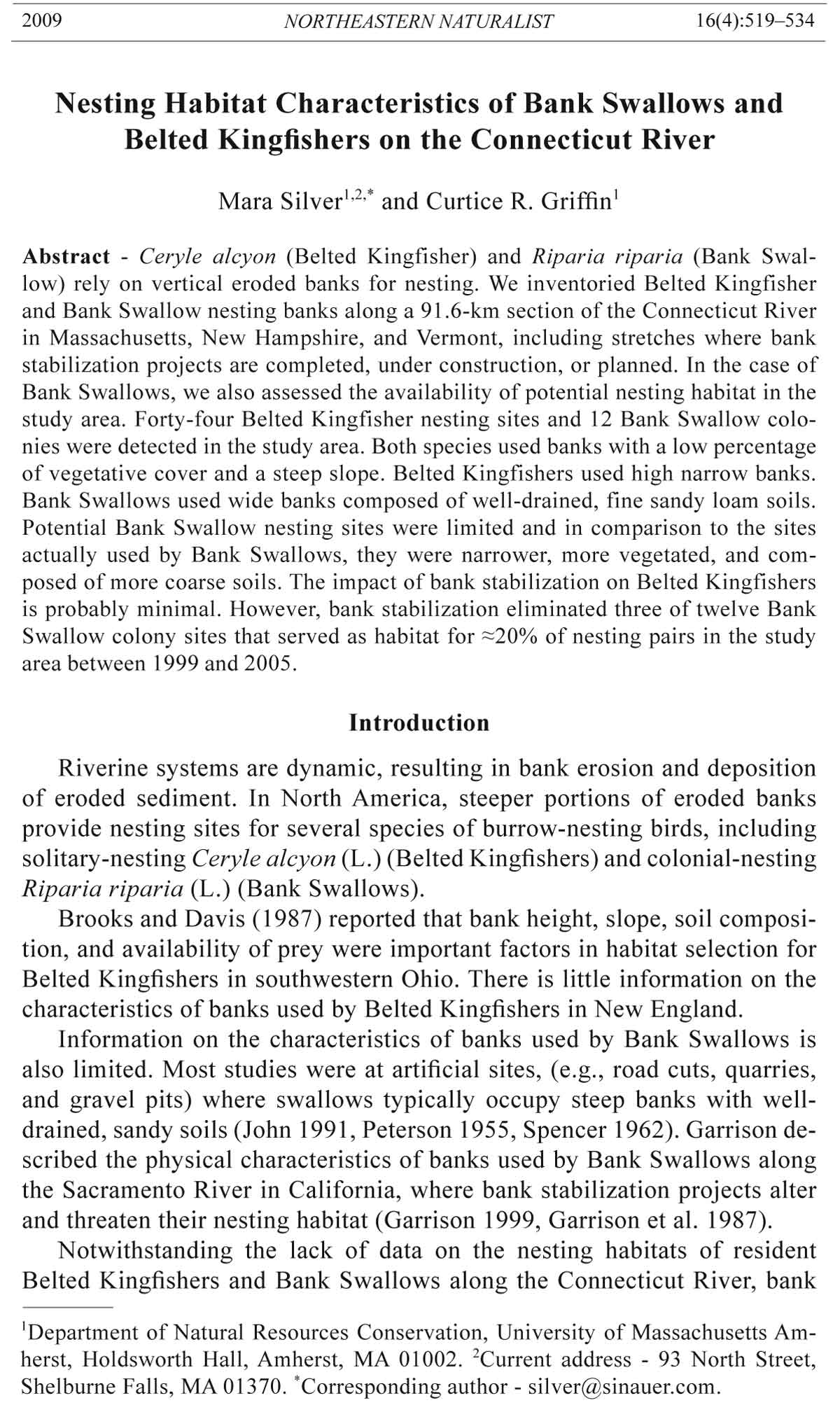
Belted Kingfishers on the Connecticut River
Mara Silver1,2,* and Curtice R. Griffin1
Abstract - Ceryle alcyon (Belted Kingfisher) and Riparia riparia (Bank Swallow)
rely on vertical eroded banks for nesting. We inventoried Belted Kingfisher
and Bank Swallow nesting banks along a 91.6-km section of the Connecticut River
in Massachusetts, New Hampshire, and Vermont, including stretches where bank
stabilization projects are completed, under construction, or planned. In the case of
Bank Swallows, we also assessed the availability of potential nesting habitat in the
study area. Forty-four Belted Kingfisher nesting sites and 12 Bank Swallow colonies
were detected in the study area. Both species used banks with a low percentage
of vegetative cover and a steep slope. Belted Kingfishers used high narrow banks.
Bank Swallows used wide banks composed of well-drained, fine sandy loam soils.
Potential Bank Swallow nesting sites were limited and in comparison to the sites
actually used by Bank Swallows, they were narrower, more vegetated, and composed
of more coarse soils. The impact of bank stabilization on Belted Kingfishers
is probably minimal. However, bank stabilization eliminated three of twelve Bank
Swallow colony sites that served as habitat for ≈20% of nesting pairs in the study
area between 1999 and 2005.
Introduction
Riverine systems are dynamic, resulting in bank erosion and deposition
of eroded sediment. In North America, steeper portions of eroded banks
provide nesting sites for several species of burrow-nesting birds, including
solitary-nesting Ceryle alcyon (L.) (Belted Kingfishers) and colonial-nesting
Riparia riparia (L.) (Bank Swallows).
Brooks and Davis (1987) reported that bank height, slope, soil composition,
and availability of prey were important factors in habitat selection for
Belted Kingfishers in southwestern Ohio. There is little information on the
characteristics of banks used by Belted Kingfishers in New England.
Information on the characteristics of banks used by Bank Swallows is
also limited. Most studies were at artificial sites, (e.g., road cuts, quarries,
and gravel pits) where swallows typically occupy steep banks with welldrained,
sandy soils (John 1991, Peterson 1955, Spencer 1962). Garrison described
the physical characteristics of banks used by Bank Swallows along
the Sacramento River in California, where bank stabilization projects alter
and threaten their nesting habitat (Garrison 1999, Garrison et al. 1987).
Notwithstanding the lack of data on the nesting habitats of resident
Belted Kingfishers and Bank Swallows along the Connecticut River, bank
1Department of Natural Resources Conservation, University of Massachusetts Amherst,
Holdsworth Hall, Amherst, MA 01002. 2Current address - 93 North Street,
Shelburne Falls, MA 01370. *Corresponding author - silver@sinauer.com.
520 Northeastern Naturalist Vol. 16, No. 4
stabilization projects are occurring in some areas. In light of ongoing stabilization
of riverbanks in our locale, our objectives were to: (1) inventory
eroding riverbanks used by Belted Kingfishers and Bank Swallows, (2)
characterize the habitat features of eroding river banks important to these
two species, and (3) identify riverbanks that have potential as Bank Swallow
colony sites. To reach these objectives we measured: (1) characteristics of
actively used nesting banks for both species, (2) a random sample of unused
banks, and (3) potential Bank Swallow nesting banks.
Methods
Study area
The Connecticut River, New England’s largest river, originates at the
Connecticut Lakes (45°14'N, 71°12'W) in northern New Hampshire, and
flows south 650 km to Old Saybrook, CT (41°16'2N, 72°20'W), where it
empties into Long Island Sound. The river forms much of the boundary between
Vermont and New Hampshire, and continues through Massachusetts
and Connecticut to the Sound.
We conducted our fieldwork by boat on the main stem of the Connecticut
River from the Vernon Dam (42º46'N, 72º31'W, about 425 km south of the
Connecticut Lakes), in Vernon, VT and Winchester, NH, to the Holyoke Dam
(42º12'N, 72º36'W), Holyoke, MA, a river distance of 91.6 km. The Turners
Falls Dam (42º36'N, 72º32'W), Turners Falls, MA, lies 34.0 km south
of the Vernon Dam, 57.6 km north of the Holyoke Dam, and separates our
river study area into two sections (designated pools by the conventions of
hydroelectric generation). The northern pool, (the Turners Falls Pool) extends
from the Vernon Dam to the Turners Falls Dam. The southern pool (the
Holyoke Pool), extends from the Turners Falls Dam to the Holyoke Dam.
Electrical generation capacities of the Vernon, Turners Falls, and Holyoke
dams, all of which have been in place for at least a century, are 21MW, 6MW,
and 44MW, respectively. There are 12 additional functioning dams on the
main stem of the river; all of these are north of the Vernon Dam. To augment
the peak hydroelectric capacity of the river, a 1000 MW pumped-storage hydroelectric
station (Northfield Mountain Station [42°37'N 72°25'W], about
9.0 km north of Turners Falls Dam) began operation in the Turners Falls Pool
in 1972.
The interaction between the flowing river and physical features of the
land results in various bank types in the study area. These range from ledges
to steep eroded faces, terraces, beaches, and gently sloping floodplain
forests. Factors contributing to erosion include natural fluvial processes,
hydroelectric generation, recreational motorboat use, and high run-off from
storm events.
In the Turners Falls Pool, hydroelectric generation results in water level
fluctuations of up to 0.9 m over 24 hours, and 2.4 m over a one-week cycle.
As of 1991, approximately one-third of the banks of this pool were actively
eroding (US Army Corps of Engineers 1991).
2009 M. Silver and C.R. Griffin 521
The rate and magnitude of water-level fluctuations in the Holyoke
Pool are lower than in the Turners Falls Pool, and erosion is variable.
During our study (1997–1999), water levels in the Holyoke Pool fluctuated
by 0.3 m. Erosion rates are low in the first 40 km of the Holyoke
Pool below the Turners Falls Dam. Erosion rates increase along the next
7.4 km. South of this, to the Holyoke Dam (10.2 km), the banks on both
the east and west sides of the river are composed primarily of ledge, and
erosion rates are minimal.
For both Belted Kingfishers and Bank Swallows, after initial
investigation revealed the pattern of erosion in the two pools, fieldwork
was concentrated in the two stretches of the river with high bank erosion
rates, where the two species were found to nest: the entire Turners Falls
Pool (34.0 km), and the 7.4-km area of high erosion in the Holyoke Pool.
To maintain consistency, however, all results were considered relative to
the 96.1-km river study area. Fieldwork investigating Belted Kingfisher
nesting sites was conducted in both pools in the 1999 season. For Bank
Swallows, we worked the three seasons 1997–1999 in both pools.
Belted Kingfisher nest-burrow inventory
After the nesting season (i.e., after 31 July) in 1999, daily surveys were
conducted for 21 days to identify Belted Kingfisher nest burrows throughout
both pools. Belted Kingfisher nest burrows are unique in our study area.
Although Stelgidopteryx serripennis (Audubon) (Northern Rough-winged
Swallows), a secondary cavity nester, will use abandoned kingfisher burrows
for nesting, no other species in our region constructs nests with the same appearance.
Thus, we assumed that even if a kingfisher burrow was not fresh,
it was active within the past two years. The locations of recent burrows were
recorded, while locations of older burrows were not. Burrows with partiallyclosed
entrances (by either soil or vegetation) and with sediment (i.e., sand)
in the entrance hole were considered older (constructed prior to 1998).
Multiple recent nest burrows were present in some banks. However, because
Belted Kingfishers vigorously defend individual territories, it is unlikely that
two pairs would nest in the same bank. A second or third burrow would more
likely be last season’s or a partially excavated burrow.
Bank Swallow colony inventory
Surveys to locate active Bank Swallow colonies were conducted in both
pools during the nesting seasons in 1997–1999. Large colonies are usually
composed of smaller subcolonies that are often separated by bare bank face,
vegetation, or fallen trees. We considered one bank with multiple subcolonies
to be one colony.
Bank habitat characteristics
Bank height, width, slope, aspect, vegetative cover, and soil type were
determined at all banks used by Belted Kingfishers and Bank Swallows, at
potential Bank Swallow nest sites, and at a random sample of bank sites.
Potential colony sites were identified based on the following criteria: 5–20 m
522 Northeastern Naturalist Vol. 16, No. 4
height (i.e., we did not find active nests in banks <5 m tall), 10–150 m wide,
70–90° slope, and ≤10% vegetative cover. Potential sites were considered
a single site if vegetation between them was ≤20 m wide and/or <1 m high.
These criteria were chosen based on characteristics of active sites observed
in 1997. Random sites were chosen by dividing each power pool into 11-km
long segments. In each segment, 11 bank sites (one per km) were selected
for measurement using a random numbers table without replacement.
Bank height was measured from the base to the top of the bank at the approximate
center of the bank. Base of bank was (considered to begin) at the
high water mark; height included both the vertical portions of the bank and
any material that had slumped. Little slumped material was present in the
measured sites, probably due to strong intermittent currents and rapid depth
fluctuations resulting from hydroelectric generation as well as recreational
boating. Height was measured via triangulation for banks >6 m high and
with a 2 m-long pole for those <6 m high.
For used banks, width was considered the entire vertical bank face, not
just the bank face where nest holes were present. For potential banks, width
included the total area with a slope ≥70°, and vegetative cover ≤10% at
the onset of the breeding season (late April–early May). We used the same
criteria at random sites that we used for potential banks if the site occurred
on an eroded bank. If the random site was part of a long section of uniform
bank, bank width was truncated at 300 m. Bank width was measured with a
2 m-long pole across the base of shorter banks, and visually estimated for
long banks.
Slope of all banks was measured as the angle of the bank from the top
of the bank to the high water mark across the entire width of the bank face.
For each 5 m of bank width, one randomly chosen point was taken for slope
measurement, and an average slope was calculated from multiple measurements.
Slope was measured with an inclinometer attached to a 2 m-long pole.
For random banks that were part of a long, uniform stretch of bank, slope
was visually estimated.
For banks facing in one direction, aspect was determined from the center
of the bank. For banks on river bends, aspect was the angle of most of the
bank. Aspect was determined with a compass.
Vegetative cover on the bank face was estimated via visual surveys
using cover classes (1–5% [midpoint = 3.0], 6–15% [midpoint = 10.5],
16–25% [midpoint = 20.5], 26–50% [midpoint = 38.0], 51–75% [midpoint
= 63.0], 76–95% [midpoint = 85.5], and 96–100% [midpoint = 98.0] total
vegetative cover). Vegetative cover surveys were conducted in late July–
August when most vegetation had fully leafed out. Soil type was determined
using USDA county soil maps (USDA Soil Conservation Service
1967, 1978, 1981, 1987, 1989). Given the parent material of the soils along
the Connecticut River in our study area, the textural composition is of a
fairly narrow range, and generally composed of silts, fairly fine sand, and
very fine sand. Additionally, the soils developed in alluvium, which has a
2009 M. Silver and C.R. Griffin 523
range in texture and composition that is fairly limited; thus, we assumed
soil maps were of a fine enough scale for this study.
Data analyses
Data from both the Turners Falls and Holyoke pools were combined
after preliminary statistical analysis indicated no significant differences
among measured variables between pools (P ≥ 0.1). To determine which
variables described Belted Kingfisher and Bank Swallow nesting habitat, a
regression model was built for each. Additionally, a third model was built
to determine the best predictor(s) of swallow presence at used versus potential
sites. We tested for variables with high Pearson’s pair-wise correlation
(P > 0.75), and none met this criterion. Thus, all variables were entered into
the models separately. We used forward selection (SAS Institute 1990). Our
observation/predictor ratio (12 observations and 6 predictors) violates that
recommended by Steyerberg et al. (1999). Thus, univariate analysis may be
a more comprehensive measure of results for the swallow models, whereas
the logistic regression models serve as an exploratory investigation. In the
model-building phase, we first examined the effects of each independent
variable separately. Independent variables were bank height, width, slope,
aspect, vegetative cover, and soil type. Bank width, vegetative cover, and
soil type had bimodal distributions; each was divided into two categories for
analysis (Table 1). The variable soil type was categorized from an original
30 soil types. To determine which variables would be included in the logistic
model, we conducted univariate screening using χ2 and t-tests. Variables
were retained if significant (P < 0.1).
The overall goodness-of-fit of the Belted Kingfisher model was assessed
with the Hosmer-Lemeshow statistic (Hosmer and Lemeshow 1989). This
statistic indicates whether the model produces estimates that are significantly
different than observed values. For swallow models, the goodness-of-fit could
not be determined due to the low sample size and consequent low number of
groups (6) required for calculation of the goodness-of-fit (Hosmer and Lemeshow
1989). Thus, as already stated, the univariate analysis may be a more
comprehensive measure of results for the swallow models.
Table 1. Bank characteristics measured at Belted Kingfisher nest sites, used and potential Bank
Swallow colony sites, and random sites along the Connecticut River, 1997–1999 and used in
regression models.
Variable Type Description
Height Continuous Height of bank (m)
Width Categorical Width of bank (0–150 m versus >150 m)
Slope Continuous Average slope of bank
Aspect Continuous Aspect of bank face
Vegetative cover Categorical Percent of vegetation covering bank face (0–11% versus >11%)
Soil typeA Categorical Category 0; Category 1
ACategory 0 = very deep (1.5 m) well to moderately well drained, textures ranging from silt loam
through sand with <5% coarse fragments. Category 1 = wetter than moderately well drained,
coarse fragments >5% or shallow (<1.5 m) to bedrock.
524 Northeastern Naturalist Vol. 16, No. 4
The logistic regression model to predict the presence of Belted Kingfishers
included height, width, slope, and vegetative cover of banks. The Bank
Swallow model included width, slope, vegetative cover, and soil type. The
used/potential Bank Swallow model included width and vegetative cover. A
probability cut point of 0.5 was used to classify observations as events or
non-events (Hosmer and Lemeshow 1989).
Results
Belted Kingfisher inventory and bank habitat characteristics
We found 44 Belted Kingfisher nest sites along 96.1 km of river, or 0.5
nests/km overall (Fig. 1). There were 0.4 nests/km in the 34-km Turners
Falls Pool, and 1.0 nests/km in the 7.4-km focus area of the Holyoke Pool.
In the Holyoke Pool, we did not find kingfisher nests outside of this 7.4-km
stretch of river. Nesting sites were distributed evenly in both stretches of
river in which they were found.
We compared the bank characteristics of nest sites (Table 2) to those of
90 random sites (Fig. 2, Table 3). Height, width, slope, and vegetative cover
were included and remained in the logistic model (Table 4), providing 93%
correct classification. Bank slope and vegetative cover were the best predictors
of bank use (highest Wald χ2 values). However, bank use was negatively
related to width and vegetative cover, and positively related to height and
slope. The odds ratio indicated that kingfishers were 1.4 times as likely to
use higher banks per unit height increase (per meter), and 1.2 times as likely
to use vertical banks per unit slope increase (per degree). According to these
data, kingfishers selected banks that were both higher and narrower than
Figure 1. Active Belted Kingfisher nest site.
2009 M. Silver and C.R. Griffin 525
unused banks. Average widths of banks used for kingfisher nesting were
narrower than those used by Bank Swallows (mean = 25.8 m and mean =
128.3 m, respectively).
Bank Swallow inventory and bank habitat characteristics
We located 12 active Bank Swallow colonies in the study area over
three seasons (Fig. 3). In 1999, there were 1007 total nesting pairs in 11
banks (one bank was discovered late in the nesting season in 1999, and
total nesting pairs could not be determined for that colony). Colony size
ranged from 1 to 250 pairs (mean = 92 pairs). There were five colonies
(11% of total nesting pairs) with 1–49 nesting pairs, one colony (5% of
total nesting pairs) with 50–99 pairs, three colonies (36% of total nesting
Table 2. Average measures of bank characteristics at Belted Kingfisher nest sites, active and potential
Bank Swallow colony sites, and random sites along the Connecticut River, 1997–1999.
Used (kingfishers) Used (swallows) Potential (swallows) Random
Variable n = 44 n = 12 n = 31 n = 90
Height (m) 7.6 7.3 7.0 5.7
Width (m) 25.8 128.3 32.6 257.7
Slope (degrees) 89.0 88.0 89.0 55.0
Aspect (compass) 187.2 180.0 133.4 185.7
Vegetative cover (%) 7.5 7.3 24.5 84.9
Soil typeA
% in Cat 0 77.0 100.0 77.0 74.0
% in Cat 1 23.0 0.0 23.0 26.0
ASee Table 1 for definitions of soil categories.
Figure 2. Random site. Random sites were variable; this one depicts a non-ideal nesting
site for Belted Kingfishers and Bank Swallows.
526 Northeastern Naturalist Vol. 16, No. 4
pairs) with 100–149 pairs, no colonies with 150–199 pairs, and two colonies
(48% of total nesting pairs) with 200–250 pairs. Eighty-four percent
of all birds in the study nested in banks with ≥100 active nests, and 48%
nested in banks with ≥200 active nests. Eleven of 12 colonies were occupied
all three years of the study.
Width, slope, vegetative cover, and soil type differed between active
colony sites and random sites (Table 5). Banks with active colonies were
wider, steeper, less vegetated, and had deeper, better-drained soil with
fewer coarse fragments than random sites. In the stepwise logistic procedure,
only vegetation remained in the model (parameter estimate = -4.25,
SE = 0.89, Wald χ2 = 23.18, odds ratio = 0.01, P = 0.0001) as the single
best predictor of nesting Bank Swallows at a site, providing 92% correct
Table 3. Bank habitat characteristics at used Belted Kingfisher nest sites (n = 44) and random
sites (n = 90) along the Connecticut River, 1997–1999.
Used vs. Random
Used Random df χ2 P
Vegetative cover
0–11% 38 6 1 85.11 8.81E-21
>11% 6 84
Soil type
Cat. 0 34 67 1 0.13 0.832
Cat. 1 10 23
Width
0–150 m 41 15 1 71.12 2.49E-18
>150 m 3 75
Used vs. Random
Used Random t P
Height (m)
Mean 7.6 5.7 -3.51 0.0006
SE 0.3 0.4
Slope (degrees)
Mean 89.0 55.0 -14.10 0.0001
SE 0.7 2.3
Aspect (degrees)
Mean 187.2 185.7 -0.08 0.935
SE 16.3 9.9
Table 4. Results of logistic regression for predicting nesting Belted Kingfisher nest sites along
the Connecticut River 1997–1999.
Parameter
Variable estimate SE Wald χ2 Odds ratio P
Average slope 0.18 0.07 6.85 1.2 0.009
Vegetative cover -2.20 0.95 5.37 0.1 0.021
Height 0.34 0.17 3.97 1.4 0.046
Width -1.96 1.05 3.95 0.1 0.062
Goodness-of-fit statistic = 3.94, df = 6, P = 0.684
2009 M. Silver and C.R. Griffin 527
classification. Slope and vegetative cover were highly related (t = 3.97,
P = 0.001). Banks that had 0–11% vegetative cover had a mean slope of
Figure 3. Active Bank Swallow colony showing nesting burrows.
Table 5. Bank habitat characteristics at used (n = 12) and potential (n = 31) Bank Swallow
colonies, and random sites (n = 90) along the Connecticut River, 1997–1999.
Used vs. Potential Used vs. Random
Used Potential Random df χ2 P df χ2 P
Vegetative cover
0–11% 10 14 6 1 5.11 0.039 1 47.06 2.19E-08
>11% 2 17 84
Soil type
Cat. 0 12 24 67 1 3.24 0.163 1 3.96 0.063
Cat. 1 0 7 23
Width
0–150 m 5 30 15 1 17.35 17.3E-04 1 4.20 0.055
>150 m 7 1 75
Used vs. Potential Used vs. Random
Used Potential Random t P t P
Height (m)
Mean 7.3 7.0 5.7 -0.23 0.820 -1.27 0.210
SE 1.2 0.5 0.4
Slope (degrees)
Mean 88.0 89.0 55.0 0.38 0.710 -13.51 0.0001
SE 0.8 1.4 2.3
Aspect (degrees)
Mean 180.1 133.4 185.7 -1.25 0.220 0.19 0.847
SE 30.7 19.9 93.6
528 Northeastern Naturalist Vol. 16, No. 4
79°, whereas banks with >11% vegetation had a mean slope of 56°. The
parameter estimate indicates that as vegetation increases, the probability
of nesting swallows decreases.
Thirty-one potential sites (Fig. 4) were identified and compared to used
sites. In the univariate analysis (Table 5), width and vegetative cover differed
between used and potential sites. These two variables were included
and remained in the logistic model (Table 6), providing 81% correct classification.
The parameter estimate indicates that as bank width increases, the
probability of nesting swallows increases; yet as vegetation increases,
the probability of nesting Bank Swallows decreases. These results were
reinforced by our finding that 82% of the swallows in our study nested in
banks >150 m wide. Thus, potential banks were consistently narrower, with
more vegetative cover than used banks. Using these criteria, we considered
11 (five in the Turners Falls Pool and six in the Holyoke Pool) of the 31 potential
sites to be suitable for Bank Swallow nesting. If we combine these
11 suitable potential sites with our 12 active colonies, we arrive at a site
occupancy of about 50%.
Table 6. Results of logistic regression comparing used and potential Bank Swallow sites along
the Connecticut River 1997–1999.
Parameter
Variable estimate SE Wald χ2 Odds ratio P
Width 3.94 1.34 8.62 51.4 0.003
Vegetative cover –2.07 1.18 3.08 0.1 0.080
Figure 4. Potential nesting site for Bank Swallow colony.
2009 M. Silver and C.R. Griffin 529
Discussion
Belted Kingfishers
Our count of 1.0 nest/km in the focus area (higher erosion) of the Holyoke
Pool is similar to that reported in Colorado (Shields and Kelly 1997). In
contrast, Belted Kingfisher nests were found at a lower density (0.4 nest/km)
in the Turners Falls Pool, where there was more fluctuation of water levels
and higher river bank erosion rates than in the Holyoke Pool. It is unlikely
that there were no kingfisher nests in the remainder of the Holyoke Pool;
however, we were unable to locate them with the techniques that we had
developed. In this respect, we feel justified in the conclusion that kingfisher
nesting sites were rare outside of the 7.4-km high erosion area of the Holyoke
Pool. The nest density over the entire 96.1-km study area, 0.5 nests/km,
appears to reinforce this interpretation.
Belted Kingfishers select nesting banks that are vertical, free of vegetation,
and consist of sandy soils with variable clay content (Hamas 1994). Brooks
and Davis (1987) argued that higher banks afforded kingfisher nests protection
from predators, fluctuating water levels, and floods along stream habitats
in Pennsylvania and Ohio. They reported that the average slope of kingfisher
nesting banks was 88.0° (± 5°) in Pennsylvania and 89.0° (± 2°) in Ohio. In
Colorado, Shields and Kelly (1997) found that kingfishers selected high banks
that sloped uniformly to the waterline (without a decrease in slope at the base)
and had a lower sand content than those reported by Brooks and Davis. Our
results were similar to these two studies regarding slope and height, but soil
characteristics were not significant in our investigation.
Bank Swallows
We located 12 colonies along 91.6 km of the Connecticut River, whereas
60 colonies were found along 256 km of the Sacramento River (Garrison
et al. 1987) and 211 colonies were found along a 586-km segment of the
River Tisza in Hungary (Szép 1991). However, our ≈50% site occupancy is
approximately twice the site occupancy (between 20% and 30%) observed
in mid-1990s on the Sacramento River by B.A. Garrison (Rancho Cordova,
CA, 2006 pers. comm.). Our relatively high occupancy rate may indicate that
nesting habitat is limited, which may also explain the persistence of colonies
at the same sites throughout the three years of our study.
Although there were more colonies with 1–49 pairs, most individuals
in our study nested in banks with over 100 pairs. Similarly, 60% of Bank
Swallow colonies in Michigan had 1–50 active nests, but 71% of swallows
were in colonies with ≥100 active nests, and 47% inhabited colonies
≥200 nests (Hoogland and Sherman 1976). In Hungary, average colony
size was 158 pairs, and 67% of the birds nested in colonies with >200
pairs (Szép 1995).
Bank Swallows prefer a freshly eroded bank face for nesting, even
though new burrows must be excavated annually (Hickling 1959). Banks
relatively free of vegetative cover probably facilitate the excavation of burrows
by swallows, and reduce access by predators.
530 Northeastern Naturalist Vol. 16, No. 4
Steep slopes probably facilitate excavation of the swallows’ long horizontal
burrows and, again, deter predators. Previous studies reported that
areas highest on the vertical bank face are more easily defended against
threats and evictions from conspecifics during burrow-excavation (Peterson
1955). John (1991) found that swallows only nested in banks with sufficient
stability to maintain a 3-m vertical face. Although slope did not remain in
our stepwise regression model, this was most likely due to its high correlation
with vegetative cover.
Bank Swallows typically prefer sandy, silty, loamy soils, characterized
by small particle size (Garrison 1999). Along the Sacramento River, Garrison
et al. (1987) found that 68.6% of swallows nested in fine sandy loam,
loam, and silt-loam. Similarly, Spencer (1962) found that the birds preferred
loamy sands or sandy loams with low clay and high sand content. Peterson
(1955) reported that swallows prefer sand to clay or chalk, and that nest burrows
were deeper when excavated in sand (92% sand) than sandy loam (65%
sand). In accord with these investigators, we found colonies in deep, fine,
uniform, river-deposited sediments.
Our observation that 82% of swallows nested in banks that were >150 m
wide was consistent with Garrison et al.’s (1987) study on the Sacramento
River where nesting bank width averaged 454.6 m. Although Spencer (1962)
reported an average bank width of only 57.1 m (range = 9.1–304.8), 24 of
25 sites in his study were human-made; these artificial banks tend to be narrower
than banks along rivers and streams. Larger colonies are located on
wider banks, and these larger colonies tend to persist longer than smaller
colonies (Garrison 1999). We suspect that the Connecticut River probably
provides important Bank Swallow nesting habitat in the study area because
of the presence of wide banks.
Petersen (1955) suggested that social forces play a role in keeping Bank
Swallow burrows concentrated, and some researchers noted a surplus of unused
bank habitat (Spencer 1962). Similarly, there appeared to be sufficient
suitable potential habitat in our study area that was unused. However, based
on characteristics of used sites, we found a shortage of wide banks or vegetation-
free banks for nesting. One explanation for the high number of potential
banks with high vegetative cover may be related to vegetation phenology.
We identified many of the potential sites early in the growing season before
vegetation had leafed out. Many of these sites were covered with vegetation
by mid- to late-summer when vegetative cover was measured. This was not
the case with used sites, which remained vegetation-free. Further, a higher
percentage of potential sites were composed of coarser soils than used sites.
Thus, width, vegetative cover, and soil type may differentiate used from potential
sites, thereby limiting the utility of potential sites for nesting swallow
colonies along this stretch of the Connecticut River.
Conservation
Although we did not find published records, Bank Swallows have always
nested in some numbers along the length of the river (S. Kellogg,
2009 M. Silver and C.R. Griffin 531
Springfield, MA, 2007 pers. comm.), and a colony has been observed nesting
in one particular section of riverbank in Holyoke Pool of the study for the
last 45 years (T. Gagnon, Amherst, MA, 2007 pers. comm.).
Nest-site characteristics of Belted Kingfishers and Bank Swallows differed
in our study area. Although both species used steep eroding banks with
little vegetation, kingfishers tended to use narrow banks, whereas swallows
used wide banks. Considering there are relatively fewer suitable wide banks,
swallow nest-sites are probably more limited than kingfisher nest sites in our
study area. This limited number of suitable nest sites in combination with
their moderate levels of nest site tenacity (Bergstrom 1951, Stoner 1941)
makes Bank Swallows vulnerable to bank stabilization programs along the
Connecticut River.
As bank stabilization continues, fewer sites erode and additional habitat
is not created (Fig. 5). Further, the most highly eroded and widest banks are
typically chosen for stabilization projects; yet, these banks are the most important
for nesting swallows in our study area. During our study, two of six
active swallow colony sites in the Turners Falls Pool were lost to stabilization
projects. Observations made after our study and information provided
by The Franklin Regional Council of Governments revealed that at least five
banks, with a total width of 1798 m, were stabilized within the Turners Falls
Pool by 2000. Additionally, between 2000 and 2005, another 2171 m of riverbank
were stabilized in our study area, eliminating one more active colony
Figure 5. Stabilized bank. Current stabilization efforts in the Turners Falls Pool are
done using a method called “bioengineering”; the banks are graded, creating a shallow
slope, and a stone toe is installed. The bank is then covered with “fabric” and
further stabilized with plantings.
532 Northeastern Naturalist Vol. 16, No. 4
site and four of five sites we considered suitable potential sites. Thus, three
of six active colonies in the Turners Falls Pool were eliminated between
1997 and 2005. Stabilization of an additional 299 m was scheduled to occur
by the end of 2005, with 518 m more by the end of 2007, and additional work
is planned beyond 2007.
The three Bank Swallow colonies in the Turners Falls Pool that were
lost to stabilization between 1997 and 2005 accounted for ≈20% of the
nesting pairs of birds recorded in 1999 in our 96.1-km study area. One of
these sites was a larger site (135 pairs). It is not known if the birds that
nested at this site moved to another nesting site in the study area in the subsequent
year. For the six years following our study, we have not received
any casual reports indicating that the birds have been able to exploit new
habitat (comparable to the size of the large site that was eliminated) elsewhere
in the Turners Falls Pool.
The size and impact of the pumped-storage hydroelectric facility at
Northfield Mountain Station has contributed to the decision favoring intensive
soil conservation efforts in the Turners Falls Pool. The energy of
the moving water must, however, be somehow dissipated; the future effects
of these projects with respect to our study species, even if these effects are
largely confined to the Turners Falls Pool, are unknown. It seems likely that
habitat availability in this pool will diminish as the river is increasingly
channelized. Garrison et al. (1987) reported that erosion control projects
on the Sacramento River threatened over 50% of that river’s Bank Swallow
population. By 1996, Schlorff (1997) reported that the number of nesting
pairs on the Sacramento River had declined by 66% since 1986. Our work
suggests a similar effect over a much shorter stretch of river than that of
the Sacramento. A greatly expanded effort, encompassing a much greater
portion of the 650-km main stem of the river, is necessary to help bring perspective
to our work.
Although erosion is a natural fluvial process that provides nesting habitat
for Belted Kingfishers and Bank Swallows along the Connecticut River,
human activities also affect erosion rates both positively (i.e., water fluctuation
for hydropower generation), and negatively (i.e., bank stabilization).
To conserve nesting Bank Swallows in our study area of the river, the wide
banks currently used for nesting and erodable areas adjacent to these sites
should not be stabilized. Additionally, wide banks that we consider to have
high potential as future swallow nest sites should also be protected from
stabilization. The long-term conservation of Belted Kingfishers and Bank
Swallows on the Connecticut River depends on maintenance of dynamic
erosive processes of the river.
Acknowledgments
For helpful comments on early drafts of the manuscript, we thank P. Vickery
and T. Litwin. We thank P. Kuzeja, C. Silver, and G. LeBaron for help with fieldwork,
and we are indebted to Trina Hosmer for her assistance with data analyses. Funding
2009 M. Silver and C.R. Griffin 533
for this project was provided by Northeast Utilities Corporation, the Sweetwater
Trust, and the Charles Blake Fund. We also acknowledge B.A. Garrison and two
anonymous reviewers, whose comments greatly improved the manuscript.
Literature Cited
Bergstrom, E.A. 1951. The South Windsor Bank Swallow colony. Bird-Banding
22:54–63.
Brooks, R.P., and W.J. Davis. 1987. Habitat selection by breeding Belted Kingfishers
(Ceryle alcyon). American Midland Naturalist 117:63–70.
Garrison, B.A. 1999. Bank Swallow (Riparia riparia). In A. Poole and F. Gill (Eds.).
The Birds of North America, No. 414. Academy of Natural Sciences, Philadelphia,
PA, and American Ornithologists’ Union, Washington, DC.
Garrison, B.A., J.M. Humphrey, and S.A. Laymon. 1987. Bank Swallow distribution
and nesting ecology on the Sacramento River, California. Western Birds
18:71–76.
Hamas, M.J. 1994. Belted Kingfisher (Ceryle alcyon). In A. Poole and F. Gill (Eds.).
The Birds of North America, No. 84. Academy of Natural Sciences, Philadelphia,
PA, and American Ornithologists’ Union, Washington, DC.
Hickling, R.A.O. 1959. The burrow-excavation phase in the breeding cycle of the
Sand Martin Riparia riparia. Ibis 101:497–500.
Hoogland, J.L., and P.W. Sherman. 1976. Advantages and disadvantages of Bank
Swallow (Riparia riparia) coloniality. Ecological Monographs 46:33–58.
Hosmer, D.W., Jr., and S. Lemeshow. 1989. Applied Logistic Regression. John Wiley
and Sons, Inc. New York, NY.
John, R.D. 1991. Observations on soil requirements for nesting Bank Swallows,
Riparia riparia. Canadian Field-Naturalist 105:251–254.
Petersen, A.J. 1955. The breeding cycle in the Bank Swallow. Wilson Bulletin
67:235–286.
SAS Institute, Inc. 1990. SAS/STAT User’s Guide. Version 6.12. SAS Institute.
Cary, NC.
Schlorff, R.W. 1997. Monitoring Bank Swallow populations on the Sacramento
River: A decade of decline. Transactions of the Western Section of the Wildlife
Society 33:40–48.
Shields, S J., and J.F. Kelly. 1997. Nest-site selection by Belted Kingfishers (Ceryle
alcyon) in Colorado. American Midland Naturalist 137:401–403.
Spencer, S.J. 1962. A study of the physical characteristics of nesting sites used by
Bank Swallows. Ph.D. Dissertation, Pennsylvania State University, University
Park, PA.
Steyerberg, E.W., Eijkemans, M.J.C., and J.D. Habbema. 1999. Stepwise selection in
small data sets: A simulation study of bias in logistic regression analysis. Journal
of Clinical Epidemiology 52:935–942.
Stoner, D. 1941. Homing instinct in the Bank Swallow. Bird-Banding 12:104–109.
Szép, T. 1991. Number and distribution of the Hungarian Sand Martin [Riparia riparia
(L.), 1758] population breeding along the Hungarian reaches of the River
Tisza. Aquila 98:111–124.
Szép, T. 1995. Relationship between west African rainfall and the survival of central
European Sand Martins Riparia riparia. Ibis 137:162–168.
534 Northeastern Naturalist Vol. 16, No. 4
United States Army Corps of Engineers. 1991. General investigation study, Connecticut
River streambank erosion. US Corps of Army Engineers, New England
Division, Concord, MA.
United States Department of Agriculture, Soil Conservation Service (USDA SCS).
1967. Soil survey, Franklin County Massachusetts. US Government Printing Office, Washington, DC.
USDA SCS. 1978. Soil survey, Hampden County Massachusetts. US Government
Printing Office, Washington, DC.
USDA SCS. 1981. Soil survey, Hampshire County Massachusetts. US Government
Printing Office, Washington, DC.
USDA SCS. 1987. Windham County, Vermont. US Government Printing Office,
Washington, DC.
USDA SCS. 1989. Cheshire County, New Hampshire. US Government Printing Office, Washington, DC.