2012 NORTHEASTERN NATURALIST 19(1):25–42
Plant Species Diversity of Highway Roadsides in Southern
New England
Rebecca Nelson Brown1,* and Carl D. Sawyer1
Abstract - Mowed roadsides represent a significant proportion of the grassland habitat
in New England, but they receive little attention from naturalists. We sought to test the
assumption that mowed roadsides are ecological wastelands dominated by deliberately
seeded introduced perennial grass species. Surveys of seven sites in Rhode Island during
the summer of 2008 revealed that roadsides are important refugia for grassland plants, including
two species and two subspecies believed to be rare in New England. We found 80
grass and forb species, 45% of which are native. We also examined the effects of distance
from the road and topography on the relative distributions of annual versus perennial
species and of native versus introduced species. Perennial species cover increased with
distance from the road at all seven sites, and the number of perennial species increased
at five sites. The front slope had the most annual species and the most annual cover at all
sites. Perennial species dominated the back slope, swale, and flat areas. Neither distance
from the road nor topography had a clear effect on the distribution of native species
relative to introduced species. Highway roadsides in southern New England are not an
ecological wasteland, but rather are a complex upland grassland habitat reminiscent of
the agricultural grasslands which dominated the region in the nineteenth century.
Introduction
Grasslands and open shrublands are traditional and culturally important components
of the landscape in coastal New England. However, these open lands
primarily resulted from deforestation and agricultural activities; they did not
exist on a significant scale prior to European settlement (Foster and Motzkin
2003). In 1650, nearly 100% of New England uplands were forested; however,
by 1850, forest cover had decreased to less than 40% in southern New England,
and agricultural grasslands such as pastures and hayfields predominated (Foster
1995). As agriculture declined during the twentieth century, grasslands were
replaced by forests and urban development, and many grassland species became
rare (Neill 2007). As a result, lawns and mowed rights-of-way (roadsides, utility
lines, and airfields) have become the predominant grasslands. In 1995, there were
an estimated 805,000 acres of residential lawns in southern New England (Vinlove
and Torla 1995). The area in lawns has undoubtedly increased in the past 15
years, and this estimate does not include parks, golf courses, or other managed
turf areas. In addition, there is an estimated 4 acres of mowed roadside for every
mile of limited access highway in southern New England – roughly 600,000 acres
in Rhode Island, Connecticut, and Massachusetts combined (K. Berger, University
of Rhode Island, Kingston, RI, pers.comm.). By contrast, there is only an
estimated 50,000 acres of natural grassland habitat in the region; it is not known
1Department of Plant Sciences and Entomology, University of Rhode Island, Kingston,
RI 02881. *Corresponding author - brownreb@uri.edu.
26 Northeastern Naturalist Vol. 19, No. 1
how much of that is protected (P. August, University of Rhode Island, Kingston,
RI, pers. comm.).
The roadside is a highly engineered environment designed to drain water
away from the pavement. Vegetation is selected for the ability to prevent erosion
and filter runoff while minimizing danger to vehicles; mowing-tolerant grasses
and legumes are preferred (FHWA 2003). In Rhode Island and throughout New
England, Festuca rubra (Red Fescue), Poa pratensis (Kentucky Bluegrass),
and Lolium perenne (Perennial Ryegrass) are the most commonly used species,
with the legume Lotus corniculatus (Birdsfoot Trefoil) added to supply nitrogen
(RIDOT 2004). These species are also preferred for lawns in the region. Fertilization,
frequent mowing, and the use of herbicides effectively suppress most
other species in maintained lawns. It has been reported that roadsides are similar
to lawns in being almost devoid of ecological value (Forman et al. 2003). However,
maintenance of roadsides in New England is limited to mowing every 3–4
weeks from June through October (S. Clarke, RI Department of Transportation
[RIDOT], Providence, RI, pers.comm.). Thus, the survival of cultivated turfgrasses
on roadsides may be significantly different than for maintained lawns.
The floras of southern New England contain many grassland species that were
abundant in pastures and field edges in the nineteenth century, but are becoming
increasingly scarce (Beck 1868, Gleason and Cronquist 1991, Gould et al. 1998,
Graves et al. 1910). Significant resources have been invested in conserving a
small number of natural grasslands that are important as habitat for grassland
birds. Roadsides are not particularly good habitat for grassland birds and large
mammals due to noise and risk of collision with vehicles, but they can be effective
habitat for plants at substantially less cost per acre. Research in Europe has
shown that roadsides can be important refugia for plants and insects that require
early-succession habitats (Blomqvist et al. 2003, Eversham and Telfer 1994, Parr
and Way 1988, Way 1977). Perring (1969) reported that 27 out of the 300 rarest
plant species in Britain occurred primarily on roadsides. Roadside wetlands in
Prince George County, VA have proven to be successful refugia for the rare Sarracenia
flava L. (Yellow Pitcher Plant) and associated bog species (Nye 2001).
Sheridan et al. (1997) surveyed powerline easements in Georgia, Virginia, and
Maryland for state rare plant species; they found a total of 65 rare plant species.
There are no published descriptions of the vegetation communities of mowed
highway rights-of-way in New England.
In this study, we sought to determine whether native plants were establishing
in the mowed highway rights-of-way, and to describe their patterns of distribution.
The environment of the roadside is strongly influenced by distance from
the pavement, which determines exposure to the water and chemicals flowing
off the pavement, as well as temperature and relative humidity (Forman et al.
2003). Topography is variable within the verge due to interaction between the
natural terrain of the landscape through which the road is constructed and the
engineered topography of the roadside; topography also influences exposure of
roadside plants to water and chemicals. We investigated the effects of topography
2012 R. Nelson Brown and C.D. Sawyer 27
and distance from the road on the incidence and abundance of native plants, and
on the balance between annuals and perennials.
This study was part of a larger project designed to improve the persistence
of perennial grasses on roadsides in Rhode Island. While limited in scope, this
study was able to test the hypothesis that roadsides are dominated by introduced
perennial turfgrasses and annual weeds. As the first published vegetation survey
for high-speed roadways in New England, this study also provides insights into
which portions of the roadside are most likely to harbor native plants, and which
portions are dominated by annual species that may provide insufficient erosion
control. It is our hope that the results presented here may serve as an impetus for
more extensive surveying of and interest in roadside grassland communities.
Methods
Field site description
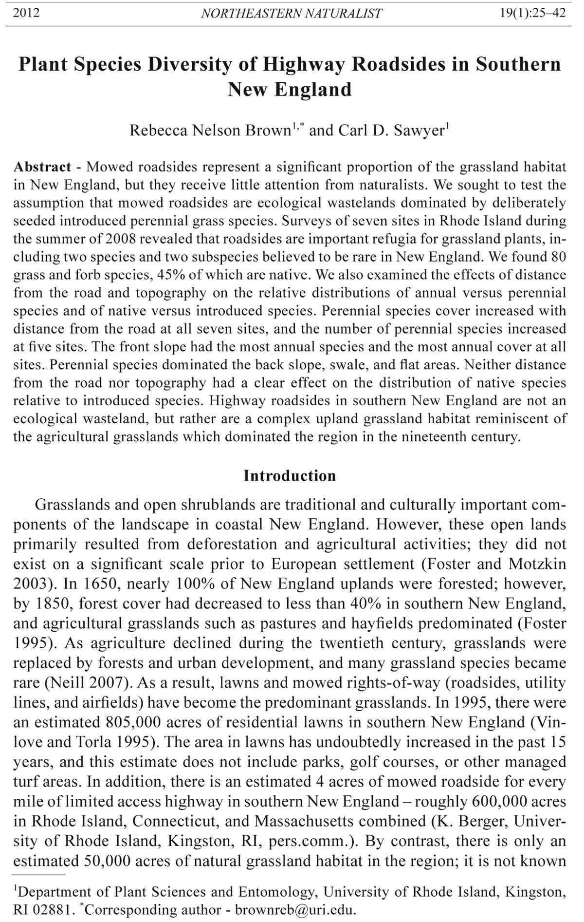
We surveyed 7 sites alongside limited-access highways in Rhode Island (Table
1, Fig. 1). The initial date of vegetation establishment for each site is listed in
Table 1; all sites had been reseeded repeatedly, but none had been seeded within
the previous 5 years. The bedrock for all sites is granite; the soils are a mixture
of silt and sand with gravel and stones of all sizes. Soils are acidic, with pH ranging
from 3.9 to 5.5. Soil pH is increased by roughly 0.5 units within 3.3 m of the
pavement. Increased pH close to the pavement has been associated with deposition
of salt and nitrogen (Green et al. 2008, Truscott et al. 2005).
The right-of-ways for all seven sites are maintained by RIDOT crews. Vegetation
is mowed with large tractor-mounted rotary mowers every 3–4 weeks from
late June through October. Clippings are not removed. Plantings receive no other
inputs or maintenance. Sanding and salting of the roads for ice control is done
by RIDOT crews; a standard application rate is used statewide. However, salt
exposure may vary by location as inland areas receive more precipitation as snow
or freezing rain than coastal areas do. Medians receive salt and other chemicals
from both directions, but as the majority of material is deposited within 5 m of the
road and all medians surveyed were wider than 10 m, the “double-dose” effects
should be minimal (Bryson and Barker 2002, Truscott et al. 2005).
The basic topography of the engineered roadside is an almost flat upper front
slope for the first 2–3 m from the pavement and then a steeper lower front slope
Table 1. Locations and initial seeding dates for survey sites. Dates are from Anderson (2009).
Date of Number of
Site Location (all in Rhode Island) GPS coordinates initial seeding quadrats
1 US-1 median, Matunuck 41°23'N, 71°32'W 1950s 18
2 I-95 shoulder, Hopkinton 41°29'N, 71°42'W 1953 18
3 I-95 median, West Greenwich 41°36'N, 71°39'W 1969 18
4 RI-4 shoulder, North Kingstown 41°36'N, 71°29'W 1988 18
5 RI-4 median, East Greenwich 41°39'N, 71°29'W 1972 12
6 I-295 median, Cranston 41°45'N, 71°28'W 1968 15
7 I-295 median, North Providence 41°52'N, 71°30'W 1975 15
28 Northeastern Naturalist Vol. 19, No. 1
down to a drainage swale and a back slope stretching up from the swale. However,
the specific terrain of each site is also influenced by the topography of the
larger area. Sites 2 and 4 are located on the shoulder, with a paved breakdown
lane separating the vegetation from the travel lane. The other sites are located in
medians. Both the upper and lower front slopes of site 1 are nearly flat and the
swale runs at an angle to the pavement such that the eastern end of the survey site
has no front slope and the western end is mostly front slope. The south-facing
back slope is quite steep at the eastern end and decreases to the west. Site 2 is
the driest site, with very sandy soil. The front slope is wide and nearly flat, with
Figure 1. Location of survey sites. All sites are along urban/suburban limited access highways
and are maintained by the Rhode Island Department of Transportation.
2012 R. Nelson Brown and C.D. Sawyer 29
the shallow swale located more than 10 m from the pavement. The back slope is
covered with a dense stand of conifers. Site 3 is entirely on the front slope which
declines gradually from the pavement to a swale 15–20 m away. Site 4 most
resembles the typical roadside, with a flat upper front slope and a gentle lower
front slope leading to a swale approximately 5 m from the pavement and a steep
mowed back slope that faces east. Site 5 is a 10–15-m-wide median on a northfacing
hillside ending in a wetland; it has 2 front slopes rather than a back slope.
Site 6 is similar to site 5, but the cross-section of the median is nearly flat, and
the site is more uniform than the others. Site 7 is similar to site 3.
Surveying
The survey area at each site was defined as a rectangle with a width of 10
m running perpendicular from the edge of the pavement and a length of 300
m running parallel to the road. All of the roads are classified as urban/suburban
and have similar traffic levels. Surveying was done using a 1-m2 quadrat
divided into 100 sections of 10 cm x 10 cm each. Mowing favors plants that
spread via rhizomes or stolons, leading to patchy vegetation that cannot be effectively
sampled with smaller quadrats. The number of quadrats sampled was
set at the point where the species accumulation rate decreased below one species
per additional quadrat. Since salt, nitrogen, grit, and many other pollutants
decrease with distance from the pavement we divided each site into three 3.3 m
zones based on distance from the pavement. Zone 1 was from 0–3.3 m, zone 2
was from 3.3–6.6 m, and zone 3 was from 6.6–10 m. The initial quadrat location
was selected randomly. Subsequent quadrats were spaced 50 m apart. Site
#5 had only 2 zones as the entire median was within 5–7 m of pavement. Each
species present within the quadrat square was identified and recorded. Species
richness was measured as the number of species per quadrat, irrespective of
cover. Since it can be impossible to distinguish genetic individuals in grassland
species with strong vegetative reproduction, we recorded species abundance as
the number of quadrat sections containing the species. Abundance is a hybrid of
frequency and cover since a single large plant such as a dandelion could occupy
multiple sections, while a single section could contain many small individuals
such as crabgrass seedlings. For each quadrat, we recorded the zone and the
topographical location within the site: upper front slope, lower front slope,
swale, back slope, or flat. Each site was surveyed on a single date between 25
June and 15 August 2008.
Species identification
All plants were identified to genus, and to species and subspecies wherever
possible. Phillips (1962) was used to identify mowed grasses based on vegetative
characteristics. The Flora of North America Volumes 22–25 (FNA 1993) and
Gleason and Cronquist (1991) were used to identify plants for which flowers
were available. Grasses, sedges, and rushes that could not be identified to species
without flowers or fruit were transplanted to the research farm and permitted to
flower. We also returned to the survey sites in June 2009 before the first mowing
30 Northeastern Naturalist Vol. 19, No. 1
to confirm species identifications. Scientific names are based on the Flora of
North America. All species were classified as native, introduced, or cryptic. Determination
of native status (native to the contiguous United States) was based
on the PLANTS database (USDA-NRCS 2009). Cryptic species are those of
indeterminate origin and included ones that may be native but may also have
been deliberately planted, and ones that could only be identified to genus, with
the genus containing both native and introduced species. Agrostis capillaris L.
(Colonial Bentgrass) was classified as cryptic because the populations found on
roadsides in Rhode Island appear to be genetically distinct from the cultivated
A. capillaris. (K. Amundson, USDA-ARS, Beltsville, MD, pers. comm.). Agrostis
taxonomy is complex, and the degree of relatedness between Rhode Island
Colonial Bentgrass and Eurasian Colonial Bentgrass is not yet clear.
Data analysis
The species richness for each site was computed using the sample-based rarefaction
curve with 95% confidence interval scaled by the number of individuals
accumulated (Colwell et al. 2004). The mao tau values were computed using
EstimateS (Colwell 2009). Effects of distance from the road and topography on
richness and abundance of native species and of perennial species were evaluated
using a general linear model ANOVA with distance and topography as the main
effects. The interaction term could not be tested as not all topography classes
occurred at all distances. Species richness and abundance data were expressed
as percentages of the total values for each quadrat. The unit of replication was
the individual quadrat. Data for each site were analyzed separately. Means comparison
tests were performed using Fisher’s least significant difference, which is
highly robust to unbalanced models.
Results
Roadside grasslands included numerous species in addition to those planted
by RIDOT, including many native species. A total of 80 graminoid and forb
species were identified in the 114 quadrats sampled (Appendix 1). Thirty-five
species were clearly native, 32 were introduced, and the remaining 13 were classifi
ed as cryptic. Fifty-seven (71%) of the species were perennials, and 23 (29%)
were annuals. Species number per site ranged from 29 to 39, with a mean of 34.
Perennials outnumbered annuals at all sites, and natives outnumbered introduced
species at all sites except #6 (Fig. 2).
The species seeded by RIDOT did not dominate the grassland. Birdsfoot Trefoil
was the most widespread, and it was only found at five of the seven sites. Red
Fescue was the most abundant, occurring in 1335 sections representing 35 quadrats
at 4 sites, which was only 21% of the total sections at those sites. Kentucky
Bluegrass was also found at 4 sites, but in only 408 sections from 14 quadrats.
Perennial Ryegrass occurred in only three sections from a single site.
The most abundant species overall was Digitaria ischaemum (Smooth Crabgrass),
which was found throughout all seven sites. It occurred in 75% of the
sections (Fig. 3A) and had 100% abundance in 24 quadrats. Total abundance
2012 R. Nelson Brown and C.D. Sawyer 31
for Smooth Crabgrass was 40% (Fig. 3B). Rumex acetosella (Sheep Sorrel) and
Rhode Island Bentgrass were the second and third most frequently encountered
species, respectively. After Smooth Crabgrass, the most abundant species were
Rhode Island Bentgrass, Sheep Sorrel, Red Fescue, and Nuttallanthus canadensis
(Blue Toad Flax). Twenty of the 32 introduced species had total abundances of
less than 0.5%, while half of the native species had total abundances between
1% and 10% (Fig. 3B). Twenty-five species occurred at only one site; only five
species were found at all seven sites. The most abundant species at each site are
listed in Table 2.
Figure 2. A) Relative abundance of native, introduced, and cryptic species at each site.
B) Relative abundance of annual and perennial species at each site. Values are the species
occurrence counts for each site, not the mean abundance values across all quadrats
at each site.
32 Northeastern Naturalist Vol. 19, No. 1
Among the 35 native species were four grasses that are considered to be of
special concern in Rhode Island or neighboring states. Panicum philadelphicum
(Philadelphia Witchgrass) and Paspalum setaceum var. psammophilum (Hairy
Paspalum) are listed in Rhode Island and in Massachusetts (Cullina et al. 2007,
Enser 2007). Only one population of Philadelphia Witchgrass and two of Hairy
Paspalum are listed in the Rhode Island Natural Heritage Program database
(Enser 2007). However, we found Philadelphia Witchgrass at two of our sites
Figure 3. Histograms showing the variation in frequency (A) and abundance (B) for the
native, introduced, and cryptic species across all seven sites. Frequency is measured
as the percentage of the 114 quadrats the species occurred in, without regard to cover.
Abundance is measured as the space (quadrat sections) the species occupied, expressed
as a percentage of the 11,400 total sections.
2012 R. Nelson Brown and C.D. Sawyer 33
and Hairy Paspalum at four sites. Dichanthelium sphaerocarpon (Round-seeded
Panic Grass) is listed in Connecticut; we found the species at five sites. Three
subspecies of Dichanthelium acuminatum (White-haired Panic Grass) are known
to occur in southern New England. Subspecies fasciculatum and implicatum are
widespread, but subspecies acuminatum is listed in Massachusetts (Cullina et al.
2007). We were able to confirm the presence of subspecies acuminatum at two
sites; we found the species at six sites, but could not always distinguish between
subspecies acuminatum and the more common subspecies.
The effects of distance from the road on the distribution of native species
varied among sites (Fig. 4). At site #1, the relative number of native species
was highest close to the road, and decreased significantly as distance
increased (P = 0.0273). However, distance had the opposite effect at site #2,
where there were relatively more native species in zone #3 than in zone #1.
The effect on the abundance of native species was significant only at site #2
(P = 0.0481), where it followed the same pattern as species richness. We also
analyzed the pattern of occurrence for rare native species. The average number
of rare species per quadrat increased significantly with distance from the
road for site #2 (P = 0.0566) and site #3 (P = 0.0033).
Distance from the road had a greater effect on the proportion of perennial species
than it did on the occurrence of native species (Fig. 5). At sites 3, 5, and 7,
the relative number of perennial species increased significantly (P < 0.0001) with
distance from the road. Abundance of perennial species increased significantly
with distance (P < 0.05) at all sites except site #6 (Fig. 5).
Table 2. The five most abundant species at each site based on the number of quadrat sections in
which each species occurred. Introduced species are indicated with a superscript i, and cryptic species
with a superscript c. Numbers in parentheses are the number of quadrat sections the species
occurred in at that particular site. Paspalum setaceum is listed as a rare species but it is locally
abundant at site #1.
Site 1 Site 2 Site 3
Digitaria ischaemumi (25%) D. ischaemumi (48%) A.capillarisc (40%)
Agrostis capillarisc (25%) Nuttallanthus canadensis (16%) D. ischaemumi (38%)
Paspalum setaceum (22%) A. capillarisc (16%) R. acetosellai (25%)
Festuca rubrac (21%) Elymus repensi (10%) Dicanthelium oligosanthes (8%)
Rumex acetosellai (19%) Carex pennsylvanica (6%) Achillea millefoliumc (7%)
Site 4 Site 5 Site 6
Digitaria ischaemumi (56%) D. ischaemumi (54%) F. rubrac (39%)
N. canadensis (35%) N. canadensis (36%) R. acetosellai (36%)
Juncus tenuis (24%) Festuca arundinaceai (19%) Poa pratensisc (24%)
A. capillarisc (17%) F. rubrac (15%) Elymus repensi (22%)
F. rubrac (11%) Juncus tenuis (12%) D. ischaemumi (16%)
Site 7
D. ischaemumi (45%)
Aristida oligantha (40%)
Agrostis capillarisc (29%)
R. acetosellai (22%)
Eragrostis spectabilis (13%)
34 Northeastern Naturalist Vol. 19, No. 1
Topography significantly affected the distribution of native species only at
site #1 and site #2, and there was no consistent pattern. At site #1, the upper front
slope had highest proportion of native species (76%), significantly (P = 0.05)
more than on the flat (32%). Native species accounted for significantly more (P =
0.05) cover on the backslope (73%) and the flat (61%) at site #2, where only 22%
of the cover was native species on the upper front slope and 28% on the lower
front slope. Topography significantly affected the occurrence of rare species only
at site #3 (P = 0.0049), where more rare species were detected in the swale than
on the front slope.
Topography significantly (P < 0.001) affected the number of perennial
species only at sites 5 and 7. Both sites are medians with a simple front slope
and swale topography; the front slopes contained mostly annual species while
the majority of the species in the swales were perennial. Differences in cover
Figure 4. Effects of distance from the pavement on richness and abundance of native
species. Richness and abundance values were expressed as percentages of the total species
values for each quadrat. Values shown are means; error bars indicate standard error.
Zone 1 was within 3.3 m of the pavement, zone 2 was from 3.3 m to 6.6 m, and zone 3
was from 6.6 m to 10 m. There was no zone 3 at site #5.
Figure 5. Effects of distance from the pavement on richness and abundance of perennial
species. Richness and abundance values were expressed as percentages of the total species
values for each quadrat. Values shown are means; error bars indicate standard error.
Zone 1 was within 3.3 m of the pavement, zone 2 was from 3.3 m to 6.6 m, and zone 3
was from 6.6 m to 10 m. There was no zone 3 at site #5.
2012 R. Nelson Brown and C.D. Sawyer 35
were highly significant (P < 0.0005) at sites 4, 5, and 7, and borderline significant
(P < 0.1) at the other sites. At all sites, the portion of vegetative cover
provided by perennial species was lowest on the upper front slope, falling below
20% at sites 4, 5, and 7.
Discussion
We found a diverse collection of native and naturalized grassland plants and
scant evidence of RIDOT’s seeding efforts. Among the 35 native plant species
found on the roadside were four rare species, supporting the hypothesis that roadside
grasslands are serving as refugia for rare grassland plant species. As of this
writing, none of these rare species is commercially available in the seed trade.
Seed is not available even for native species considered ubiquitous, such as Aristida
oligantha (Prairie Three-awn), Eragrostis spectabilis (Purple Lovegrass),
and Danthonia spicata (Poverty Oatgrass).
We examined the effects of distance and topography on the species distribution.
Concentrations of salt, nitrogen, and many other chemicals decrease with
distance from the pavement, while soil moisture tends to increase. Topography
affects moisture levels and the height at which plants are mowed; both moisture
and height of cut are higher in swales than on the slopes and are generally lowest
on the upper front slope. The hypothesis that species richness and abundance
would increase with distance from the road was supported for the distribution of
perennial versus annual species, with the richness and abundance of perennial
species being lowest on the front slope, particularly in zone 1. It was also supported
for the distribution of the four rare species, all of which are perennials.
However, the pattern was less clear for the distribution of native species relative
to introduced or cryptic species, with no suggestion that any portion of the
roadside is particularly favorable or unfavorable. Rather, native plants are able
to colonize in all of the various microenvironments.
Introduced and invasive species are perceived to be a significant problem
on mowed roadsides (Forman et al. 2003, Harper-Lore 1999) because they may
spread from roadsides to other sites, and because they decrease the regional
uniqueness of roadsides. Approximately half the species present in our survey
plots are non-natives, as is common for upland grasslands in New England (Neill
2007). However, the majority of introduced species were rare, occurring in fewer
than 5% of the quadrats (Fig. 3A). The flora of the northeastern United States
has a higher proportion of non-native grass species than any other region, and
non-natives are particularly common among the “disturbance specialists” that
colonize grasslands (Angelo and Boufford 2010, Von Holle and Motzkin 2007).
The most abundant introduced species were Smooth Crabgrass, Sheep Sorrel,
Elymus repens (Quackgrass), Hypochaeris radicata (Cat’s Ear), and Festuca
arundinacea (Tall Fescue). All of these have been widely naturalized since before
1850 (Beck 1868) and may be as natural a part of the New England upland
grassland community as the native species which adapted to take advantage of
agricultural grasslands in historical times (Foster and Motzkin 2003).
36 Northeastern Naturalist Vol. 19, No. 1
The prevalence of Red Fescue and Kentucky Bluegrass and the absence
of Rhode Island Bentgrass and most perennial native grass species at site #6
may be a result of higher soil moisture and nutrient retention at this site than
at the other sites surveyed. The slope-and-swale topography of the other sites
was absent at site #6, which was essentially flat. However, the large number
of annual weeds suggests that the site may have been significantly disturbed
more recently than the other sites. This scenario is further supported by the
abundance of Quackgrass along the pavement edge, as Quackgrass is a major
component of the hay bales used for erosion control during construction and
often sprouts from the bales.
The Federal Highway Authority no longer considers soil to be a reliable
source of native plant seeds for revegetation of roadsides, and recommends deliberate
planting of native species (Harper-Lore 1999). However, our findings
suggest that native species will colonize roadsides in Rhode Island. Seed may be
present in the screened loam used for planting, or may spread to the site by wind
or water. Natural colonization is significant as widespread use of native grass
and forb seed on roadsides is cost-prohibitive, and seed is unavailable for many
southern New England species and ecotypes. It appears that cool-season grasses,
particularly Perennial Ryegrass, are effective as non-persistent nurse species on
the roadside, preventing soil erosion while the native vegetation re-establishes.
At present, frequent mowing favors grasses over native forbs, but many native
forb species are present in areas missed by mowers and could spread if mowing
frequency were reduced.
Sandplain grasslands are of highest priority for conservation in New England
because they support a wealth of vanishing species. However, they are expensive
to conserve because repeated disturbances are necessary to prevent natural succession
to woodland (Neill 2007). Roadsides are not good habitat for grassland
birds and large mammals because of noise pollution, but they do provide habitat
for small mammals, reptiles, insects, and plants (Forman et al. 2003). The cost
of mowing to maintain roadsides as grasslands is justified because it contributes
to human safety. While roadsides will not replace the need for high-quality conservation
grasslands, they can supplement these habitats at minimal cost. The
generally dry, sandy soil of roadsides is an important habitat for low-growing
grassland species that may be out-competed by species such as Schizachyrium
scoparium (Little Bluestem) and Panicum virgatum (Switchgrass) on the better
soils of the conservation grasslands. The challenge is to manage the roadside
in a way that meets the needs of the rare species while providing sufficient soil
fertility to permit the growth of enough perennial grasses and forbs to prevent
erosion and filter runoff even on the front slope. One way to enhance the presence
of rare species might be to alter mowing practices to allow the grasses to flower
and mature seed. Mowing once in mid-summer and once in late fall could permit
both warm-season and cool-season grasses to mature seed while still preventing
the growth of woody plants. Raising the height of cut and using narrower mowers
could reduce disturbance and favor perennial species over annuals. Incorporation
of nutrient-rich organic matter into the soil at the top of the front slope would
2012 R. Nelson Brown and C.D. Sawyer 37
improve survival of perennial grasses (Brown and Gorres 2011), but research is
needed to determine application rates that would not result in the soil further from
the pavement becoming too rich for native species. Development of commercially
available seed supplies would permit deliberate planting of native species,
enhancing colonization and possibly preventing establishment of introduced,
naturalized species. The adoption of compost berms or other seed-free erosioncontrol
devices in place of hay bales could significantly reduce the establishment
of Quackgrass, which is alleleopathic and can prevent the establishment of other
species. Hay bales are also a likely source of other introduced species commonly
found in fields.
Acknowledgments
The research reported here was funded by grant number SPR-2(31)2299 from the
Rhode Island Department of Transportation. The authors thank Sheleen Clark and
the staff of the RIDOT Maintenance Division for assistance in accessing the survey
sites. The map for Figure 1 was drawn by Katie Berger from GIS data. The authors
also thank Evan Preisser, Howard Ginsberg, and three anonymous reviewers for suggestions
that significantly improved the manuscript.
Literature Cited
Anderson, S. 2009. The roads of metro Boston. Available online at http://www.bostonroads.
com. Accessed 6 December 2010.
Angelo, R., and D. Boufford. 2010. Atlas of the Flora of New England. Available online
at http://neatlas.org. Accessed 6 December 2010.
Beck, L.C. 1868. Botany of the United States North of Virginia. Harper and Brothers,
New York, NY. 480 pp.
Blomqvist, M.M., P. Vos, P.G.L. Klinkhamer, and W.J. ter Keurs. 2003. Declining plant
species richness of grassland ditch banks: A problem of colonisation or extinction?
Biological Conservation 109:391–406.
Brown, R.N., and J.H. Gorres. 2011. The use of soil amendments to improve survival of
roadside grasses. HortScience 46(10):1404–1410.
Bryson, G.M., and A.V. Barker. 2002. Sodium accumulation in soils and plants along
Massachusetts roadsides. Communications in Soil Science and Plant Analysis
33:67–78.
Colwell, R.K. 2009. EstimateS: Statistical estimation of species richness and shared species
from samples, Version 8.2. University of Connecticut. Available online at http://
viceroy.eeb.uconn.edu/EstimateS.
Colwell, R.K., C.X. Mao, and J. Chang. 2004. Interpolating, extrapolating, and comparing
incidence-based species accumulation curves. Ecology 85:2717–2727.
Cullina, M.D., P. Somers, and K. Wilensky. 2007. Status list of Massachusetts rare plants.
Natural Heritage and Endangered Species Program, Massachusetts Division of Fisheries
and Wildlife, Westborough, MA.
Enser, R.W. 2007. Rare native plants of Rhode Island. Available online at http://www.
rinhs.org/wp-content/uploads/ri_rare_plants_2007.pdf. Accessed 6 December 2010.
Eversham, B.C., and M.G. Telfer. 1994. Conservation value of roadside verges for
stenotopic heathland Carabidae: Corridors or refugia? Biodiversity and Conservation
3:538–545.
38 Northeastern Naturalist Vol. 19, No. 1
Federal Highway Administration (FHWA). 2003. The Nature of Roadsides and the Tools
to Work with It. US Department of Transportation Federal Highway Administration,
Washington, DC. 32 pp.
Flora of North America Editorial Committee (FNA). 1993+. Flora of North America North
of Mexico. 12+ vols. Flora of North America, New York, NY and Oxford, UK.
Forman, R.T.T., D. Sperling, J.A. Bissonette, A.P. Clevenger, C.D. Cutshall, V.H. Dale,
L. Fahrig, R. France, C.R. Goldman, K. Heanue, J.A. Jones, F.J. Swanson, T. Turrentine,
and T.C. Winter. 2003. Road Ecology Science and Solutions. Island Press,
Washington, DC. 481 pp.
Foster, D. 1995. Land-use history and 400 years of vegetation change in New England.
Pp. 253–319, In B.L. Turner II, A.G. Sal, F.G. Bernaldez, and F. di Castri (Eds.).
Global Land-Use Change: A Perspective from the Columbian Encounter. Consejo
Superior de Investigaciones Cientificas, Madrid, Spain.
Foster, D.R., and G. Motzkin. 2003. Interpreting and conserving the openland habitats of
coastal New England: Insights from landscape history. Forest Ecology and Management
185:127–150.
Gleason, H.A., and A. Cronquist. 1991. Manual of Vascular Plants of Northeastern
United States and Adjacent Canada, 2nd Edition. New York Botanical Garden, Bronx,
NY. 993 pp.
Gould, L.L., R.W. Enser, R.E. Champlin, and I.H. Stuckey. 1998. Vascular Flora of
Rhode Island. Rhode Island Natural History Survey, Kingston, RI. 265 pp.
Graves, C.B., E.H. Eames, C.H. Bissell, L. Andrews, E.B. Harger, and C.A. Weatherby.
1910. Catalogue of the Flowering Plants and Ferns of Connecticut Growing Without
Cultivation. State Geological and Natural History Survey, Hartford, CT. 569 pp.
Green, S.M., R. Machin, and M.S. Cresser. 2008. Effect of long-term changes in soil
chemistry induced by road salt applications on N-transformations in roadside soils.
Environmental Pollution 152:20–31.
Harper-Lore, B.L. (Ed.). 1999. Roadside Use of Native Plants. US Department of Transportation
Federal Highway Administration, Washington, DC. 665 pp.
Neill, C. 2007. The challenge of managing disturbance regimes, terrestrial communities,
and rare species in a suburbanizing region: The northeastern US coastal sandplain.
Biological Conservation 136:1–3.
Nye, S.T. 2001. Rare plants flourish on highway rights-of-way. Greener Roadsides,
Spring 2001. P. 5.
Parr, T., and J. Way. 1988. Management of roadside vegetation: The long-term effects of
cutting. Journal of Applied Ecology 25:1073–1087.
Perring, F.H. 1969. The botanical importance of roadside verges. Pp. 8–14, In J. Way
(Ed.). Road Verges: Their Function and Management. Monks Wood Experimental
Station, London, UK. 52 pp.
Phillips, C.E. 1962. Some Grasses of the Northeast. AES Field Manual No. 2. University
of Delaware, Newark, DE. 77 pp.
Rhode Island Department of Transportation (RIDOT). 2004. Standard specifications for
road and bridge construction. Rhode Island Department of Transportation, Providence,
RI.
Sheridan, P.M., S.L. Orzell, and E.L. Bridges. 1997. Powerline easements as refugia for
state rare seepage and pineland plant taxa. The Sixth International Symposium on
Environmental Concerns in Rights-of-Way Management. Elsevier.
Truscott, A.M., S.C.F. Palmer, G.M. McGowan, J.N. Cape, and S. Smart. 2005. Vegetation
composition of roadside verges in Scotland: The effects of nitrogen deposition,
disturbance, and management. Environmental Pollution 136:109–118.
2012 R. Nelson Brown and C.D. Sawyer 39
US Department of Agriculture - Natural Resources Conservation Service (USDANRCS).
2009. The PLANTS Database. National Plant Data Center. Available online
at http://www.plants.gov. Accessed 13 November 2009.
Vinlove, F., and R. Torla. 1995. Comparative estimations of US home lawn area. Journal
of Turfgrass Management 1:83–97.
Von Holle, B., and G. Motzkin. 2007. Historical land use and environmental determinants
of nonnative plant distribution in coastal southern New England. Biological Conservation
136:33–43.
Way, J. 1977. Roadside verges and conservation in Britain: A review. Biological Conservation
12:65–74.
40 Northeastern Naturalist Vol. 19, No. 1
Appendix 1. Species identified in roadside grasslands with their status and occurrence data. Native plants are native to the contiguous United States and
known to persist outside of cultivation in southern New England according to the PLANTS database (USDA-NRCS 2009). Determination of rarity is based
on classification as a species of concern in Rhode Island, Connecticut, or Massachusetts. Cryptic species are those for which native status is unclear, either
because of deliberate seeding of the species on roadsides or because the plants could only be identified to the genus level and the genus contains both native
and introduced species known to grow in southern New England. Freq. = frequency of occurence, abund. = abundance.
Species (scientific name) Species (common name) Status # sites Freq. Abund.
Achillea millefolium L. Yarrow Cryptic 4 6.1 1.44
Agrostis capillaris L. Rhode Island Bentgrass Cryptic 6 43.0 19.43
Agrostis perennans (Walter) Tuck. Autumn Bentgrass Native 3 6.1 0.84
Agrostis stolonifera L. Creeping Bentgrass Cryptic 2 3.5 1.25
Aira caryophyllea L. Silver Hairgrass Introduced 6 12.3 3.07
Ambrosia artemisiifolia L. Common Ragweed Cryptic 1 3.5 0.17
Andropogon virginicus L. Broomsedge Native 4 8.8 1.29
Anthoxanthum odoratum L. Sweet Vernal Grass Introduced 2 4.4 0.66
Aristida oligantha Michx. Prairie 3-Awn Native 3 21.1 7.58
Artemisia vulgaris L. Mugwort Native 1 0.9 0.04
Carex festucacea Schkuhr ex Willd. Fescue Sedge Native 3 8.8 2.16
Carex pensylvanica Lam. Pennsylvania Sedge Native 3 5.3 1.88
Carex swanii (Fernald) Mack. Swan's Sedge Native 2 2.6 0.22
Carex vulpinoidea Michx. Fox Sedge Native 1 0.9 0.09
Centaurea spp. L. Batchelor's Buttons Cultivated 1 0.9 0.25
Centaurea stoebe L. Spotted Knapweed Introduced 1 2.6 0.63
Cerastium fontanum Baumg. Mouse-Ear Chickweed Introduced 3 3.5 0.22
Chamaesyce maculata (L.) Small Spotted Spurge Introduced 2 1.8 0.02
Chenopodium album L. Lambsquarters Cryptic 1 0.9 0.01
Conyza canadensis (L.) Cronquist Horseweed Native 4 6.1 0.23
Cruciata laevipes Opiz Smooth Bedstraw Introduced 1 0.9 0.04
Cyperus esculentus L. Yellow Nutsedge Introduced 1 1.8 0.03
Cyperus lupulinus (Spreng.) Marcks Hop Sedge Native 1 0.9 0.02
Dactylis glomerata L. Orchard Grass Introduced 1 0.9 0.11
Danthonia spicata (L.) P. Beauv. ex Roem. & Schult. Poverty Oatgrass Native 4 8.8 1.41
Daucus carota L. Wild Carrot Introduced 1 0.9 0.02
2012 R. Nelson Brown and C.D. Sawyer 41
Species (scientific name) Species (common name) Status # sites Freq. Abund.
Dichanthelium acuminatum (Sw.) Gould & C.A. ClarkA White-Haired Panic Grass Native 6 33.3 3.30
Dichanthelium acuminatum (Sw.) Gould & C.A. Clark subsp. acuminatum White-Haired Panic Grass Native, rare 2
Dichanthelium oligosanthes (Schult.) Gould Few-Flowered Panicgrass Native 4 7.9 1.42
Dichanthelium sphaerocarpon (Elliot) Gould Roundseed Panicgrass Native, rare 5 15.8 3.27
Digitaria ischaemum (Schreb.) Schreb. ex Muhl. Smooth Crab Introduced 7 74.6 39.99
Digitaria sanguinalis (L.) Scop. Large Crab Native 7 36.0 3.19
Elymus repens (L.) Gould Quackgrass Introduced 5 16.7 5.36
Eragrostis spectabilis (Pursh) Steud. Purple Lovegrass Native 4 19.3 2.84
Festuca arundinacea Schreb. Tall Fescue Introduced 4 8.8 3.51
Festuca rubra L. Red Fescue Cryptic 4 30.7 11.71
Festuca trachyphylla (Hack.) Krajina Hard Fescue Native 3 9.6 1.31
Hieraceum L. spp. Hawkweed Cryptic 5 6.1 0.17
Holcus lanatus L. Velvet Grass Introduced 1 2.6 0.23
Hypericum gentianoides (L.) Britton, Sterns & Poggenb. Orange Grass Native 3 4.4 0.85
Hypericum L. spp. St. Johnswort Cryptic 1 0.9 0.01
Hypochaeris radicata L. Cat's Ear Introduced 5 24.6 3.68
Juncus bufonius L. Toad Rush Native 3 4.4 1.28
Juncus tenuis Willd. Path Rush Native 5 31.6 7.25
Leontodon autumnalis L. Fall Dandelion Introduced 2 14.0 1.93
Lepidium densiflorum Schrad. Peppergrass Native 2 3.5 0.18
Linaria vulgaris Mill. Butter And Eggs Introduced 2 1.8 0.07
Lolium perenne L. Perennial Ryegrass Introduced 1 0.9 0.03
Lotus corniculatus L. Birds-Foot Trefoil Introduced 5 7.0 0.92
Lythrum salicaria L. Purple Loosestrife Introduced 1 1.8 0.19
Mollugo verticillata L. Carpet Weed Native 3 6.1 0.35
Nuttallanthus canadensis (L.) D.A. Sutton Blue Toad Flax Native 7 36.8 14.68
Oxalis stricta L. Yellow Wood Sorrel Native 7 12.3 0.18
Panicum philadelphicum Bernh. ex Trin. Philadelphia Witchgrass Native, rare 2 2.6 0.11
Panicum virgatum L. Switchgrass Native 5 17.5 1.50
Paspalum setaceum Michx. var. psammophilum (Nash) D. Banks Hairy Paspalum Native, rare 4 22.8 4.61
Plantago aristata Michx. Hairy Plantain Native 2 4.4 0.32
Plantago lanceolata L. Narrow-Leaf Plantain Introduced 6 18.4 2.25
42 Northeastern Naturalist Vol. 19, No. 1
Species (scientific name) Species (common name) Status # sites Freq. Abund.
Poa pratensis L. Kentucky Bluegrass Cryptic 4 12.3 3.58
Poa saltuensis Fernald & Wiegand subsp. saltuensis Oldpasture Bluegrass Native 1 2.6 0.12
Polygonum pensylvanicum L. Prostrate Knotweed Native 2 2.6 0.09
Polygonum persicaria L. Lady's Thumb Introduced 1 2.6 0.08
Potentilla canadensis L. Dwarf Cinquefoil Native 3 8.8 0.80
Rumex acetosella L. Sheep Sorrel Introduced 7 49.1 16.27
Schizachyrium scoparium (Michx.) Nash Little Bluestem Native 5 19.3 3.21
Scleranthus annuus L. Annual Knawel Introduced 1 0.9 0.18
Securigera varia (L.) Lassen Crown Vetch Introduced 1 0.9 0.02
Setaria pumila (Poir.) Roem. & Schult. Yellow Foxtail Introduced 1 0.9 0.04
Setaria viridis (L.) P. Beauv. Green Foxtail Introduced 1 3.5 0.12
Solidago L. spp. Goldenrod Native 3 4.4 0.34
species not known Mosses And Lichens Cryptic 4 6.1 3.16
Spergularia rubra (L.) J. Presl & C. Presl Sand Spurry Introduced 5 16.7 1.76
Sporobolus vaginiflorus (Torr. ex A. Gray) Alph. Wood Poverty Dropseed Native 3 9.6 0.04
Taraxacum officinale F. H. Wigg Dandelion Cryptic 2 2.6 0.12
Trifolium arvense L. Rabbit's Foot Clover Introduced 1 0.9 0.06
Trifolium pratense L. Red Clover Introduced 2 1.8 0.04
Trifolium repens L. White Clover Introduced 2 1.8 0.02
Veronica L. spp. Speedwell Cryptic 1 0.9 0.23
Vicia sativa L. Common Vetch Introduced 1 2.6 0.04
Vulpia myuros (L.) C.C. Gmel. Rat-Tail Fescue Introduced 1 0.9 1.11
Vulpia octoflora (Walter) Rydb. Six-Weeks Fescue Native 1 2.6 42.30
A Three subspecies of Dicanthelium acuminatum are native to Rhode Island; only subspecies acuminatum is considered to be rare. The subspecies cannot be
reliably distinguished by the naked eye, so quadrat data was collected at the species level.