Natural and Anthropogenic Influences on the Mount Hope Bay Ecosystem
2006 Northeastern Naturalist 13(Special Issue 4):145–172
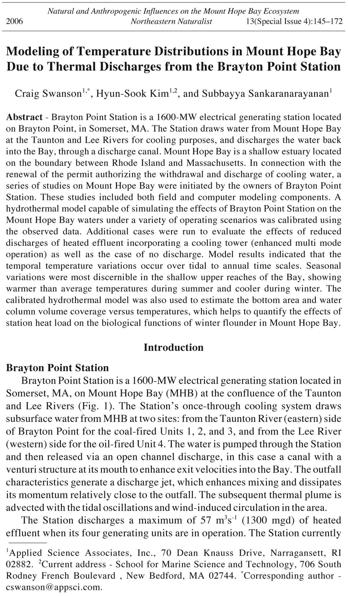
Modeling of Temperature Distributions in Mount Hope Bay
Due to Thermal Discharges from the Brayton Point Station
Craig Swanson1,*, Hyun-Sook Kim1,2, and Subbayya Sankaranarayanan1
Abstract - Brayton Point Station is a 1600-MW electrical generating station located
on Brayton Point, in Somerset, MA. The Station draws water from Mount Hope Bay
at the Taunton and Lee Rivers for cooling purposes, and discharges the water back
into the Bay, through a discharge canal. Mount Hope Bay is a shallow estuary located
on the boundary between Rhode Island and Massachusetts. In connection with the
renewal of the permit authorizing the withdrawal and discharge of cooling water, a
series of studies on Mount Hope Bay were initiated by the owners of Brayton Point
Station. These studies included both field and computer modeling components. A
hydrothermal model capable of simulating the effects of Brayton Point Station on the
Mount Hope Bay waters under a variety of operating scenarios was calibrated using
the observed data. Additional cases were run to evaluate the effects of reduced
discharges of heated effluent incorporating a cooling tower (enhanced multi mode
operation) as well as the case of no discharge. Model results indicated that the
temporal temperature variations occur over tidal to annual time scales. Seasonal
variations were most discernible in the shallow upper reaches of the Bay, showing
warmer than average temperatures during summer and cooler during winter. The
calibrated hydrothermal model was also used to estimate the bottom area and water
column volume coverage versus temperatures, which helps to quantify the effects of
station heat load on the biological functions of winter flounder in Mount Hope Bay.
Introduction
Brayton Point Station
Brayton Point Station is a 1600-MW electrical generating station located in
Somerset, MA, on Mount Hope Bay (MHB) at the confluence of the Taunton
and Lee Rivers (Fig. 1). The Station’s once-through cooling system draws
subsurface water from MHB at two sites: from the Taunton River (eastern) side
of Brayton Point for the coal-fired Units 1, 2, and 3, and from the Lee River
(western) side for the oil-fired Unit 4. The water is pumped through the Station
and then released via an open channel discharge, in this case a canal with a
venturi structure at its mouth to enhance exit velocities into the Bay. The outfall
characteristics generate a discharge jet, which enhances mixing and dissipates
its momentum relatively close to the outfall. The subsequent thermal plume is
advected with the tidal oscillations and wind-induced circulation in the area.
The Station discharges a maximum of 57 m3s-1 (1300 mgd) of heated
effluent when its four generating units are in operation. The Station currently
1Applied Science Associates, Inc., 70 Dean Knauss Drive, Narragansett, RI
02882. 2Current address - School for Marine Science and Technology, 706 South
Rodney French Boulevard , New Bedford, MA 02744. *Corresponding author -
cswanson@appsci.com.
146 Northeastern Naturalist Vol. 13, Special Issue 4
operates in accordance with a discharge permit allowing a 12.2 °C (22 °F)
temperature rise between intake and outfall temperatures during regular
operation and a 16.7 °C (30 °F) rise during piggyback operation. When the
Station is operated in the piggyback mode, a portion of the heated water
discharged from Units 1, 2, and 3 is diverted to the intake for Unit 4,
eliminating water withdrawals from the Lee River. The upper temperature
limit for effluent is 35 °C (95 °F).
Study area
The receiving water to which the Station effluent is discharged is MHB, a
shallow estuary located on the state boundary between Rhode Island and
Massachusetts (Fig. 1). It is the northeast component of the Narragansett
Bay system, connecting to the East Passage through Bristol Ferry and to the
Sakonnet River at Sakonnet (Fig. 2). Seventy percent of the Bay is less than
6 m deep at mean low water. A dredged channel 120 m (400 ft) wide and
10.5 m (34 ft) deep begins approximately 3 km (1.9 mi) northeast of the
Mount Hope Bridge and continues up past Fall River into the Taunton River.
A second channel, 10 m (33 ft) deep and 120 m (400 ft) wide, extends
easterly and then northerly toward Fall River, and a third smaller channel,
Figure 1. MHB study area shown in relation to Narragansett Bay.
2006 C. Swanson, H.-S. Kim, and S. Sankaranarayanan 147
10.4 m (34 ft) deep and 75 m (250 ft) wide, extends from the main channel in
Fall River northwesterly to the Station. Three sub-embayments are located
along the northern shore of the Bay to the west of the Taunton River mouth:
the Lee, Cole, and Kickamuit Rivers.
Tidal fluctuations in the Bay range from 1.0 m (3.3 ft) at neap tide to 1.68 m
(5.5 ft) at spring tide, with a mean range of 1.34 m (4.4 ft). Tidal currents are
typically weak, 10–25 cm s-1 (0.3–0.8 ft s-1) in the Bay, but can exceed 2 m s-1
(6 ft s-1) in the narrows at Sakonnet. There is little amplitude or phase difference
in tidal range throughout the Bay. The major freshwater source to the Bay is the
Taunton River, with an annual average flow of 29.7 m3 s-1 (1050 ft3 s-1), with
flows dramatically falling to 9.4 m3 s-1 (332 ft3 s-1) for the August mean and
rising to 33.4 m3 s-1 for the May mean (Ries 1990). The flow of the Taunton
River influences the location and range of movement of the Station plume due
to its proximity. The Cole River, the only other freshwater source, has a flow of
0.81 m3 s-1 (28.7 ft3 s-1). The Lee and Kickamuit Rivers do not contribute
measurable flows to the Bay.
Salinity-induced stratified conditions occur near the mouth of the Taunton
River, and temperature-induced stratified conditions typically occur near the
Figure 2. Location of Brayton Point Station on MHB.
148 Northeastern Naturalist Vol. 13, Special Issue 4
Station outfall. These effects generally diminish as a function of distance from
the Taunton River mouth and the Station outfall, respectively.
Hydrodynamic modeling studies in Mount Hope Bay
Huang and Spaulding (1995a) applied a three-dimensional numerical
model (Huang and Spaulding 1995b) using rectangular grids to simulate
transport processes in MHB due to combined sewer overflow (CSO) discharges.
Model predictions of surface elevation, currents, salinity, and dye
concentration showed good comparison with the observations, but they did
not simulate the temperature distribution in MHB. Swanson et al. (1998)
used a three-dimensional boundary-fitted hydrodynamic model to predict
the temperature distribution in MHB. Skill assessment methodology used
for calibrating and validating the predictions in Mount Hope Bay has been
presented in Spaulding et al. (1999b). Results of model-data skill assessment
(i.e., a formal statistical procedure to verify model performance)
show that the model application was successful. Efforts are currently underway
at SMAST (School for Marine Science and Technology, University
of Massachusetts at Dartmouth) to construct an operational three-dimensional
finite-volume-based hydrodynamic model (Chen et al. 2003) to also
predict the thermal distribution in MHB.
Background of study
Starting in 1996, New England Power (NEP), then owner of the
Brayton Point Station, initiated the application of a hydrodynamic model
that could be used to simulate the effects of the Station’s thermal discharge
on MHB under different operating conditions. The purpose of this
modeling was to support a comprehensive evaluation of the biological
impacts of the Station’s operation on MHB in connection with the renewal
of the Station’s National Pollutant Discharge Elimination System
(NPDES) permit (USEPA-NE 2002). The effects of Station heat load on
the biological functions of winter flounder in MHB is addressed in a
companion paper by O’Neill et al. (2005), which uses an innovative
biothermal model to link winter flounder biological processes to the hydrothermal
model results. To develop this model, a two-component study
was performed:
1. Physical measurements of the Bay were collected to determine the spatial
and temporal distribution of circulation and water temperature during
different seasons.
2. A simulation model was constructed to predict the hydrodynamics and
thermal structure of the Bay under different Station thermal loads and
environmental conditions. The model was calibrated and verified with the
data collected during the field program.
The calibrated model is then used to estimate the bottom area and
water-column volume coverage versus temperatures in order to support
bio-thermal modeling.
2006 C. Swanson, H.-S. Kim, and S. Sankaranarayanan 149
Hydrothermal Field Data Collection in Mount Hope Bay
An extensive program of hydrographic and thermal mapping observations
in MHB was undertaken to calibrate and validate the hydrothermal
model developed in this study. Table 1 gives a summary of field programs
supporting hydrothermal modeling of MHB, including month-long moored
hydrographic deployments that measured temperature, salinity, velocities,
and tidal elevation under summer, fall, and winter conditions, and thermalmapping
studies conducted for two- to six-week periods during different
seasons to obtain horizontal and vertical temperature data. A brief description
of the hydrographic and thermal-mapping surveys is given in the
following sections.
Month-long hydrographic surveys
Month-long studies were conducted during the late summer in 1996 and
1997 using several moored instruments, including multi-parameter monitors
measuring temperature and salinity, current meters, and a water-level sensor.
Figure 3 shows locations of long-term monitoring stations for the August 1997
study. The observations from these stations were used for calibrating the
model. Also, part of this study was acquisition of related data collected by
various organizations, including light intensity, wind speed and direction, air
temperature, river flow, and Brayton Point Station cooling-water flow and
temperature. Results from these long-term surveys are documented in ASA
(1996) for the 1996 survey and Rines and Schuttenberg (1998) for the 1997 survey.
Figure 3. Location of long term monitoring station for August 1997.
150 Northeastern Naturalist Vol. 13, Special Issue 4
Table 1. Summary of field programs supporting hydrothermal modeling of Mount Hope Bay.
Number of
Program Period covered Time of year Measurements stations
Routine monitoring (MRI) 1972 to present Full year Temperature, salinity, and DO profiles 6–7
Long-term hydrographic survey 1996 August Full month of surface and bottom temperature, salinity, DO, and velocity 2
Long-term hydrographic survey 1997 August Full month of surface and bottom temperature, salinity, DO, and velocity 4
Short-term hydrographic survey 1996 (twice) August Temperature, salinity, and DO profiles at four consecutive slack tides 17
Short-term hydrographic survey 1997 August Temperature, salinity, and DO profiles at four consecutive slack tides 17
Thermal mapping 1997 May–June 5-min. measurements of temperature at five depths per station 30
Thermal mapping 1997 August–September 5-min. measurements of temperature at five depths per station 30
Thermal mapping 1998 September 5-min. measurements of temperature at five depths per station 30
Short-term hydrographic survey 1998 September Temperature, salinity, and DO profiles four times over tidal cycle 21
Thermal mapping 1999 February–March 5-min. measurements of temperature at five depths per station 31
2006 C. Swanson, H.-S. Kim, and S. Sankaranarayanan 151
Figure 4. Observed mid-depth acoustic Doppler profiler currents at Fall River,
obtained from the National Ocean Service.
Currents are important in MHB because they move the thermal plume in
response to tides, river flow, and winds. A double pulse characterizes the
flood tide in Mount Hope Bay. Kim and Swanson (2001) showed that the
interactions among M2, M4, and M6 tides result in double-peaked flood
profiles that typify currents in MHB. The double peaks that occur during
flood tide in Mount Hope Bay are clearly seen in a typical time series of
observed mid-depth current speeds at Fall River in Figure 4. The first pulse
is typically somewhat smaller than the second, although it varies in magnitude
from almost nonexistent to equal in magnitude to the second. In
general, the mean current speeds were 13.5 cm s-1 at the Borden Flats
Station, 10.5 cm s-1 at Brayton Point Station, and 5.5 cm s-1 at the Gardners
Neck Station. The mean speeds affecting the Station thermal plume were in
the range from 5 to 10 cm s-1, a relatively low velocity.
The tidal effect on salinity variation was quite evident at the Borden
Flats Station, where diurnal variations as large as two parts per thousand
were seen at the surface and more than one part per thousand at the
bottom. At Gardners Neck, there was hardly any evidence of a tidal
signal in the salinity record near the surface and evidence of only a small
signal at the deep sensor. The records at Brayton Point Station were
intermediate between these two. There was a strong tidal variation (at
12.42 hours) evident in the temperature record at the surface at the
Borden Flats location, but this was sometimes overwhelmed by a diurnal
152 Northeastern Naturalist Vol. 13, Special Issue 4
signal (24 hours). A tidal signal was only occasionally evident at the
bottom at this station. At the Gardners Neck location, the diurnal variation
was generally greatest, although this varied through the month. At
the near-bottom sensors, the short-term temperature changes were very
irregular. By comparison, there was a strong tidal element to the temperature
record at all three depths at the Brayton Point location, with the
largest swing often occurring at the surface, where a diurnal component
was added to the temperature changes.
Thermal mapping surveys
An extensive field program to map the thermal structure in space and time
in MHB was conducted. Four major surveys were conducted: May 19–June 4,
1997, August 8–September 12, 1997, September 1–18, 1998, and February
12–March 22, 1999. Figure 5 shows the locations of the thermistor strings for
the May 1997 survey. The strings were generally laid out in arcs of concentric
circles centered on the Station outfall, with radii of 0.5, 1, 2, and 4 km. These
thermistor strings consisted of buoyed lines with self-logging thermistors
attached at 0.25-, 0.5-, 1-, 2-, and 4-m depths. Results from these thermistor
surveys, including animations on CD, are documented in Rines (1998) for the
Figure 5. Location of thermistor strings for May 1997 field study.
2006 C. Swanson, H.-S. Kim, and S. Sankaranarayanan 153
1997 surveys, Rines (1999) for the 1998 survey, and Swanson et al. (1999) for
the 1999 survey. A description of these surveys is also found in Appendix E of
USGenNE (2001).
The thermistor surveys show that, in the Taunton River, events were
driven mostly by tides, weather, and river flows, with no effect from the
Brayton Point Station plume. In MHB, the temperature pattern was distinctly
tidal in nature, with the most regular cycles seen at the deepest
thermistor, where weather influences were mitigated. The shallowest thermistor
recorded the largest temperature peaks, probably due to the effects
of daily warming and cooling at the air/water interface. Close to the outfall,
strong temperature peaks with tidal periodicity were common. No
significant vertical stratification was seen in the observations. At middepths
during winter, these temperatures peaked, representing the passing
Brayton Point Station plume. This can exhibit a stable condition, since the
surface discharge consisted of warm, more saline water into a receiving
water that was colder and fresher. It is to be noted that the intake is located
at the bottom (hence draws more saline water), while the discharge is
located at the surface. During summer, the plume was consistently at the
surface. There was no upwelling or downwelling event to be addressed,
since the vertical profiles of the month-long moorings did not display any
bending thermoclines.
A series of aircraft overflights using sensors to measure radiance were
conducted concurrently with the thermistor in-situ surveys. Processing of
the overflight data and analysis of the results are described in Fisher and
Mustard (2004).
.
Simulation Model
Description of the WQMAP model system
WQMAP (Water Quality Modeling and Analysis Program), a modeling
system developed by ASA and the University of Rhode Island, is an integrated
system for modeling the circulation and water quality of estuarine and coastal
waters (Spaulding et al. 1999a). The system has a suite of integrated environmental
models, including a boundary-conforming grid-generation model, a
three-dimensional hydrodynamic model, and a set of pollutant transport and
fate models (single- and multiple-constituent and WASP5 [Water Quality
Analysis Simulation Program]). All operate on a boundary-conforming grid
system and are supported by an embedded geographic information system and
environmental data management tools. WQMAP is configured for operation
on a personal computer running a Windows operating system. Color graphics
and animations are used to display model predictions. The system is structured
to facilitate application to any geographic area.
WQMAP’s hydrodynamic model solves the three-dimensional conservation
of water mass, momentum, salt, and energy equations on a spherical,
non-orthogonal, boundary-conforming grid system. The boundary-fitted
model matches the model coordinates with the shoreline boundaries of the
154 Northeastern Naturalist Vol. 13, Special Issue 4
water body, accurately representing the variable geometry of the coastal
features of MHB. A sigma stretching system is used to map the free surface and
bottom to resolve bathymetric variations and the vertical structure. Development
of the boundary-fitted model approach has proceeded for almost two
decades (Spaulding 1984; Swanson et al. 1989; Muin and Spaulding 1996;
Muin and Spaulding 1997a,b). A detailed description of the governing equations,
numerical solution methodology, and in-depth testing against analytic
solutions for two- and three-dimensional flow problems can be found in the
papers cited above. WQMAP has been applied to many different types of
coastal problems, including thermal plume simulations in Sandwich,
Weymouth, and Saugus, MA; Vernon, VT; and Jubail, Saudi Arabia.
The WQMAP hydrodynamic (or hydrothermal) model can simulate the
effects of tide, river flow, air temperature, solar radiation, and wind-induced
environmental forcing. The observed meteorological and thermodynamic
data at Rhode Island’s T.F. Green Airport (located 19 km southwest of
Brayton Point Station) was obtained from the Northeast Regional Climate
Center (NRCC) at Cornell University. The environmental heat transfer
submodel at the water surface, which closely follows Edinger et al. (1974),
contains an explicit balance of shortwave solar radiation, longwave atmospheric
radiation, longwave radiation emitted from the water surface,
convective (sensible) heat transfer, and evaporative (latent) heat transfer
between water and air. More details on the heat transfer model are reported
in Appendix B of Swanson et al. (1998).
Model application
The first step in the setup of a hydrodynamic model is generating a
grid that defines the study area of interest. For the current study, the
northern portion of MHB is the focus. Experience with previous model
applications suggests, however, that open boundaries should ideally be
placed away from the area of interest to minimize their effect on the
interior solution. The grid used for this application is shown in Figure 6.
Here, the full grid encompasses the northern half of Narragansett Bay and
the Sakonnet River and extends to the head of tide in the Taunton River.
There are a total of 3300 water grid cells covering the area. The grid in
Narragansett Bay and the Sakonnet River is purposely coarse (1 km [0.6
mi]) to minimize the calculations required yet still provide reasonable
predictions. Typical grid cell dimensions in the southern portion of the
Bay are 200 to 300 m (650 to 1000 ft). The grid is finer in the area near
the Station (Fig. 7) to better resolve the circulation affecting the thermal
plume. Here, the typical grid cell dimensions are 50 to 100 m (160 to 330
ft). A depth value must be assigned to each grid cell. A database of
bathymetric soundings (NGDC 1996) with associated latitude and longitude
for the area was accessed, and depths were interpolated onto the
grid. The depths in the grid were manually edited with the depths from
the NOAA charts, to represent the channels. The 120-m-wide channels
are adequately resolved using two cells.
2006 C. Swanson, H.-S. Kim, and S. Sankaranarayanan 155
Figure 6.
Full model
grid of
g r e a t e r
M o u n t
Hope Bay.
Figure 7.
M o d e l
grid of area
around
the Brayton
Point
Station.
156 Northeastern Naturalist Vol. 13, Special Issue 4
Forcing functions are used in the model to drive the circulation of water
throughout the Bay, which in turn affects the location of the thermal plume
and the Bay-wide temperature structure. The forcing functions are applied
at the model open boundaries. For the Brayton Point Station application,
the open boundaries are located in Narragansett Bay, in the Sakonnet
River, at the head of the Taunton River, at the air-sea interface, and at the
Station’s intake and discharge. These time-varying functions were flows
(river flow), atmospheric effects (winds, temperature, solar radiation), water
level (tidal and non-tidal), density gradients (salinity held constant at 32
psu and time-varying temperature), and Station loads (flow rate and temperature
increase). The water-level open-boundary condition allowed
simulations of both periodic and non-periodic events. The outfall discharge
did not exhibit any periodicity; instead, it was steady with flows remaining
constant for days. The wind speed and direction were converted to wind
stress using a standard wind-stress formulation given in Muin and
Spaulding (1996).
Model calibration
Calibration and confirmation (verification) are important steps in the
process of applying a model to a specific problem, particularly for those
models that contain many degrees of freedom. The calibration/confirmation
process is a structured approach to evaluate how well a model can reproduce
observations. The calibration procedure (McCutcheon et al. 1990) followed
for the Brayton Point Station application included these steps:
1. Reproduce elevation and velocities at selected locations by adjusting
bottom-friction and eddy-viscosity coefficients.
2. Reproduce distributions of natural tracers (salinity) by adjusting eddy
diffusivities.
3. Reproduce temperature distributions by adjusting flux rates to the atmosphere.
Since the meteorological observations were from the land-based
station at Green Airport, air temperatures used for the surface heat-flux
model were adjusted slightly so that the error between the observed and
model-predicted temperatures was minimized. This adjustment in air temperature
was supported by a limited set of observed air temperatures in the
Bay. In addition, the Station thermal load was distributed over grid cells
adjacent to the discharge.
Confirmation or verification of the model is performed with an independent
set of data to determine how well the model can predict the distribution
of the model variables. It is expected that the verification results will be
similar to the calibration results. If not, then a review is warranted to
determine what model parameters were responsible. If necessary, the model
is recalibrated through a process of optimization.
A series of comparisons are used to provide measures for the success of
the calibration and confirmation steps. These measures are both qualitative
and quantitative. The qualitative comparison of model results and observations
depends on data dimensionality. For example, a time series of data
2006 C. Swanson, H.-S. Kim, and S. Sankaranarayanan 157
collected at a particular site can be plotted together with model output to
provide a visual comparison. This comparison can provide information on
the suitability of the model to simulate the range of variability evident in
the observations. The most direct way to provide a qualitative comparison
is to plot the model predictions and the observed data for each variable
over the time of the simulation. The error in model-predicted surface
elevations and currents met the target criteria given in McCutcheon et al.
(1990), and the details are given in Spaulding et al. (1999b). Quantitative
estimates of the error between the observed and model-predicted temperatures
were obtained in this study to get an idea about the predictive
capability of the model. The primary focus of the calibration process is to
Figure 8. Spatial distribution of root mean square (RMS) errors between the observed
and predicted temperatures at a depth 0.25 m from the surface for the August 97
period. (Error range increment in the color contour legend is 0.3 °C.)
158 Northeastern Naturalist Vol. 13, Special Issue 4
adjust appropriate model parameters to optimize the comparison to a data
set of observations. The parameters, as discussed in the previous sections,
include bottom friction, horizontal and vertical dispersion, and atmospheric
exchange rates. The August 1997 data set was chosen for calibration
in collaboration with the Technical Advisory Committee (TAC)
because it was more extensive and complete than the 1996 data set. This
was due, in part, to a better understanding of the circulation in MHB
gained from analysis of the 1996 data. The period of comparison was from
August 1 through September 2, 1997. Figure 8 shows the contours of root
mean square (RMS) error between the observed and model-predicted surface
(0.25 m from the surface) temperatures in MHB, with errors less than
Figure 9. Spatial distribution of root mean square (RMS) errors between the observation
and predicted temperatures at a depth 4.0 m from the surface for the August 97
period. (Error range increment in the color contour legend is 0.3 °C.)
2006 C. Swanson, H.-S. Kim, and S. Sankaranarayanan 159
1.5 °C. Figure 9 shows the spatial distribution of RMS error between the
observed and predicted temperatures at a depth 4 m from the surface, with
errors less than 1 °C.
Model verification
The purpose of the verification (confirmation) process is to determine
how well the model performs in comparison to a data set that is independent
from that used in the calibration step. All of the parameter values
used in the calibration are held constant for the verification. The August
1996 data set was initially chosen for confirmation (verification) because
it was less extensive and complete than the 1997 data set. This is described
in detail in Swanson et al. (1998). Ultimately, the TAC requested
that a different season be used for model verification, so the winter 1999
was used. Figure 10 compares the observed and predicted temperatures at
the surface for a series of thermistors in the winter of 1999. A similar
comparison of the observed and predicted temperatures at a depth 4 m
from the surface is shown in Figure 11. The model successfully simulates
the multiple time scales (tidal, daily, and weekly) seen in data during this
period. Additional information on the model–data comparison can be
found in the winter verification report (Swanson et al. 1999).
Figure 10. Temperature comparison between observations and model predictions at
0.25 m from surface at five sites during winter of 1999. (The solid lines denote
observations and the broken lines denote model predictions.)
160 Northeastern Naturalist Vol. 13, Special Issue 4
Model optimization
Optimization of the hydrodynamic model of MHB was performed in
response to a request from the TAC to refine the model to simulate, as
closely as possible, observed temperature conditions in the Bay. The specific
focus of the optimization was to match the observed temperatures acquired
during the thermistor surveys of summer 1997, winter 1999, and spring 1997
with an emphasis on thermistors 18, 19, 20, 21, and 22 (Fig. 5) with their
locations forming a ring (Ring 3, located at 2 km radius from the Station
outfall) that is generally coincident with the Massachusetts/Rhode Island
boundary. As a result of the optimization, the vertical and horizontal
temperature dispersion rates, local atmospheric temperature, and Station
thermal load were slightly modified.
The measures that were used in the quantitative model assessment were
the mean difference (MD) between model prediction and observed data and
the RMS error between the two. These statistics were generated for individual
meter locations as well as aggregations of meters (thermistors by
depth, thermistors by section of the Bay, thermistors by radial distance from
the Station, etc.). In Table 2, a summary of the statistical comparisons to the
thermistors shows the success of the optimization to the set of thermistors on
Ring 3, particularly for the MD.
Figure 11. Temperature comparison between observations and model predictions at
4.0 m from surface at five sites during winter of 1999. Solid lines denote observations
and the broken lines denote model predictions.
2006 C. Swanson, H.-S. Kim, and S. Sankaranarayanan 161
Two memoranda were prepared in July 2000 to document this analysis.
They are found in Swanson et al. (2001). Ultimately, the TAC accepted the
WQMAP model in September 2000 as suitably calibrated for use in predicting
the thermal structure of MHB under both different seasonal conditions
and Station loading conditions.
Selection of model runs
The final step in the modeling process was the selection of the operating
scenarios to be evaluated. The year 1999 was determined to be a
reasonable worst-case warm-water year and was therefore selected to provide
the environmental conditions under which the cases were run.
Although many scenarios were run and presented during the course of the
studies in support of the Brayton Point Station’s permit application, this
discussion focuses on three that span the range from existing operations
(known as MOAII), an enhanced multimode (EMM) operating scenario
that significantly reduced thermal discharge, and the no-plant case. A
summary of the model runs is shown in Table 3. Mean Station flow,
temperature increase, and heat load are shown for comparison.
Results
Plume characterization
Figures 12 and 13 show typical spatial distributions of temperatures in
MHB at maximum ebb and maximum flood, respectively, for the EMM
hydrothermal model run. The inserts on the figures show the sectional
view of the plume from the outfall. At maximum ebb, the thermal plume
extends in the south-southwest direction (Fig. 12), since the ebb current
moves in that direction. As the tide turns, the plume generated during the
Table 2. Comparison of model-predicted and observed temperature data. MD = mean difference;
RMSE = root mean square error.
MD (°C) RMSE (°C)
Summer 1997
All thermistors -0.21 0.83
Ring 3 0.03 0.57
Winter 1999
All thermistors -0.67 1.13
Ring 3 -0.10 0.71
Spring 1997
All thermistors 0.69 1.12
Ring 3 1.03 1.34
Table 3. Summary of hydrothermal model runs for the warm year 1999.
Flow Temperature Heat load
Operating scenario (mgd) increase (°F) (tBTU/mo) Description
MOA II 868.15 14.71 3.18 Actual operation data for 1999
EMM 593.38 14.64 2.25 Enhanced multimode
No-plant 0.00 0.00 0.00 No Station operation
162 Northeastern Naturalist Vol. 13, Special Issue 4
previous ebb is moved north, while the plume generated during the flood
moves towards the mouth of the Taunton River. At maximum flood (Fig.
13), the remnants of the ebb plume are seen to the west of the Station
discharge, while the just discharged flood plume is seen to the east.
The WQMAP hydrothermal model output was processed to generate a
series of products needed for the biological assessment:
1. Daily averaged total temperatures for water-column volume and bottom
area,
2. Daily averaged temperature increases over background (no-plant) conditions,
3. Distributions of Bay volume and bottom area for a range of total temperatures,
and
4. Distributions of Bay volume and bottom area for a range of temperature
increases over background conditions.
These products were generated for the historical and hypothetical Station
loads listed in Table 3 using 1999 environmental conditions.
Figure 12. Plan view of distribution of surface temperatures in MHB for EMM model
run at maximum ebb. Vertical cross-sectional view of the plume from the outfall is
shown in the insert.
2006 C. Swanson, H.-S. Kim, and S. Sankaranarayanan 163
A comparison of typical results from the different Station loads is shown
in Figures 14 to 19. Each figure shows a plan view of the daily averaged
temperature distribution for one representative day during the winter and
summer periods of biological significance. Figures 14 and 15 show the
results for MOA II, which has the highest load. The upper panel (Fig. 14)
shows the water-column volume winter plume offset to the southwest due to
environmental conditions (higher river flow) compared to the lower panel
(Fig. 15) for summer conditions. Peak temperatures occur in the immediate
area of the discharge, with the plume oriented toward the southwest away
from the discharge. The results are similar but reduced in magnitude for the
bottom area during both summer and winter. The EMM scenario, shown in
Figures 16 and 17, generates smaller plumes with lower peak temperatures
than MOA II because its heat load is lower. Figures 18 and 19 show the same
results for the environmental background (no-plant) scenario. There are
small variations over the Bay (less than 1 °C) during the different seasons,
with the northern portions slightly colder in winter and warmer in summer.
Figure 13. Plan view of distribution of surface temperatures in MHB for EMM model
run at maximum flood. Vertical cross-sectional view of the plume from the outfall is
shown in the insert.
164 Northeastern Naturalist Vol. 13, Special Issue 4
Figure 14.
Plan view
of daily
mean wat
e r - c o l -
umn temp
e r a t u r e
for MOA
II hydrot
h e r m a l
model run
on March
15, 1999.
Figure 15.
Plan view
of daily
mean wat
e r - c o l -
umn temp
e r a t u r e
for MOA
II hydrot
h e r m a l
model run
on August
1, 1999.
2006 C. Swanson, H.-S. Kim, and S. Sankaranarayanan 165
Figure 16.
Plan view
of daily
mean water-
column
temperature
for enh
a n c e d
multimode
hydrothermal
model
run on
March 15,
1999.
Figure 17.
Plan view
of daily
mean wat
e r - c o l -
umn temp
e r a t u r e
for enh
a n c e d
m u l t i -
mode hyd
r o t h e r -
mal model
run on
August 1,
1999.
166 Northeastern Naturalist Vol. 13, Special Issue 4
Figure 18.
Plan view
of daily
mean water-
column
t e m p e r a -
ture for no-
Plant hydrothermal
model run
on March
15, 1999.
Figure 19.
Plan view
of daily
mean water-
column
t e m p e r a -
ture for
n o - P l a n t
hydrothermal
model
run on August
1, 1999.
2006 C. Swanson, H.-S. Kim, and S. Sankaranarayanan 167
As would be expected, the no-plant case results in slightly cooler temperatures
for much of MHB. The temperature increases over ambient conditions
were determined by subtracting the no-plant case from the MOAII and EMM
cases. An average wind of 6 m s-1 blowing towards the south on March 15th
generated a strong current in the southeast direction and caused the plume to
spread in that direction. On August 1, the average wind of 3.6 m s-1 towards
the east induced a much weaker current causing less spreading of the plume.
Thus, the difference in orientation and extent of the plumes on March 15th
and August 1st for all three forcing cases (Figs. 14–19) can be attributed to
the difference in the wind on those days. March 15th and August 1st were
chosen to represent, respectively, the spring and summer conditions for the
seasonal variation of freshwater flow and heat flux.
Figures 20 and 21 show plan view of temperature differences for the
EMM hydrothermal model run relative to the no-plant at maximum ebb
and maximum flood, respectively. The effects of tide on the plume seen
in Figures 20 and 21 is very similar to that exhibited in Figures 12 and
13. At maximum ebb, the thermal plume extends in the south-southwest
direction (Fig. 20), since the ebb current moves in that direction. As the
Figure 20. Plan view of surface temperature differences for the EMM hydrothermal
model run relative to the no-plant run at maximum ebb. Vertical cross-sectional view
from the outfall is seen in the insert.
168 Northeastern Naturalist Vol. 13, Special Issue 4
tide turns, the plume generated during the previous ebb is moved north,
while the plume generated during the flood moves towards the mouth of
the Taunton River. At maximum flood (Fig. 21) the remnants of the ebb
plume are seen to the west of the Station discharge, while the just-discharged
flood plume is seen to the east.
Another comparison of the relative effects of the various scenarios is
shown in Figure 22. Here, the cumulative percent of the volume of the
Bay that is greater than a specific temperature is displayed against that
temperature for the different Station loads. This analysis indicates how
much of the Bay is subject to different temperature regimes. The analysis
was based on the daily averaged temperatures over the simulated worstcase
warm year (1999). The no-plant scenario shows the lowest volume at
all temperatures and the MOAII scenario (current operating condition)
typically shows the largest volume, with the EMM scenario (reduced heat
operating condition) falling between the two, consistent with Station
load. The difference in volume between the cases at a given temperature
is small, however. For example, at 5 °C, the no-plant scenario shows 72%
coverage compared to 82% coverage for the MOAII scenario. Similarly,
Figure 21. Plan view of surface temperature differences for the EMM hydrothermal
model run relative to the no-plant run at maximum flood. Vertical cross-sectional
view from the outfall is seen in the insert.
2006 C. Swanson, H.-S. Kim, and S. Sankaranarayanan 169
at 15 °C, the no-plant scenario shows 39% coverage compared to 43%
coverage for MOAII, and at 25 °C, No-Plant gives 1% coverage and
MOAII gives 5% .
The WQMAP model with a coarser grid (to keep run times reasonable)
was also run for the four-decade period from 1960 to 1999, with
environmental (no-plant) forcing to provide information on ambient (environmental
background) conditions. The model results were averaged by
day over the period and subsequently analyzed to reveal that 1999 was
the second warmest year, which confirmed its selection as a reasonable
worst-case warm year.
Presentation of the model results is found in a summary of hydrodynamic
results (Swanson et al. 2001), the variance request (USGenNE 2001), and
the Section 308 Information Request Response (ASA and LMS 2001).
Summary and Conclusions
A two-component hydrothermal assessment was conducted to understand
the effects of the Brayton Point Station on MHB over different seasons
and years. The first component, an extensive field data program, was
designed and executed to provide physical data, with the short- and longterm
temperature structure of the Bay being the primary focus. Very large
data sets were acquired for use in characterizing the plume as it presently
Figure 22. Volume coverage as a function of temperature over the 1999 yearly
simulation for various Brayton Point Station heat loads: MOA II (current operating
condition), EMM (reduced heat operating condition), and no-plant operating scenarios.
170 Northeastern Naturalist Vol. 13, Special Issue 4
exists as well as for use in a hydrothermal model. The thermal plume from
the Station is typically in the upper part of the water column and often
confined at or near the surface and is principally located in the northern
reaches of the Bay adjacent to the Station.
The second component was the application of a hydrothermal model
that predicted the three-dimensional, time-varying distribution of temperature
in MHB under the influence of both ambient conditions (i.e., without
Brayton Point Station) and thermal loading from the Station. The model
was successfully calibrated and verified to the data sets collected during
the field programs and accepted for use as a tool to evaluate thermal effects
by the Station Technical Advisory Committee.
The model was then used to examine a variety of Station operations, both
historical and hypothetical, and their effect on the temperature of MHB
during different seasons and years, particularly summer and winter periods
of 1999, a warm year. It was found that the resulting temperature variations
induced by the Station discharge are small relative to the natural thermal
variations in the Bay. The Station has an incremental effect on the natural
distribution of temperature.
A series of data products was developed for use in the subsequent
biothermal assessment to determine the extent of biological impacts the
Station may have on the communities that inhabit or use the Bay for
various life cycles at various times during the year (O’Neill et al. 2005,
USGenNE 2001). These products were designed to distill an immense
amount of model-generated data to provide a rational analysis of temperature
effects.
Literature Cited
Applied Science Associates, Inc. (ASA). 1996. Data report New England Power
Company Brayton Point Station dissolved oxygen assessment field studies. Report
to New England Power Co., Westborough, MA. December 1996.
Applied Science Associates, Inc., and Lawler, Matusky, and Skelly Engineers LLP
(ASA and LMS). 2001. Supplemental hydrothermal and biothermal evaluation.
Report to the US Environmental Protection Agency, Boston, MA, on behalf of
Brayton Point Station.
Chen, C., H. Liu, and R.C. Beardsley. 2003. An unstructured, finite-volume, threedimensional,
primitive equation ocean model: Application to coastal ocean and
estuaries. Journal of Atmospheric and Oceanic Technology 20:159–186.
Edinger, J.E., D.K. Brady, and J.C. Greyer. 1974. Heat exchange and transport in the
environment, Report No. 14, Cooling Water Research Project (RP-49), Electrical
Power Research Institute, Palo Alto, CA.
Fisher, J.A., and J.F. Mustard. 2004. High spatial resolution sea surface climatology
from Landsat thermal infrared data. Remote Sensing of Environment 90:293–307.
Huang, W., and M.L. Spaulding. 1995a. Modeling of CSO-induced pollutant transport
in Mount Hope Bay. Journal of Environmental Engineering 121(7):492–498.
Huang, W., and M.L. Spaulding. 1995b. A three-dimensional numerical model of
estuarine circulation and water quality induced by surface discharges. Journal of
Hydraulic Engineering 121(4):300–311.
2006 C. Swanson, H.-S. Kim, and S. Sankaranarayanan 171
Kim, H.-S., and J.C. Swanson, 2001. Modeling of double flood currents in the
Sakonnet River. 7th Annual International Conference on Estuarine and Coastal
Modeling (ECM 7), St. Pete Beach, fl. November 5–7, 2001.
McCutcheon, S.C., Z. Dongwei, and S. Bird. 1990. Model calibration, validation,
and use. Chapter 5, In J.L. Martin, R.B. Ambrose and S.C. McCutcheon (Eds.).
Technical Guidance Manual for Performing Waste Load Allocations, Book III:
Estuaries. Part 2: Application of Estuarine Waste Load Allocation Models.
Office of Water, USEPA, Washington, DC. March 1990.
Muin, M., and M.L. Spaulding. 1996. Two-dimensional boundary fitted circulation
model in spherical coordinates. Journal of Hydraulic Engineering
122(9):512–521.
Muin, M., and M.L. Spaulding. 1997a. Three-dimensional boundary fitted circulation
model. Journal of Hydraulic Engineering 123(1):2–12.
Muin, M., and M.L. Spaulding. 1997b. Application of three-dimensional boundary
fitted circulation model to the Providence River. Journal of Hydraulic Engineering
123(1):13–20.
National Geophysical Data Center (NGDC). 1996. National Ocean Service, hydrographic
survey data, Geophysical Data System (GEODAS) for hydrographic
survey data. National Geophysical Data Center, NOAA, Boulder, CO.
O’Neill, R.J., T.L. Englert, and J.K. Ko, 2005. Effects of Brayton Point Station’s
thermal discharge on Mount Hope Bay winter flounder, Northeastern Naturalist
13(Special Issue 4): 71–94.
Ries, K.G. 1990. Estimating surface-water runoff to Narragansett Bay, Rhode Island
and Massachusetts. Water Resources Investigations Report 89-4164. US Geological
Survey, Denver, CO.
Rines, H. 1998. Mapping temperature distributions in Mount Hope Bay with respect
to the Brayton Point Station outfall. Report to NEPCo. ASA, Narragansett, RI.
April 1998.
Rines, H. 1999. Mapping temperature distributions in Mount Hope Bay, Fall 1998
deployment. Report to NEPCo. ASA, Narragansett, RI. September 1999.
Rines, H., and H. Schuttenberg. 1998. Data report New England Power Company,
Brayton Point Station, Mount Hope Bay field studies for 1997. Report to
NEPCo., Westborough, MA. ASA, Narragansett, RI. April 1998.
Spaulding, M.L. 1984. A vertically averaged circulation model using boundary fitted
coordinates. Journal of Physical Oceanography 14:973–982.
Spaulding, M.L., D. Mendelsohn, and J.C. Swanson. 1999a. WQMAP: An integrated
three-dimensional hydrodynamic and water quality model system for estuarine
and coastal applications. Marine Technology Society Journal 33(3):38–54.
Spaulding, M.L., J.C. Swanson, and D. Mendelsohn. 1999b. Application of quantitative
model–data calibration measures to assess model performance. Estuarine
and Coastal Modeling 6 (ECM6), New Orleans, LA. November 3-5, 1999.
Swanson, J.C., M.L. Spaulding, J.P. Mathisen, and O.O. Jenssen. 1989. A threedimensional,
boundary-fitted coordinate hydrodynamic model, Part I: Development
and testing. Deutsche Hydrographische Zeitschrift 42(1989):169–186.
Swanson, J.C., D. Mendelsohn, H. Rines, and H. Schuttenberg. 1998. Mount Hope
Bay hydrodynamic model calibration and confirmation. Report to NEPCo,
Westborough, MA. ASA, Narragansett, RI. May 1998.
172 Northeastern Naturalist Vol. 13, Special Issue 4
Swanson, J.C., H. Rines, D. Mendelsohn, T. Isaji, and M. Ward. 1999. Mount Hope
Bay winter 1999 field data and model confirmation. Report to PG&E National
Energy Group, Somerset, MA. ASA, Narragansett, RI. October 1999.
Swanson, J.C., H.S. Kim, T. Isaji, and M. Ward. 2001. Summary of hydrodynamic
model results for Brayton Point Station simulations. Report to PG&E National
Energy Group, Somerset, MA. ASA, Narragansett, RI. January 2001.
United States Environmental Protection Agency–New England (USEPA-NE). 2002.
Clean water act NPDES permitting determinations for thermal discharge and
cooling water intake from Brayton Point Station in Somerset, MA. NPDES
Permit No. MA 0003654, Boston, MA, 22 July 2002.
USGen New England, Inc. (USGenNE). 2001. Demonstration in support of NPDES
Renewal NPDES Permit No. MA0003654. USGen New England, Brayton Point
Station, Somerset, MA, December, 2001.


 The Northeastern Naturalist is a peer-reviewed journal that covers all aspects of natural history within northeastern North America. We welcome research articles, summary review papers, and observational notes.