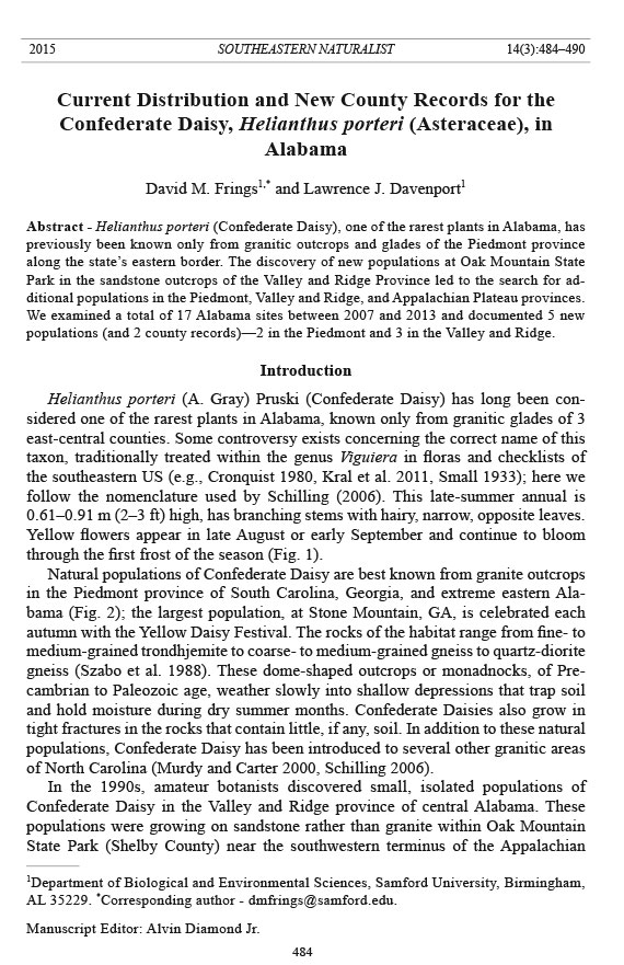
Southeastern Naturalist
D.M. Frings and L.J. Davenport
2015 Vol. 14, No. 3
484
2015 SOUTHEASTERN NATURALIST 14(3):484–490
Current Distribution and New County Records for the
Confederate Daisy, Helianthus porteri (Asteraceae), in
Alabama
David M. Frings1,* and Lawrence J. Davenport1
Abstract - Helianthus porteri (Confederate Daisy), one of the rarest plants in Alabama, has
previously been known only from granitic outcrops and glades of the Piedmont province
along the state’s eastern border. The discovery of new populations at Oak Mountain State
Park in the sandstone outcrops of the Valley and Ridge Province led to the search for additional
populations in the Piedmont, Valley and Ridge, and Appalachian Plateau provinces.
We examined a total of 17 Alabama sites between 2007 and 2013 and documented 5 new
populations (and 2 county records)—2 in the Piedmont and 3 in the Valley and Ridge.
Introduction
Helianthus porteri (A. Gray) Pruski (Confederate Daisy) has long been considered
one of the rarest plants in Alabama, known only from granitic glades of 3
east-central counties. Some controversy exists concerning the correct name of this
taxon, traditionally treated within the genus Viguiera in floras and checklists of
the southeastern US (e.g., Cronquist 1980, Kral et al. 2011, Small 1933); here we
follow the nomenclature used by Schilling (2006). This late-summer annual is
0.61–0.91 m (2–3 ft) high, has branching stems with hairy, narrow, opposite leaves.
Yellow flowers appear in late August or early September and continue to bloom
through the first frost of the season (Fig. 1).
Natural populations of Confederate Daisy are best known from granite outcrops
in the Piedmont province of South Carolina, Georgia, and extreme eastern Alabama
(Fig. 2); the largest population, at Stone Mountain, GA, is celebrated each
autumn with the Yellow Daisy Festival. The rocks of the habitat range from fine- to
medium-grained trondhjemite to coarse- to medium-grained gneiss to quartz-diorite
gneiss (Szabo et al. 1988). These dome-shaped outcrops or monadnocks, of Precambrian
to Paleozoic age, weather slowly into shallow depressions that trap soil
and hold moisture during dry summer months. Confederate Daisies also grow in
tight fractures in the rocks that contain little, if any, soil. In addition to these natural
populations, Confederate Daisy has been introduced to several other granitic areas
of North Carolina (Murdy and Carter 2000, Schilling 2006).
In the 1990s, amateur botanists discovered small, isolated populations of
Confederate Daisy in the Valley and Ridge province of central Alabama. These
populations were growing on sandstone rather than granite within Oak Mountain
State Park (Shelby County) near the southwestern terminus of the Appalachian
1Department of Biological and Environmental Sciences, Samford University, Birmingham,
AL 35229. *Corresponding author - dmfrings@samford.edu.
Manuscript Editor: Alvin Diamond Jr.
Southeastern Naturalist
485
D.M. Frings and L.J. Davenport
2015 Vol. 14, No. 3
Figure 1. Flowers of Confederate Daisy from the sandstone habitat at Oak Mountain State
Park, Shelby County, AL. Photograph by Dr. Mike Howell.
Figure 2. Distribution of Confederate Daisy in the southeastern US.
Southeastern Naturalist
D.M. Frings and L.J. Davenport
2015 Vol. 14, No. 3
486
Mountains. Their habitats are similar to those in the Piedmont of Georgia and east
Alabama, with the exception of lithology. At Oak Mountain, the xeric habitats
are based on sandstones of the Pottsville Formation of Pennsylvanian age. This
extremely hard, light-gray, coarse-grained, massive-bedded sandstone contains
scattered quartz pebble conglomerates; it is mapped as the Shades Sandstone Member
of the Pottsville Formation by the Geological Survey of Alabama (Irvin et. al.
2002, Osborne 1996).
Discovery and examination of the Oak Mountain population suggested that the
daisy might be more widespread than originally thought and that additional sites
for investigation should be identified. Our purpose was to determine if Confederate
Daisy occurred at other locations in the Piedmont (granite) and Valley and Ridge
(sandstone) provinces of Alabama, as well as in the state’s Appalachian Plateau
(also sandstone).
Methods
Our study began in the fall of 2007 and concluded in 2013. We visited sites
with known Confederate Daisy populations and collected the following data: solar
exposure, pH, lithology, soil type, and elevation. We then used the field conditions
observed at the known sites to identify other locations that might support previously
unknown populations. We studied geologic maps to define areas that are
underlain by granite and sandstone and then examined these areas on aerial photographs
(Google Earth®) to determine if rock glades or expansive rock escarpments
were present. If a site appeared to have the correct habitat to support Confederate
Daisy, we field-checked the site for several years during the fall bl ooming season.
Following this study, we deposited voucher specimens for all plant collections
in the Samford University Herbarium (SAMF), Birmingham, AL.
Results
We surveyed 17 Alabama sites for the presence of Confederate Daisy (Table 1).
This rare species had been previously documented at 4 of these sites—Almond
(granite), Blakes Ferry (granite), Penton (granite), and Oak Mountain (sandstone).
We located 5 new populations, 2 of which were county records (Fig. 3).
Piedmont
The Almond and Blakes Ferry granitic glades are located in the northern Piedmont
in Randolph County, AL. Both glades are formed on Almond Trondhjemite, a
fine- to medium-grained, foliated trondhjemite with abundant muscovite or biotite
and epidote (Neathery and Reynolds 1975). In contrast, the Penton glade is located
in the inner Piedmont in Chambers County. This glade is formed on the Rock Mills
Granite Gneiss, which is included in the Dadeville Complex. The Rock Mills substrate
is coarse- to medium-grained biotite granite gneiss (Szabo et al. 1988).
We found 2 new Piedmont populations on Camp Hill Granite Gneiss: New
Harmony in eastern Tallapoosa County near the Lee County line; and Roxana,
just across the border in Lee County. Camp Hill Gneiss is composed of coarse- to
Southeastern Naturalist
487
D.M. Frings and L.J. Davenport
2015 Vol. 14, No. 3
Table 1. Field data and presence of Confederate Daisy in Alabama: AT = Almond Trondhjemite, RMGG = Rock Mills Granite Gneiss, DCHG = Dadeville
Complex Camp Hill Gneiss, PVB = Pottsville Formation Boyles member, PPVS = Pottsville Formation Shades Sandstone member, PPPS = Pottsville
Formation Pine Sandstone member, and PPUD = Pottsville Formation undefined.
Location Province County Elevation Formation Rock type Soil pH Voucher
Oak Mountain State Park Valley and Ridge Shelby 900–1000 PPVS Sandstone 3.6–6.5 Davenport 3893
The Narrows Valley and Ridge Shelby 686–723 PPVS Sandstone 4.5–6.5 Davenport 3899
Moss Rock Preserve Valley and Ridge Jefferson 600–700 PPUD Sandstone 5.0–6.0 Absent
Straggler’s Ridge Valley and Ridge St. Clair 900–1300 PPPS Sandstone 5.0–5.8 Davenport 4083
Bowlin Bluff Valley and Ridge St. Clair 1090–1106 PPPS Sandstone - Davenport 4139
Eight-Acre Rock Appalachian Plateau Tuscaloosa 698–735 PVB Sandstone 3.9 –4.9 Absent
Hinds Road Appalachian Plateau Etowah 751–793 PPUD Sandstone 4.4–5.1 Absent
Hackleburg Appalachian Plateau Marion 584–671 PPUD Sandstone 4.6–5.3 Absent
Corinth Appalachian Plateau Walker 643–694 PPUD Sandstone 4.5–5.2 Absent
Straight Mountain Appalachian Plateau Cherokee 1572–1677 PPUD Sandstone 6.4–7.1 Absent
Lynn Overlook Appalachian Plateau DeKalb 1218–1245 PPUD Sandstone 5.3–5.8 Absent
Duck River Appalachian Plateau Cullman 659–668 PPUD Sandstone 4.7–5.2 Absent
Blakes Ferry Piedmont Randolph 794–835 AT Trondjhemite - Davenport 4126
Almond Piedmont Randolph 755–835 AT Trondjhemite 6.1–6.3 Davenport 4105
Penton Piedmont Chambers 755–835 RMGG Granite Gneiss 4.4–6.9 Davenport 4104
New Harmony Piedmont Tallapoosa 629–748 DCHG Granite Gneiss 6.4–6.9 Davenport 4778
Roxana Piedmont Lee 682–755 DCHG Granite Gneiss - Davenport 4790
Southeastern Naturalist
D.M. Frings and L.J. Davenport
2015 Vol. 14, No. 3
488
medium-grained, foliated gneiss and quartz diorite gneiss. This gneiss may be locally
rich in biotite and contain amphibolite pods.
Currently, the stratigraphic relationship between the Rock Mills Granite Gneiss
(Penton) and Camp Hill Granite Gneiss (New Harmony and Roxana) is uncertain.
The designated boundary between these 2 formations is arbitrary and requires additional
mapping and analysis (Szabo et al. 1988).
Valley and Ridge
We documented 3 new Valley and Ridge populations on the same sandstonebased
Pottsville Formation as is found at Oak Mountain State Park: The Narrows
(Shelby County), Straggler’s Ridge (St. Clair County), and Bowlin Bluff (St. Clair
County). All of these sites (see Fig. 4) are developed on the basal Shades Sandstone
Member of the Pottsville Formation which is composed of light-gray, very hard,
coarse-grained, massive-bedded quartzose sandstone with scattered beds of quartz
pebble conglomerate near the base (Raymond et al. 1988).
Discussion
The 9 known Alabama Confederate Daisy populations are limited by their
specific habitat requirements (Table 1), which include the presence of open rock
Figure 3. Distribution of Confederate Daisy in Alabama in relation to the physiographic
provinces: Interior Low Plateau (ILP), Appalachian Plateau (AP), Valley and Ridge (VR),
Piedmont (PM), and East Gulf Coastal Plain (GCP).
Southeastern Naturalist
489
D.M. Frings and L.J. Davenport
2015 Vol. 14, No. 3
glades or escarpments formed on granites or sandstones, sandy soil with an acidic
pH, and full exposure to the sun, especially on a south-facing outcrop. We found
the following 8 species—each one well-adapted to these xeric conditions—at all
of the Confederate Daisy sites: Andropogon virginicus L. (Broom-sedge), Cheilanthes
lanosa (Michaux) D.C. Eaton (Hairy Lip Fern), Croton willdenowii G.L.
Webster (Glade Rushfoil), Hypericum gentianoides (L.) BSP. (Pineweed), Liatris
microcephala (Small) K. Schumann (Smallhead Blazing Star), Phemeranthus mengesii
(W. Wolf) Kiger (Menges’ Fameflower), Polygala curtissii A. Gray (Curtiss’
Milkwort), and Vaccinium arboreum Marshall (Sparkleberry).
Based on shared geology and soil characteristics, we identified 7 sites in the
Appalachian Plateau province of Alabama that could support Confederate Daisy
populations—Eight-Acre Rock (Tuscaloosa County), Hackleburg (Marion County),
Corinth (Winston County), Hinds Road (Etowah County), Straight Mountain
(Cherokee County), Lynn Overlook (DeKalb County), and Duck River (Cullman
County). All of these locations are on the same or similar quartz sandstones as
the sandstone glade sites that support populations of this species (Irvin and Osborne
2009, Szabo et. al. 1988). When we surveyed the candidate sites, we found
that the plant associates listed above were present but Confederate Daisies were
not. Significantly, each of these sites hosted populations of other fall-blooming,
yellow-flowered composites: Helianthus longifolius Pursh (Longleaf Sunflower) or
Bigelowia nuttallii L.C. Anderson (Nuttall’s Rayless Goldenrod).
Figure 4. David Frings examines the Confederate Daisy population on the sandstone escarpment
at Straggler’s Ridge, St. Clair County, AL.
Southeastern Naturalist
D.M. Frings and L.J. Davenport
2015 Vol. 14, No. 3
490
Although the habitat appeared to be suitable, we did not detect Confederate
Daisy during our surveys of the Valley and Ridge location at Moss Rock (Jefferson
County). This site hosts the complete set of associates listed above as well as Nuttall’s
Rayless Goldenrod. The absence of Confederate Daisies from Moss Rock is
most perplexing because that site lies just 12 km north of the Oak Mountain sites.
Conclusions
Our studies show that, contrary to published literature, Confederate Daisy is
not restricted to a single rock type or physiographic province within Alabama. It
is, however, apparently restricted to a narrow band of highlands and ridges near
the southern terminus of the Piedmont and Valley and Ridge provinces. Outside of
this band, it may be restricted by competition with other fall-blooming, yellowflowered
composites.
Acknowledgments
We thank the Birmingham Audubon Society for awarding a Walter F. Coxe Research
Fund grant to the senior author at the beginning of this project. We also thank our 2 reviewers,
Brian Keener and Ed Osborne, for their very helpful suggestions.
Literature Cited
Cronquist, A. 1980. Vascular flora of the Southeastern United States, Volume I: Asteraceae.
University of North Carolina Press, Chapel Hill, NC. 261 pp.
Irvin, D.G., and W.E. Osborne. 2009. Geologic map of the Woodstock 7.5-minute quadrangle,
Tuscaloosa and Bibb counties, Alabama. Quadrangle Series Map 19, Geological
Survey of Alabama, Tuscaloosa, AL. 9 pp.
Irvin, D.G., W.E. Osborne, and W.E. Ward. 2002. Geologic map of the Chelsea 7.5-minute
quadrangle, Shelby County, Alabama. Quadrangle Series Map 22, Geological Survey of
Alabama, Tuscaloosa, AL. 23 pp.
Kral, R., A.R. Diamond Jr., S.L. Ginzbarg, C.J. Hansen, R.R. Haynes, B.R. Keener, M.G.
Lelong, D.D. Spaulding, and M. Woods. 2011. Annotated Checklist of the Vascular
Plants of Alabama. BRIT Press, Fort Worth, TX. 112 pp.
Murdy, W.H., and M.E.B. Carter. 2000. Guide to the Plants of Granite Outcrops. University
of Georgia Press, Athens, GA. 106 pp.
Neathery, T.L., and J.W. Reynolds. 1975. Geology of the Lineville East, Ofelia, Wadley
North, and Mellow Valley quadrangles. Bulletin 109, Geological Survey of Alabama,
Tuscaloosa, AL. 120 pp.
Osborne, W.E. 1996. Geology of the Helena 7.5-minute quadrangle, Jefferson and Shelby
counties, Alabama. Quadrangle Series Map 14, Geological Survey of Alabama, Tuscaloosa,
AL. 21 pp.
Raymond, D.E., W.E. Osborne, C.W. Copeland, and T.L. Neathery. 1988. Alabama Stratigraphy.
Circular 140, Geological Survey of Alabama, Tuscaloosa, AL. 97 pp.
Schilling, E.E. 2006. Helianthus. Flora of North America 21:141–169.
Small, J.K. 1933. Manual of the Southeastern Flora, 3rd Edition. J.K. Small, New York, NY.
1544 pp.
Szabo, M.W., W.E. Osborne, C.W. Copeland Jr., and T.L. Neathery. 1988. Geologic map of
Alabama. Special Map 220, Geological Survey of Alabama, Tuscaloosa, AL.


 The Southeastern Naturalist is a peer-reviewed journal that covers all aspects of natural history within the southeastern United States. We welcome research articles, summary review papers, and observational notes.