Southeastern Naturalist
S.E. Collins, J.E. Flotemersch, C.D. Swecker, and T.G. Jones
2015 Vol. 14, No. 4
612
2015 SOUTHEASTERN NATURALIST 14(4):612–622
Effectiveness of a Stream-Restoration Effort Using Natural
Material Instream Structures
Sean E. Collins1, Joseph E. Flotemersch2,*, Casey D. Swecker3, and
Thomas G. Jones4
Abstract - The substrata of fluvial systems can be altered by human disturbance in watersheds.
This disturbance often results in a reduction of habitat diversity and subsequent
reductions in species diversity. Restoration efforts in impacted areas require a thorough
understanding of the characteristics of exemplary stream habitat in the region as well as
habitat requirements of taxa targeted by specific restoration efforts. The Little Coal River,
WV, has historically been disturbed by various land-use practices resulting in near homogeneity
of the riverbed substratum such that it is composed almost everywhere primarily
of fine-particle or sand-substrate classes. Restoration of an 8-km section of the Little Coal
River was attempted with the installation of a series of natural material instream-structures.
We monitored the riverbed substratum, including sediment size-class data, prior to and after
installation of these structures for a 2-year period to evaluate their effectiveness in restoring
overall habitat heterogeneity. Our GIS analysis of the data suggested that approximately 80%
of the riverbed substratum was composed of fine-particle or sand substrate classes prior to
the natural material structure addition. After 2 years, these 2 substrate classes had decreased
by nearly 25%, suggesting that restoration efforts reduced the overall percent composition
of fine-particle and sand-substrate classes and increased overall habitat heterogeneity. Our
analysis of these data indicate that the natural material instream structures installed in the
Little Coal River achieved the objective of promoting downstream movement of some fineparticle
and sand substrate that characterized the system (i.e., via sediment transport) and
increased substratum heterogeneity.
Introduction
The size and structure of riverbed substrate are determined by a number of
factors including current velocity, rock type, and geological history (Benke and
Cushing 2005), as well as land use and large instream structures (e.g., large wood).
Natural stream and river channels evolve over time toward a balance of deposition
and transport. Changes that disrupt the balance result in an unstable system (Leopold
et al. 1964). Human interactions with watersheds often impact the balance of
deposition and transport and result in changes to substrate composition. Beyond
altering the size and structure of riverbed sediments, this interaction may also interfere
with the basic structure and function of the affected ecosystem.
1Division of Science and Mathematics, Lees-McRae College, Banner Elk, NC 28604. 2National
Exposure Research Laboratory, US Environmental Protection Agency, Ecological
Exposure Research Division, 26 West Martin Luther King Drive, Cincinnati, OH 45268.
3Environmental Solutions and Innovations, Inc., 4525 Este Avenue, Cincinnati, OH 45232.
4Department of Integrated Science and Technology, Marshall University, Huntington, WV
25755. *Corresponding author - flotemersch.joseph@epa.gov.
Manuscript Editor: Paul M. Stewart
Southeastern Naturalist
613
S.E. Collins, J.E. Flotemersch, C.D. Swecker, and T.G. Jones
2015 Vol. 14, No. 4
In the US, a 2008–2009 national survey of the condition of streams and rivers
detected excessive levels of streambed sediment in about 15% of river and stream
lengths (USEPA 2013). The report also stated that poor biological conditions
were 60% more likely to exist in rivers and streams where excessive levels of fine
streambed sediments were found. On a global scale, UNESCO (1984) listed the
evolution of riverbed substrates, their sedimentation, and the influences of direct
and indirect drivers as the third of 9 major scientific hydrological challenges that
required further study. In general, sediment pollution is a function of disturbance
in the watershed (Terrell 2011). Anthropogenic sources of this disturbance include
common land-use practices such as logging, mining, agriculture, and urban development.
Stream-bank erosion can also contribute considerable amounts of fine
sediments when increased discharge exacerbates natural erosional processes (Waters
1995). Deposition occurs when increased input of fine sediments to a channel is
greater than the stream flow can transport. As a result, habitats become increasingly
homogenous, which negatively affects the composition of aquatic communities
(Henley et al. 2000, Poff et al. 2007).
In 2000, the West Virginia Department of Environmental Protection (WVDEP)
identified several sections of the Little Coal River (roughly half the total stream
length) as impacted by a variety of activities (e.g., resource extraction, highway
development) and pollutants (e.g., pathogens, fecal coliform bacteria, acid mine
drainage) (WVDEP 2000). The Little Coal River remained listed as impacted in the
subsequent 6 biennial reports (WVDEP 2002, 2004, 2006, 2008, 2010, 2012). Substrate-
composition surveys of the Little Coal River revealed it to be homogenous
in many places and dominated by sand or fine-particle substrate. Physical habitat
assessments in sections of the river detected low substrate-diversity, and bioassessment
surveys found depauperate species diversity (T.G. Jones, pers. observ.), a
finding consistent with those of Williams (1980), who, in an experiment performed
on the east branch of Duffin Creek, ON, Canada, noted that more macroinvertebrate
taxa were found where substrate heterogeneity was highest.
In 2007, WVDEP supported a large-scale project to install several natural material
instream rehabilitation structures (e.g., rock, large wood; as described in
Rosgen and Silvey 1996). The project objectives included reducing streambank
erosion, facilitating sediment transport, and enhancing fish habitat. We positioned
these Rosgen-type structures in an 8-km section of the Little Coal River, WV, to
mimic naturally occurring rock and debris formations in streams. We installed the
structures to disrupt the prevailing laminar flow patterns and promote downstream
movement (i.e., via sediment transport) of some fine-particle substrate and sand that
characterized the system. Further, we intended the structures to promote sediment
deposition on upstream and downstream banks while narrowing the river channel
to promote increases in flow rates that would function to help maintain substrate
heterogeneity through time. Herein, we evaluate the effectiveness of the installed
structures at increasing substrate heterogeneity in sections previously dominated by
sand or fine-particle substrate.
Southeastern Naturalist
S.E. Collins, J.E. Flotemersch, C.D. Swecker, and T.G. Jones
2015 Vol. 14, No. 4
614
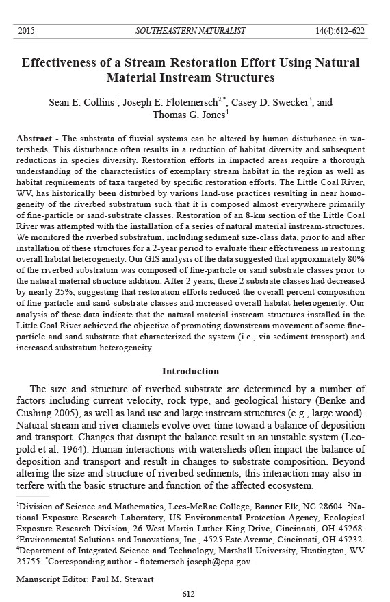
Figure 1. The Little Coal River. (a) The approximate location (outlined in red) of the Little
Coal River within WV; (b) the location (outlined in red) of the study area between Lincoln
and Kanawha counties; and (c) aerial imagery surrounding the section of interest, the shapefile
outlining the bankful width of the study area in blue, and the approximate location and
type of management structures installed in this study.
Material and Methods
Study area
The Little Coal River, a 5th-order stream in the Appalachian Plateau physiographic
province of southern West Virginia (Fig. 1), begins at the confluence of
Southeastern Naturalist
615
S.E. Collins, J.E. Flotemersch, C.D. Swecker, and T.G. Jones
2015 Vol. 14, No. 4
Spruce Fork and Pond Fork in Boone County. It flows northward through Boone,
Lincoln, and Kanawha counties with a total drainage area of ~205 km2. It is a major
tributary of the Coal River, which has a watershed area of ~2232 km2 and flows
into the Kanawha River. The Coal River includes ~141 km of stream, making it
the second-longest river completely contained within West Virginia. Based on the
first sampling event (described below), riverbed substrate composition on the Little
Coal River was fairly homogenous and dominated by sand or fine-particle substrate
classes; however gravel, cobble, and boulder substrate classes were also present
along the river. Other similar streams in the Appalachian Plateau predominantly
contained carbonate (e.g., limestone, dolostone) and clastic (e.g., sandstone, shale)
rock (Messinger and Hughes 2000).
We installed 10 natural material instream structures within the 8-km zone targeted
for restoration (Fig. 1). These included 3 J-hook and 3 cross-vane structures (Rosgen
2001), and 3 boulders and 1 wing-deflector (Fig. 1). J-hook structures, typically
placed on the outside of stream-bends, are designed to reduce bank erosion and nearbank
stream velocity (Rosgen 2001). Cross-vane structures are designed to reduce
near-bank stream velocity while increasing the energy in the main channel (Rosgen
2001). Wing deflectors are used to decrease the width of over-widened streams.
Sediment sampling
We collected sediment data along the 8-km section of the Little Coal River
(Fig. 1) before construction of the instream structures in 2007 (hereafter, 2007a).
To ensure consistency in data quality, we collected sediment data using the same
methodology after structure addition in summer 2007 (hereafter, 2007b), 2008, and
2009. We collected data using the sounding-rod method (Collins and Flotemersch
2014). This procedure consists of using a capped hollow copper (or aluminum) pipe
to determine substrate type at ~100 points per km in a zigzag pattern sampled along
a continuum from bank to bank (as recommended by Bevenger and King 1995).
We repeatedly struck the substrate with the capped pipe at each sampling point to
obtain tactile and auditory cues relating to the substrate composition. This method
is reasonably accurate and precise, with >80% of samples allocated to the correct
sediment class (Collins and Flotemersch 2014). The substrate survey resulted in
a sample of ~800 points per sampling event, and a total sample of ~3200 points
across all 4 events. At each point, we recorded substrate as belonging to one of 6
common classes: fine-particle, sand, gravel, cobble, boulder, or bedrock. These
substrate classes were based on the Wentworth (1922) scale, which is commonly
used for sediment analysis. We recorded the geographical position of each data
point using a Garmin eTrex® Venture handheld GPS unit.
We detected change in the sediment-size distribution using Kolmogorov-
Smirnov tests. We determined the proportional contribution of the 5 sediment-size
classes (excluding bedrock) from the ~800 samples for each sampling event. We
used the sediment-size distribution from 2007a as the expected distribution and
compared it to each of the 3 post-construction samples. We set a significance level
of α = 0.05 to detect differences; sample size was set to n = 800 for each sample.
Southeastern Naturalist
S.E. Collins, J.E. Flotemersch, C.D. Swecker, and T.G. Jones
2015 Vol. 14, No. 4
616
GIS analysis
We managed georeferenced data (using the UTM system) in a Microsoft Access
database (Office 2007; Microsoft Corporation, Redmond, WA). We gave each substrate
class an integer value, where 1 = fine-particle substrate (fines), 2 = sand, 3 =
gravel, 4 = cobble, 5 = boulder, and 6 = bedrock. We used ArcGIS (Version 10.2.1;
ESRI, Redlands, CA) to view points and manipulate data. We created a polygon
shapefile using ArcCatalog and edited it in ArcMap to outline bankful width of the
target section of the stream (Fig. 1) overlaid on aerial imagery of the area (http://
wvgis.wvu.edu/data/data.php). The outline shapefile masked any raster outputs that
fell outside the bankful width of the stream within the study area. We employed an
inverse distance-weighted (IDW) technique found within Spatial Analyst Tools to
interpolate sediment samples from each sampling event (i.e., 2007a, 2007b, 2008,
2009) and create a numerical substrate raster. We generated a reclassified raster for
each of the 4 sampling events using 6 substrate designations (Reclassify, Spatial
Analyst Tools; ESRI). We reclassified the substrates as fines = 1 (values ranging
from 0 to 1.50), sand = 2 (1.51–2.0), gravel = 3 (2.51–3.50), and so forth. From the
attribute table of each reclassified raster, we determined the percent composition of
each substrate class for the 8-km section of the river .
We used the Minus tool from the Math toolset (Spatial Analyst Tools) to quantify
change in substrate composition over time. By comparing 2007a data with
data from each subsequent sampling event, we were able to calculate and visually
portray changes in substrate composition along the Little Coal River over time. In
this case, negative values indicated a change from a lower numerical value (e.g.,
sand) to a higher numerical value (e.g., cobble) and vice versa .
Results
Sediment-size distributions in each of the 3 post-construction samples were
significantly different from the pre-construction sample. The Kolmogorov-
Smirnov statistics for 2007b (D = 0.103), 2008 (D = 0.314), and 2009 (D = 0.245)
all exceeded the critical statistic (D800, 0.05 = 0.048), indicating that these samples
were significantly different from the expected (i.e., original) distribution (2007a).
The greatest proportional difference in sediment-size distribution between the
pre- and post-construction sampling events was always in the sand substrate
class, with the proportional contribution of sand reduced by 10% from 2007a to
2007b, 31% from 2007a to 2008, and 24% from 2007a to 2009 (Table 1). There
was also a continual decline in the proportion of fine sediment over the 4 sampling
events (Table 1).
Our GIS analysis showed that approximately 80% of the riverbed substratum
was composed of fine-particle or sand substrate classes prior to the Rosgen-type
structure additions. By the final sampling event, these 2 substrate classes combined
had been reduced by nearly 25% (Table 1), suggesting that restoration efforts reduced
the overall percent composition of fine-particle- and sand-substrate classes
and increased overall habitat heterogeneity (Fig. 2).
Southeastern Naturalist
617
S.E. Collins, J.E. Flotemersch, C.D. Swecker, and T.G. Jones
2015 Vol. 14, No. 4
We compared maps from 2007b, 2008, and 2009 to data collected in 2007a to
show the immediate change in substrate composition as well as the total change
within a 1- and 2-year period (Fig. 3). We used the resulting maps to visually assess
changes in substrate. Large sections of the Little Coal River were transformed
Table 1. Percent composition of each substrate class within the 8-km study area of the Little Coal
River. 2007a indicates substrate sample prior to addition of Rosgen-type structures, and 2007b indicates
substrate sample after this addition. A Komolgorov-Smirnov test was used to determine if the
substrate distribution for each sampling event varied from the expected distribution (i.e., 2007a) with
α = 0.05. * denotes a significant change in distribution when compared to 2007a. The overall change
(Δ) in substrate composition between 2007a and 2009 is shown in the final column.
Substrate Size (mm) 2007a 2007b* 2008* 2009* Δ
Fines less than 0.06 8.49 4.45 1.05 0.83 -7.66
Sand 0.06–2 68.88 62.67 44.93 52.08 -16.80
Gravel 2–64 11.77 18.51 35.22 31.23 19.45
Cobble 65–256 7.84 11.36 16.69 14.62 6.77
Boulder 257–500 3.02 3.01 2.11 1.25 -1.77
Figure 2. Rasters showing overall substrate composition of an 8-km section of the Little
Coal River were created using an inverse distance-weighted (IDW) technique and reclassified
to include common substrate classes. (a) 2007 before construction of Rosgen-type
structures, (b) 2007 after construction of Rosgen-type structur es, (c) 2008, and (d) 2009.
Southeastern Naturalist
S.E. Collins, J.E. Flotemersch, C.D. Swecker, and T.G. Jones
2015 Vol. 14, No. 4
618
from smaller-size class sediment (e.g., sand) to larger-size class sediment (e.g.,
cobble), presumably resulting from increased downstream transport of fine-particle
substrate and sand, indicating the efficacy of the structures designed and installed
Figure 3. Rasters showing change over time in substrate composition of an 8-km section of
the Little Coal River were created using the Minus tool. Comparisons were made between
(a) pre-construction and post-construction in 2007, (b) pre-construction and 2008, and (c)
pre-construction and 2009. In each panel, gray indicates no change in substrate composition,
green indicates a change from a smaller substrate class to a larger substrate class, and
red indicates a change from a lar ger substrate class to a smaller substrate class.
Southeastern Naturalist
619
S.E. Collins, J.E. Flotemersch, C.D. Swecker, and T.G. Jones
2015 Vol. 14, No. 4
for this purpose. Sediment-size class decreased in some areas. This change further
highlighted that increased substrate heterogeneity occurred in some sections of the
river that previously supported a rather homogenous substrate.
Discussion
Stream-restoration efforts often have the goal of emulating pre-disturbance
conditions of stream substrata while also mitigating the degradation of streams and
rivers. Evaluating such efforts requires monitoring over space and time (Mueller et
al. 2014). Such assessments also require collaborations among diverse stakeholders
by sharing images, maps, and analyses in a non-technical, inclusive manner
(Soomai et al. 2013).
Stream-restoration projects are often not monitored, or when they are, they are
monitored poorly (Bernhardt et al. 2005). In many cases, researchers assess the
implementation of the restoration effort, not the ecosystem response. This approach
has led to a focus on the restoration process that comes at the expense of ecological
concepts or ecosystem services (Lake et al. 2007). Ward et al. (2001) recognized the
need for particular configurations of physical habitat and appro priate flow regimes
for successful restoration at an ecosystem level. In some cases, restoration efforts
have qualitatively improved physical-habitat condition (e.g., Jähnig and Lorenz
2008, Moerke et al. 2004), but a quantitative approach for determining substrate
composition as well as the spatial arrangement of various habitat patches facilitates
the successful monitoring of stream restoration projects.
From an ecosystem perspective, increasing substrate diversity in restored sections
may result in higher beta-diversity when compared to un-restored sections
(Jähnig and Lorenz 2008). Simply increasing the diversity should not be the sole
aim of restoration; rather, the goal should include restoration of stream sections
to a physical structure capable of supporting populations and communities of
organisms that existed prior to disturbance or the best regional expectations for
such. Achieving this outcome requires a thorough understanding of the unique
habitat (Southwood 1977) and spatiotemporal (Schneider 1994) requirements of
the desired biota; an especially challenging goal when dealing with organisms
requiring very specific substrate-condition requirements such as lithophilic fishes
(e.g., Mueller et al. 2014) and unionid mussels (e.g., Niraula et al. 2015, Watters
et al. 2009). The mapping technique we present in this paper offers a simple visual
portrayal of existing substrate conditions, graphically imposing desired conditions,
and monitoring post-restoration success.
In the present study, results suggested that the installation of natural material
instream structures are an effective method for promoting downstream movement
of accumulated fine-particle substrate and sand. This finding was evidenced by a
nearly 25% decrease in fine-particle or sand substrate, which in most cases occurred
directly downstream of the installed structures. Additionally, substrate size decreased
at some locations in the study area that were rather homogeneous prior to
the installation of structures (Fig. 3). This observed substrate change, apparently
Southeastern Naturalist
S.E. Collins, J.E. Flotemersch, C.D. Swecker, and T.G. Jones
2015 Vol. 14, No. 4
620
resulting from the installation of the structures, further contributed to the stated
goal of increasing the heterogeneity of the substrate in the st udy area.
Several questions remain that warrant further investigation. First, to what extent
has the increase in substrate heterogeneity in the study area resulted in an increase
in biotic heterogeneity? Second, has the instream-structure installation, and subsequent
downstream movement of accumulated fine-particles and sand resolved a
problem, or simply translocated the problem to a new location? Lastly, how have
the structures and consequent increase in sediment heterogeneity that they apparently
encouraged persisted through time?
Acknowledgments
Funding sources for this project included a grant to Marshall University from the West
Virginia Department of Environmental Protection and the Coal River Group, a Wieman
Wendel Benedict Research Award from the University of Cincinnati to S.E. Collins, and
collaborative development support from the USEPA. We thank Jo Garofalo, Alex Hall, Roger
Wolfe, Dennis Stottlemyer, Randy Huffman, and anonymous reviewers for comments on
an earlier manuscript draft. The views expressed in this paper are those of the authors and
do not necessarily reflect the views or policies of the US Environmental Protection Agency.
Literature Cited
Benke, A.C., and C.E. Cushing. 2005. Background and approach. Pp. 1–16, In A.C. Benke.
and C.E. Cushing (Eds.). Rivers of North America. Elsevier Academic Press, San Diego,
CA. 553 pp.
Bernhardt, E., M.A. Palmer, J.D. Allan, G. Alexander, K. Barnas, S. Brooks, J. Carr, S.
Clayton, C. Dahm, J. Follstad-Shah, D. Galat, S. Gloss, P. Goodwin, D. Hart, B. Hassett,
R. Jenkinson, S. Katz, G.M. Kondolf, P.S. Lake, R. Lave, J.L. Meyer, T.K. O’Donnell,
L. Pagano, B. Powell, and E. Sudduth. 2005. Synthesizing US river restoration efforts.
Science 308:636–637.
Bevenger, G.S., and R.M. King. 1995. A pebble-count procedure for assessing watershed
cumulative effects. Research Paper RM-RP-319. US Department of Agriculture, Forest
Service, Fort Collins, CO.
Collins, S.E., and J.E. Flotemersch. 2014. Evaluating the sounding-rod method for sampling
coarse river-bed materials in non-wadeable streams and rivers. River Research and
Applications 30:1065–1069.
Henley, W.F., M.A. Patterson, R.J. Neves, and A.D. Lemly. 2000. Effects of sedimentation
and turbidity on lotic food webs: A concise review for natural-resource managers. Reviews
in Fisheries Science 8:125–139.
Jähnig, S.C., and A.W. Lorenz. 2008. Substrate-specific macroinvertebrate-diversity patterns
following stream restoration. Aquatic Sciences 70:292–303.
Lake, P.S., N. Bond, and P. Reich. 2007. Linking ecological theory with stream restoration.
Freshwater Biology 52:597–615.
Leopold, L.B., M.G. Wolman, and J.P. Miller. 1964. Fluvial Processes in Geomorphology.
Dover Publications, Mineola, NY. 544 pp.
Messinger, T., and C.A. Hughes. 2000. Environmental setting and its relation to water quality
in the Kanawha River Basin. Report 00-4020. Water-Resources Investigations, US
Geological Survey, Charleston, WV. 66 pp.
Southeastern Naturalist
621
S.E. Collins, J.E. Flotemersch, C.D. Swecker, and T.G. Jones
2015 Vol. 14, No. 4
Moerke, A.H., K.J. Gerrard, J.A. Latimore, R.A. Hellenthal, and G.A. Lamberti. 2004. Restoration
of an Indiana, USA, stream: Bridging the gap between basic and applied lotic
ecology. Journal of the North American Benthological Society 23:647–660.
Mueller, M., J. Pander, and J. Geist. 2014. The ecological value of stream-restoration measures:
An evaluation on ecosystem and target-species scales. Ecological Engineering
62:129–139.
Niraula, B.B, J.M. Hyde, J.M. Miller, P.D. Johnson, and P.M. Stewart. 2015. Microhabitat
associations among three federally threatened and a common freshwater mussel species.
American Malacological Bulletin 33:1–9.
Poff, N.L, J.D. Olden, D.M. Merritt, and D.M. Pepin. 2007. Homogenization of regional
river dynamics by dams and global biodiversity implications. Proceedings of the National
Academy of Sciences 104:5732–5737.
Rosgen, D.L. 2001. The cross-vane, w-weir, and j-hook-vane structures: Their description,
design, and application for stream stabilization and river restoration. American
Society of Civil Engineers, Restoration Proceedings, Reno, NV. doi: http://dx.doi.
org/10.1061/40581(2001)72).
Rosgen, D.L., and H.L. Silvey 1996. Applied River Morphology. Wildland Hydrology
Books, Pagosa Springs, CO. 256 pp.
Schneider, D.C. 1994. Quantitative Ecology: Spatial and Temporal Scaling. Academic
Press, San Diego, CA. 395 pp.
Soomai, S.S., B.H. MacDonald, and P.G. Wells. 2013. Communicating environmental information
to the stakeholders in coastal and marine policy-making: Case studies from
Nova Scotia and the Gulf of Maine/Bay of Fundy region. Marine P olicy 40:176–186.
Southwood, T.R.E. 1977. Habitat, the templet for ecological strategies? Journal of Animal
Ecology 46:337–365.
Terrell, J.H. 2011. Evaluating substrate metrics for monitoring sediment impairment of East
Tennessee streams. M.Sc. Thesis. University of Tennessee, Knoxville, TN. 89 pp.
United Nations Educational, Scientific, and Cultural Organization (UNESCO). 1984. International
Hydrological Challenges. Reference NS/188, Annex II, Paris, France.
US Environmental Protection Agency (USEPA). 2013. National Rivers and Streams Assessment
2008–2009: A collaborative survey. EPA/841/D-13/001. US Environmental
Protection Agency Office of Wetlands, Oceans and Watersheds and Office of Research
and Development, Washington, DC.
Ward, J.V., K. Tockner, U. Uehlinger, and F. Malard. 2001. Understanding natural patterns
and processes in river corridors as the basis for effective restoration. Regulated Rivers:
Research and Management 17:311–323.
Waters, T.F. 1995. Sediment in streams: Sources, biological effects, and control. American
Fisheries Society Monograph 7. Bethesda, MD.
Watters, G.T., M.A. Hoggarth, and D.H. Stansbery. 2009. The Freshwater Mussels of Ohio.
Ohio State University Press, Columbus, OH. 98 pp.
Wentworth, C.K. 1922. A scale of grade and class terms for clastic sediments. The Journal
of Geology 30:377–392.
West Virginia Department of Environmental Protection (WVDEP). 2000. Water quality
asessment: 305(b) report. Division of Waste and Water Management, Charleston, WV.
WVDEP. 2002. Water quality assessment: Section 303(d) List. Division of Waste and Water
Management, Charleston, WV.
WVDEP. 2004. Water quality assessment: Section 303(d) List. Division of Waste and Water
Management, Charleston, WV.
Southeastern Naturalist
S.E. Collins, J.E. Flotemersch, C.D. Swecker, and T.G. Jones
2015 Vol. 14, No. 4
622
WVDEP. 2006. Water quality assessment: Section 303(d) List. Division of Waste and Water
Management, Charleston, WV.
WVDEP. 2008. West Virginia integrated water quality monitoring and assessment report.
Division of Waste and Water Management, Charleston, WV.
WVDEP. 2010. West Virginia integrated water quality monitoring and assessment report.
Division of Waste and Water Management, Charleston, WV.
WVDEP. 2012. West Virginia integrated water quality monitoring and assessment report.
Division of Waste and Water Management, Charleston, WV.
Williams, D.D. 1980. Some relationships between stream benthos and substrate heterogeneity.
Limnology and Oceanography 25:166–172.


 The Southeastern Naturalist is a peer-reviewed journal that covers all aspects of natural history within the southeastern United States. We welcome research articles, summary review papers, and observational notes.