2010 NORTHEASTERN NATURALIST 17(1):49–62
Plant Communities of the Burden Hill Forest,
Salem County, New Jersey
Stevens Heckscher1,*, James F. Thorne1, Mike Bertram1, and Michael Ward1
Abstract - The plant community types on three tracts within the Burden Hill Forest,
a distinctive outlier of the New Jersey Pine Barrens, are described and classified.
While these tracts consist largely of a general pine barrens type, they display a
number of significant differences from the main body of the Pine Barrens. These
differences include additional forest plant community types previously undescribed
for New Jersey, higher heterogeneity of community types and woody plant diversity,
and the presence of several unusual or rare species including Castanea pumila (Allegheny
Chinquapin).
Introduction
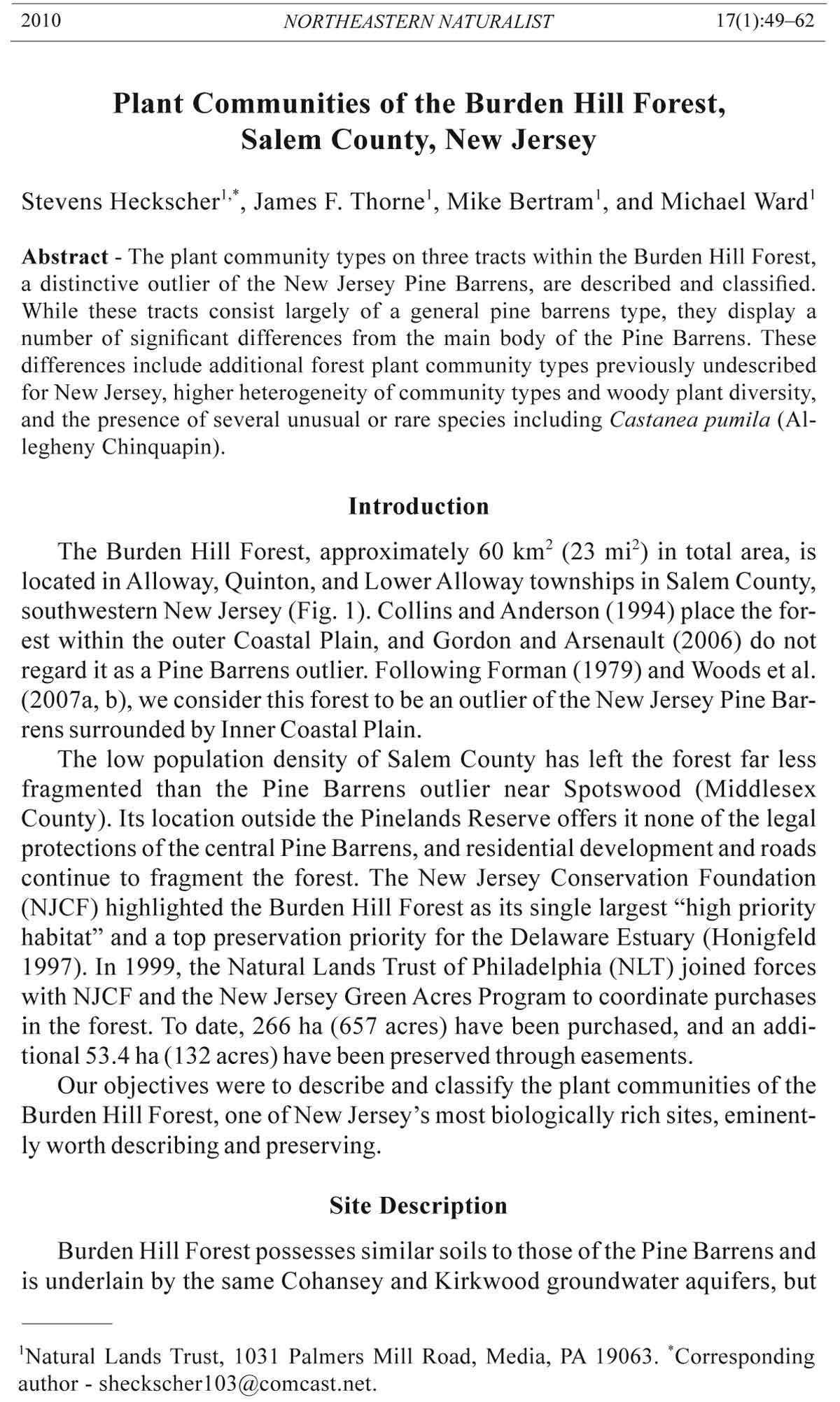
The Burden Hill Forest, approximately 60 km2 (23 mi2) in total area, is
located in Alloway, Quinton, and Lower Alloway townships in Salem County,
southwestern New Jersey (Fig. 1). Collins and Anderson (1994) place the forest
within the outer Coastal Plain, and Gordon and Arsenault (2006) do not
regard it as a Pine Barrens outlier. Following Forman (1979) and Woods et al.
(2007a, b), we consider this forest to be an outlier of the New Jersey Pine Barrens
surrounded by Inner Coastal Plain.
The low population density of Salem County has left the forest far less
fragmented than the Pine Barrens outlier near Spotswood (Middlesex
County). Its location outside the Pinelands Reserve offers it none of the legal
protections of the central Pine Barrens, and residential development and roads
continue to fragment the forest. The New Jersey Conservation Foundation
(NJCF) highlighted the Burden Hill Forest as its single largest “high priority
habitat” and a top preservation priority for the Delaware Estuary (Honigfeld
1997). In 1999, the Natural Lands Trust of Philadelphia (NLT) joined forces
with NJCF and the New Jersey Green Acres Program to coordinate purchases
in the forest. To date, 266 ha (657 acres) have been purchased, and an additional
53.4 ha (132 acres) have been preserved through easements.
Our objectives were to describe and classify the plant communities of the
Burden Hill Forest, one of New Jersey’s most biologically rich sites, eminently
worth describing and preserving.
Site Description
Burden Hill Forest possesses similar soils to those of the Pine Barrens and
is underlain by the same Cohansey and Kirkwood groundwater aquifers, but
1Natural Lands Trust, 1031 Palmers Mill Road, Media, PA 19063. *Corresponding
author - sheckscher103@comcast.net.
50 Northeastern Naturalist Vol. 17, No. 1
is separated from the central pinelands by twenty miles of more fertile coastal
plain soils. According to the Salem County Soil Survey (USDA 1969), the
dominant soil association for Burden Hill is the Sassafras-Evesboro-Downer
Association, which supports mostly very droughty and nutrient-poor soils.
The Soil Survey notes that areas abandoned from agriculture tend to grow
up in pines.
Burden Hill is the largest forest in Salem County. Robichaud and Buell
(1973) describe this forest as mostly a type of mixed oak forest, similar to
the oak-pine forests of the Pine Barrens. Its wetlands consist of seeps, small
streams, vernal ponds, and a permanent dammed pond. These contain extensive
stands of Helonias bullata L. (Swamp Pink), a federally listed plant, as
well as the state-protected Listera australis Lindl. (Southern Twayblade).
Castanea pumila (L.) P. Mill. (Allegheny Chinquapin), a state-endangered
species, is scattered throughout the forested upland areas (S. Heckscher,
pers. observ.). The forest is home to two state-listed birds known for their
affinities to large tracts of mature, unbroken forest: Buteo lineatus Gmelin
(Red-shouldered Hawk) and Strix varia Barton (Barred Owl).
F i g u r e 1 .
Location of
study area in
Burden Hill
Forest.
2010 S. Heckscher, J.F. Thorne, M. Bertram, and M. Ward 51
We studied three tracts of the Burden Hill Forest recently acquired and
now managed by the NLT: the Alloway Tract (62.9 ha [155.4 acres]), the
Cool Run Tract (84.8 ha [209.5 acres]), and the Route 49 Tract (34.7 ha [85.7
acres]) (Fig. 1). Using the results of this study, NLT has produced a management
plan for its holdings in this forest (Natural Lands Trust 2004).
Methods
Botanical nomenclature follows Kartesz (1994). Woody plants with a
diameter at breast height (DBH) greater than or equal to 10 cm were classified
as trees, and woody plants with a DBH ranging from 1 cm to 10 cm
were classified as shrubs. Shrub stems were counted individually when
they were separate and distinguishable at ground level.
Sampling design
Our method for sampling the vegetation was a stratified, iterative design
similar to that used by Pennsylvania Bureau of Forestry (2001). A color infrared
aerial photograph of the entire Burden Hill forest was overlaid onto
a GIS base map of the three study tracts (ESRI n.d., version 9.1). Polygons
were drawn on the GIS map of each tract, each bounding an area more or
less uniform in color and texture and considered to represent a distinct forest
community type. On this map, we superimposed a square, north–south,
east–west grid system, creating 0.4-ha quadrats. We randomly selected
sampling quadrats until the sampling area totaled a minimum of 10% of the
total area of each polygon. A few polygons were too small or too narrow to
fully contain quadrats, and were not included in the analyses. These were
examined in the field, and their community classifications were determined
by direct inspection.
Data collection in the field
We placed two concentric, circular sampling plots (20-m and 5-m diameters)
at the center of each randomly selected quadrat. We counted and
recorded the DBH of each tree within the larger plots and tallied the number
of shrub stems within the smaller plots. For each tree species in each plot, we
calculated relative density (number of stems for the species / total number of
tree stems), relative dominance (total basal area for the species / total basal
area for all tree species), and importance value (100 * [relative density +
relative dominance] / 2). For each shrub species in each plot, we calculated
relative density (number of stems for the species / total number of shrub
stems) and importance value (100 * relative density).
Analyses
We used multivariate analyses on four data sets for the purposes of delineation
and naming of community types: (1) on tree data from each of
the three tracts, with each tract examined separately; (2) on tree data from
all three tracts combined into a single data set; (3) on shrub data from each
of the three tracts separately; and (4) on shrub data from all three tracts
52 Northeastern Naturalist Vol. 17, No. 1
combined into a single data set. We used TWINSPAN to detect patterns in
the data and to help us to name and describe community types. To search for
additional patterns in the data, we also ran on each of the data sets (2) and
(4) a detrended correspondence analysis (DECORANA), principal components
analysis, and two cluster analyses using Euclidean distances, the first
with separation by distances between centroids, and the second by distances
between nearest neighbors. The software used for these programs was PCORD
(McCune and Mefford 1997).
Using the results of the TWINSPAN runs, community types consisting
of categories subdivided into community elements were named, described
according to dominant and other important species present, and mapped. We
used the polygons mapped earlier as guidelines wherever possible. Several
additional forays were then made into the field, ensuring that each community
type on each tract was carefully inspected at least once, and amendments
to the maps were made accordingly.
Where possible, community elements and categories that we identified
were then cross-referenced (crosswalked) to plant community classifications
in the second iteration of the New Jersey Vegetation Classification
(NJVC) (Breden et al. 2001). We made note of significant differences between
our results and those of NJVC, and these are noted in the discussion
section below.
Results
We assessed and mapped the plant community types for the Alloway
Tract (Fig. 2), the Cool Run Tract (Fig. 3), and the Route 49 Tract (Fig. 4)
in the Burden Hill Forest. Detailed descriptions of each of these community
types follows.
Acidic soils
Pitch Pine forest. On the Burden Hill tract, this category consists only of
a small stand of Pinus rigida P. Mill. (Pitch Pine) of questionable etiology—
probably planted years ago, or a successional pine community. It is poorly
represented here, and for these reasons it is not divided into community elements.
Moreover, on the Route 49 Site there is a recently disturbed area now
being colonized by a stand of Pinus rigida seedlings and saplings, marked
“early Pitch Pine regeneration” (EP) on Figure 4.
Broadleaf or broadleaf-needleleaf forest with a heath-shrub understory.
Community elements in this category are those with a broadleaf, or
broadleaf and needleleaf, more or less closed, canopy over a heath-shrub
understory. Oaks, especially Quercus alba L. (White Oak), predominate
among the broadleaf species, and Pinus rigida is the most important
needleleaf tree. The colonial species Gaylussacia baccata (Wangenh.) K.
Koch (Black Huckleberry) is generally dominant in the shrub layer, and
provides a fairly good indicator species for this category. Community elements
are as follows:
2010 S. Heckscher, J.F. Thorne, M. Bertram, and M. Ward 53
Xeric-mesic oak: This xeric-mesic hardwood community is dominated by
Sassafras albidum (Nutt.) Nees (Sassafras) and the following oaks in various
combinations: Quercus alba, Q. coccinea Muenchh. (Scarlet Oak), Q. falcata
Michx. (Southern Red Oak), and Q. velutina Lam. (Black Oak). Castanea
pumila is sometimes present, and Carya glabra (P. Mill.) Sweet (Pignut
Hickory) is scattered throughout. Pinus rigida is absent, although P. virginiana
P. Mill. (Scrub Pine) may be present as an oldfield relic. The shrub layer
appears to be extremely depauperate, with the only species recorded in it
during our data collection being Gaylussacia baccata.
Oak-pine: In this xeric-mesic community element, the following oaks in
varying combinations co-dominate: Quercus alba, Q. falcata, Q. coccinea,
Q. velutina, and Q. prinus L. (Chestnut Oak). Pinus rigida is always present,
sometimes as a co-dominant, and was regarded by us as an indicator species
separating this community element from the xeric-mesic oak community
element. Sassafras albidum is present and often abundant. Other hardwoods
sometimes present include Acer rubrum L. (Red Maple), Ilex opaca Ait.
(American Holly), Liquidambar styraciflua L. (Sweet Gum), Nyssa sylvatica
Marsh. (Black Gum), and Prunus serotina Ehrh. (Black Cherry). Castanea
Figure 2. Alloway
Site: woody plant
communities as
determined by
this study. Small
circles denote
sampling points.
Note that community
types are
often not sharply
delineated;
boundaries between
them are
usually more or
less gradual. AC
= Atlantic White
Cedar Swamp,
DPP = disturbed
Pitch Pine and
Black Cherry,
EP = early Pitch
Pine regeneration,
MH = mixed hardwoods, MHH = mesic-hydric hardwoods with lowland pitch
pine, MHL = mature mixed hardwoods with Mountain Laurel shrub layer, MV =
mid-successional oldfield with Virginia Pine, OF = open field, OH = oak-American
Holly, OL = oak-Mountain Laurel, OP = oak-pine, OS = open shrubland with Water
Willow, PP = Pitch Pine forest, PRB = Red Maple-Black Gum palustrine forest, PRP
= permanent pond, RMR = Red Maple-Black Gum-Sweetbay Magnolia riparian forest,
SP = seasonal pond, and XM = xeric-mesic oak.
54 Northeastern Naturalist Vol. 17, No. 1
pumila is present and varies from sparse to abundant. Stump sprouts of
C. dentata (Marsh.) Borkh. (American Chestnut) were found in two quadrats.
Pinus echinata P. Mill. (Shortleaf Pine) is present but sparse, while
Pinus virginiana and Juniperus virginiana L. (Red Cedar) are often present,
probably as oldfield relicts. A few hickories, i.e., Carya glabra and C. alba
(L.) Nutt. ex Ell. (SY = C. tomentosa (Lam. ex Poir.) Nutt.) (Mockernut
Hickory), are sometimes present. In the shrub-layer, Smilax glauca Walt.
(Glaucous Greenbriar) and S. rotundifolia L. (Greenbriar) are sparse, along
with the usually abundant Gaylussacia baccata and Vaccinium pallidum Ait.
(Hillside Blueberry).
Oak-American Holly: Oaks—Quercus prinus, Q. falcata, and Q. coccinea—
dominate. Ilex opaca is likely the most abundant element of the
subcanopy, and Acer rubrum is present in small numbers. The shrub layer,
dominated by Gaylussacia baccata, is species-poor, but may contain Kalmia
latifolia L. (Mountain Laurel).
Oak-Mountain Laurel: Oaks—Quercus coccinea, Q. alba, Q. falcata,
and Q. prinus—co-dominate with Sassafras albidum. Pinus rigida and
Figure 3. Cool Run Site: woody plant communities as determined by this study. Small
circles denote sampling points. Note that community types are often not sharply
delineated; boundaries between them are usually more or less gradual. See Figure 2
for community abbreviations.
2010 S. Heckscher, J.F. Thorne, M. Bertram, and M. Ward 55
P. virginiana are present but variable, as is Castanea pumila. The shrub layer
consists of Gaylussacia baccata with Kalmia latifolia, which may be very
dense in places where little grows under it, and Vaccinium pallidum.
Disturbed Pitch Pine and Black Cherry: In this disturbed element, Pinus
rigida and Prunus serotina are most abundant. Other hardwoods of some
importance include (in order of decreasing abundance) Cornus florida L.
(Flowering Dogwood), Sassafras albidum, and Castanea pumila. Oaks are
sparse. Juniperus virginiana, an oldfield relic, is present. In the shrub layer,
Kalmia latifolia and Gaylussacia baccata are present and may be abundant.
This community type occurs only in a small polygon of the Cool Run
tract that has been heavily disturbed, so this description must be regarded
as provisional.
Rich soils
Rich broadleaf forest (“mixed oak”). This category appears to be a
variant of the "mixed oak forest" of Collins and Anderson (1994). It is
Figure 4. Route 49 Site: Woody plant communities as determined by this study. Small
circles denote sampling points. Note that community types are often not sharply
delineated; boundaries between them are usually more or less gradual. See Figure 2
for community abbreviations.
56 Northeastern Naturalist Vol. 17, No. 1
characterized by a mixture of oaks, with other hardwoods, and little or no
pine. Community elements are as follows:
Mature mixed hardwoods with a Mountain Laurel shrub layer: This
community element consists of the most mature hardwood stand encountered
in this study. Oaks include at least Quercus falcata, Q. coccinea, and
Q. alba. Stump sprouts of Castanea dentata are present. Other hardwoods
include Carya alba (SY = C. tomentosa), C. glabra, Fagus grandifolia Ehrh.
(American Beech), Cornus florida, Sassafras albidum, and Ilex opaca. The
understory is unevenly dominated by Kalmia latifolia. This type is quite
possibly a more mature version of the oak-Mountain Laurel element, as described
above.
Mixed hardwoods: This community element differs from the last in that
here Kalmia latifolia is absent. It contains a mixture of oaks including Quercus
falcata, Q. coccinea, and Q. alba. Other hardwoods may include any of
the following: Carya alba (SY = C. tomentosa), C. glabra, Fagus grandifolia,
Cornus florida, Sassafras albidum, and Ilex opaca. Scattered pines and
Castanea dentata stump sprouts may occasionally be present.
Hydric soils
Red Maple-Black Gum riparian or palustrine forest. This category consists
of riparian or palustrine forests dominated by Acer rubrum, with Nyssa
sylvatica present but often sparse. Gaylussacia species, Vaccinium species,
Clethra alnifolia L. (Sweet Pepperbush), and Rhododendron viscosum (L.)
Torr. (Swamp Azalea) are often present in the shrub layer. Community elements
are as follows:
Red Maple-Black Gum-Sweetbay Magnolia riparian forest: Acer rubrum
is dominant. Nyssa sylvatica and Magnolia virginiana L. (Sweetbay Magnolia)
are present but may be sparse. Clethra alnifolia, Gaylussacia frondosa
(L.) Torr. & Gray ex Torr. (Dangleberry), and Rhododendron viscosum are
found in the shrub layer. While not reported in our data for this element,
Vaccinium corymbosum L. (Highbush Blueberry) has been seen locally
and should be looked for here, where it is probably quite common. Also to
be looked for here are Ilex verticillata (L.) Gray (Winterberry), Leucothoe
racemosa (L.) Gray (Deciduous Swamp Fetterbush), and Ilex glabra (L.)
Gray (Inkberry).
Red Maple-Black Gum palustrine forest: Acer rubrum is dominant.
Nyssa sylvatica is present but may be sparse. The shrub layer contains
Gaylussacia baccata, Vaccinium pallidum, and V. corymbosum. The single,
small polygon containing this community element, on the Route 49
tract, has been strongly modified by recent disturbance, so this description
must be regarded as provisional.
Hydric broadleaf-needleleaf forest. Description for the only community
element, below.
Mesic-hydric hardwoods with lowland Pitch Pine: Of importance are Nyssa
sylvatica, Ilex opaca, and Pinus rigida. Small numbers of Acer rubrum
2010 S. Heckscher, J.F. Thorne, M. Bertram, and M. Ward 57
are present; this paucity, combined with the abundance of Pinus rigida, distinguish
this community element from the Red Maple-Black Gum-Sweetbay
Magnolia riparian forest element, where A. rubrum is dominant. Castanea
pumila is sometimes present. Facultative wetland hardwoods include
Liriodendron tulipifera L. (Tulip Tree), Quercus falcata, and Liquidambar
styraciflua. Wetland indicators Quercus bicolor Willd. (Swamp White Oak)
and Magnolia virginiana are present but in small numbers. Vaccinium
corymbosum, Gaylussacia baccata, G. frondosa, Clethra alnifolia, Leucothoe
racemosa, and Lyonia ligustrina (L.) DC (Maleberry) are often abundant
in the shrub layer. Rhododendron viscosum is not present in our data
for this community element, although according to NJVC it probably occurs
here.
Atlantic White Cedar swamp. This is not divided into community elements.
It consists of swamp forest strongly dominated by Chamaecyparis
thyoides (L.) B.S.P. (Atlantic White Cedar).
Miscellaneous
Mid-successional oldfield with Virginia Pine. This type is not divided
into community elements. It is dominated by Pinus virginiana, apparently
succeeding to hardwoods.
Open shrubland with Water Willow. This type is not divided into community
elements. It consists of hydric shrubland with a high density of Decodon
verticillatus (L.) Ell. (Water Willow).
Discussion
In this study, we have made a first attempt at naming, describing, and
mapping the woody plant communities on three tracts in the Burden Hill Forest,
classifying the communities into categories subdivided into community
elements. Because we are working at a far finer scale, our names deliberately
reflect a finer detail than those of Breden et al. (2001). Figures 2–4 show the
locations of our community types.
The Burden Hill Forest differs from the main New Jersey Pine Barrens
in at least two respects. First, the forest appears more heterogeneous, displaying
a rich mosaic of different plant community types. For example, the
oak-dominated communities have higher species diversity of oaks and other
woody plants, including the rare Castanea pumila, and a greater abundance
of Ilex opaca in places in the understory. Secondly, the C. pumila, while
quite common at Burden Hill, is scarcely found elsewhere in the state.
One similarity of the Burden Hill Forest to the main New Jersey Pine
Barrens is important. Our second category, broadleaf or broadleaf-needleleaf
forest with a heath-shrub understory, consists of mixed hardwoods, with or
without Pitch Pine, over heath shrubs, mainly the colonial and clonal Gaylussacia
baccata (Black Huckleberry). This composition suggests strongly
that this category belongs to the generalized, fire-adapted pine-oak heath
58 Northeastern Naturalist Vol. 17, No. 1
type (Whittaker 1979) common not only in the New Jersey Pine Barrens, but
also on acidic ridgetops in the Piedmont and Ridge and Valley provinces, and
elsewhere. According to Little (1979), fire has been a significant ecological
factor in shaping community types in large parts of the Burden Hill area, as
is true with the main Pine Barrens, but there is some controversy over this
point, and the shrub or small tree Quercus ilicifolia Wangenh. (Bear Oak)
common in openings of this forest type in the main Pine Barrens, is nearly
or completely absent on our Burden Hill project area.
It is also instructive to compare our findings to those of Olsson (1979),
which covered the “central fifth of the New Jersey Pine Barrens.” Our
second category, broadleaf or broadleaf-needleleaf forest with a heath-shrub
understory, corresponds most closely to Olsson’s pine-oak vegetation type.
His Entity A1, Pinus rigida-Quercus ilicifolia, differs from our second
category in its abundance of Q. ilicifolia in the understory. His Entity A3,
Quercus alba-Q. prinus-Q. velutina, is similar to our second category except
that in our study area, Q. ilicifolia appears to be nearly or completely absent,
Q. falcata is present, and Q. prinus is comparatively less abundant.
Although Ilex opaca occurs at least sporadically in poorer-drained
sites throughout much of the New Jersey Pine Barrens, nothing similar to
our oak-American Holly community element appears in Olsson’s (1979)
classification or that of NJVC. While this type apparently does not occur
in the main body of the Pine Barrens, a similar community type does
occur in the Glades Region of New Jersey’s Cumberland County near
Fortescue (Heckscher 1994). This region lies near the Delaware Bayshore
about 25 miles to the southeast of the Burden Hill Forest. More or less
dense stands of Ilex opaca are probably widely distributed in Cumberland
and Cape May counties, and also on New Jersey’s Inner Coastal Plain
(anonymous reviewer, pers. comm.). See Collins and Anderson (1994)
for comments on American Holly in southern New Jersey. Likely factors
influencing the distribution of I. opaca and other species at Burden Hill
include proximity to the Inner Coastal Plain, where I. opaca is more common,
as well as soils, geology, and a more southerly climate than that of
the main Pine Barrens.
Gordon and Arsenault (2006) point out that, at Burden Hill, needleleaf
evergreen species such as Pinus rigida and P. echinata “occupy gaps or scars
of exposed mineral soil created by traditional land uses, and other smallscale
forest disturbances.” They attribute to the proximity of the rich Inner
Coastal Plain of south Jersey the presence at Burden Hill of at least seven
deciduous hardwood tree species.
As a contribution towards the ongoing work of classification of plant
communities in New Jersey, in Table 1 we have cross-referenced (crosswalked)
our groupings (categories and community elements) to NJVC; i.e.,
we have indicated the alliances and plant associations of NJVC into which
our groupings most nearly fit. Some of our groupings do not have clear crosswalks
to the present iteration of NJVC. We list and discuss these difficulties
2010 S. Heckscher, J.F. Thorne, M. Bertram, and M. Ward 59
Table 1. Cross- references (crosswalks) for the plant community elements found by us at the Burden Hill Forest, NJ, to the corresponding alliances and plant
associations reported in the New Jersey Vegetation Classification (NJVC) (Breden et al. 2001).1
Burden Hill element NJVC alliance NJVC plant association
Xeric-mesic oak I.B.2.N.a.100: Quercus velutina-Quercus alba- Quercus coccinea–Quercus velutina/
(Quercus coccinea) forest Sassafras albidum/Vaccinium pallidum
forest
Oak-pine I.C.3.N.a.35: Pinus (rigida, echinata)-Quercus Ambiguous; see text
coccinea forest; a poor fit; see text
Oak-American Holly Unknown
Oak-Mountain Laurel I.B.2.N.a.100: Quercus velutina-Quercus alba- Quercus velutina-Quercus coccinea-
(Quercus coccinea) forest Quercus montana (SY = Q. prinus)/
Kalmia latifolia forest
Disturbed Pitch Pine and Black Cherry Unknown
Mature mixed hardwoods with a Mountain Laurel shrub layer Belongs to formation I.B.2.N.a: lowland or Ambiguous; see text
submontane cold-deciduous forest; alliance
ambiguous, but see text
Mixed hardwoods Possibly I.B.2.N.a.31: Quercus falcata forest, Unknown
a poor fit; see text
Red Maple-Black Gum-Sweetbay Magnolia riparian forest I.B.2.N.g.2: Acer rubrum-Nyssa sylvatica Acer rubrum-Nyssa sylvatica/
saturated forest Rhododendron viscosum-Clethra
alnifolia forest
Red Maple-Black Gum palustrine forest I.B.2.N.g.2: Acer rubrum-Nyssa sylvatica Acer rubrum-Nyssa sylvatica-Magnolia
saturated forest virginiana forest
Mesic-hydric hardwoods with lowland Pitch Pine I.C.3.N.d.300: Pinus rigida-Acer rubrum Pinus rigida-Acer rubrum/Rhododendron
saturated forest viscosum forest
Atlantic White Cedar swamp I.A.8.N.g.2: Chamaecyparis thyoides Chamaecyparis thyoides/Ilex glabra forest
saturated forest
Mid-successional oldfield with Virginia Pine Possibly I.C.3.N.a.27: Pinus virginiana-Quercus Unknown
(alba, stellata, falcata, velutina) forest; see text
Open shrubland with Water Willow Unknown
1Because it is small, fragmentary, and probably a remnant of a planted area, our element Pitch Pine forest is not shown in this table (see text).
60 Northeastern Naturalist Vol. 17, No. 1
next, and we suggest that they may reveal gaps in the present iteration of
NJVC, where further study is needed.
Oak-pine: This community element fits uneasily into NJVC’s alliance
I.C.3.N.a.35, PINUS (RIGIDA, ECHINATA)-QUERCUS COCCINEA FOREST,
corresponding poorly to the descriptions of both its NJVC associations,
as follows:
Pinus (rigida, echinata)-Quercus coccinea/Ilex opaca forest (our oak-pine
element is probably on drier soil).
Pinus rigida-Quercus coccinea/Vaccinium pallidum-(Morella [=Myrica]
pensylvanica Loisel.) forest.
Oak-American Holly: Because pines are absent from our data on this
community element on Burden Hill, and also apparently from its polygon
as seen on the infrared aerial photograph, we cannot crosswalk this element
to NJVC’s PINUS (RIGIDA, ECHINATA)-QUERCUS COCCINEA / ILEX
OPACA FOREST (under I.C.3.N.a.35). Indeed, we cannot find any alliance
or association in NJVC to which this community element can be crosswalked.
Further study is needed, but see the references to American Holly in
Collins and Anderson (1994), and our discussion above.
Disturbed Pitch Pine and Black Cherry: We can find no fit in NJVC for
this community type, which appears to be the result of recent disturbance.
Mature mixed hardwoods with a Mountain Laurel shrub layer: While
this element clearly belongs to formation I.B.2.N.a, lowland or submontane
cold-deciduous forest, its understorey dominance by Kalmia latifolia renders
assignment to a current NJVC alliance difficult or impossible. This type may
be a more mature successional stage of oak-Mountain Laurel (q.v.), in which
case it could fit into alliance I.B.2.N.a.100, QUERCUS VELUTINA-QUERCUS
ALBA-(QUERCUS COCCINEA) FOREST and association Quercus velutina-
Quercus coccinea-Quercus montana forest. We suggest further study.
Mixed hardwoods: The NJVC alliance that most nearly corresponds to
this Burden Hill element is I.B.2.N.a.31, QUERCUS FALCATA FOREST,
but the fit is poor and no appropriate association can be found in the current
iteration of NJVC; indeed, the latter document indicates the need for further
study to assess the distribution of this alliance.
Mid-successional oldfield with Virginia Pine: The alliance I.C.3.N.a.27, to
which this community type may crosswalk, apparently does not contain midsuccessional
communities. To the best of our knowledge, no mid-successional
oldfield communities dominated by Pinus virginiana are presently covered in
NJVC, but such communities are discussed in Collins and Anderson (1994).
Open shrubland with Water Willow: We could find no alliance in NJVC into
which this Burden Hill community element can fit. We suggest further study on
this element at Burden Hill where it occupies only a small area, and elsewhere.
2010 S. Heckscher, J.F. Thorne, M. Bertram, and M. Ward 61
This paper is a preliminary study of portions of the Burden Hill Forest.
As such, we believe, it adds new content to our knowledge and understanding
of plant community types in New Jersey. We hope that our work will
contribute towards the next iteration of NJVC, and that, as additional portions
of this valuable tract are protected, further ecological studies covering
more of the forest will be carried out.
Acknowledgments
During the course of this study, we have received suggestions and other forms of
assistance from a number of individuals, to whom we gratefully extend our thanks.
These include Ann Rhoads, Roger Latham, Steve Eisenhauer, Joe Arsenault, Ted
Gordon, Kay Baker, Andy Selleman, Glen Mittelhauser, and three anonymous reviewers.
Rebecca McGuire and Mike McGeehin meticulously prepared the maps on
a GIS system. This research was supported in part by generous grants to the Natural
Lands Trust by the Beneficia Foundation, the Geraldine R. Dodge Foundation, and
the William Penn Foundation.
Literature Cited
Breden, T.F., Y.R. Alger, K.S. Walz, and A.G. Windisch. 2001. Classification of
vegetation communities of New Jersey: Second iteration. Association for Biodiversity
Information and New Jersey Natural Heritage Program, Office of Natural
Lands Management, Division of Parks and Forestry, New Jersey Department of
Environmental Protection, Trenton, NJ. xiii + 240 pp.
Collins, B.R., and K.H. Anderson. 1994. Plant Communities of New Jersey: A Study
in Landscape Diversity. Rutgers University Press, New Brunswick, NJ. 287 pp.
Environmental Systems Research Institute, Inc. (ESRI, Inc.). No Date. Geographic
Information Systems (GIS) Software, version 9.1.
Forman, R.T.T. (Ed.). 1979. Pine Barrens: Ecosystem and Landscape. Academic
Press, New York, NY.
Gordon, T., and J. Arsenault. 2006. A flora of the Burden Hill Forest: A floristic
survey of selected properties of the Natural Lands Trust in Alloway and Quinton
Townships, Salem County, New Jersey. Prepared for the Natural Lands Trust,
Media, PA. 16 + 2 + xx + 20 pp.
Heckscher, S. 1994. The vegetation of the Glades Region, Cumberland County, New
Jersey. Bartonia 58:101–113.
Honigfeld, H.B. 1997. Charting a Course for the Delaware Bay Watershed. New
Jersey Conservation Foundation, Far Hills, NJ. viii + 156 pp.
Kartesz, J.T. 1994. A Synonymized Checklist of the Vascular Flora of the United
States, Canada, and Greenland. Volume 1—Checklist. Second Edition. Timber
Press, Portland, OR. lxi + 622 pp.
Little, S. 1979. Fire and Plant Succession in the New Jersey Pine Barrens. Pp. 297–
314, In R.T.T. Forman (Ed.). Pine Barrens: Ecosystem and Landscape. Academic
Press, New York, NY.
McCune, B., and M.J. Mefford. 1997. PC-ORD. Multivariate Analysis of Ecological
Data, Version 3.0. MjM Software Design, Gleneden Beach, OR. vi + 47 pp.
Natural Lands Trust. 2004. Burden Hill Preserve management plan. Natural Lands
Trust, Inc., Philadelphia, PA.
62 Northeastern Naturalist Vol. 17, No. 1
Olsson, H. 1979. Vegetation of the New Jersey Pine Barrens: A Phytosociological
Classification. Pp. 245 – 263, In R.T.T. Forman (Ed.). Pine Barrens: Ecosystem
and Landscape. Academic Press, New York, NY.
Pennsylvania Bureau of Forestry. 2001. Manual for inventory of wild areas. Pennsylvania
Department of Conservation and Natural Resources, Harrisburg, PA.
58 pp.
Robichaud, B., and M.F. Buell. 1973. Vegetation of New Jersey. Rutgers University
Press, New Brunswick, NJ. 340 pp.
US Department of Agriculture (USDA). 1969. Salem County (NJ) Soil Survey.
United States Department of Agriculture, Soil Conservation Service, Washington,
DC in cooperation with New Jersey Agricultural Experiment Station, New
Brunswick, NJ. Issued May 1969, 86 pp. + maps.
Whittaker, R.H. 1979. Vegetational Relationships of the Pine Barrens. P. 322, In
R.T.T. Forman (Ed.). Pine Barrens: Ecosystem and Landscape. Academic Press,
New York, NY.
Woods, A.J., J.M. Omernik, and B.C. Moran. 2007a. Draft Level III and IV Ecoregions
of New Jersey [map]. US Environmental Protection Agency, National
Health and Environmental Effects Research Laboratory, Corvallis, OR. Available
online at ftp:ftp.epa.gov/wed/ecoregions/nj/nj_map.pdf. Accessed 2008.
Woods, A.J., J.M. Omernik, and B.C. Moran. 2007b. Level III and IV Ecoregions
of New Jersey. US Environmental Protection Agency, National Health and Environmental
Effects Research Laboratory, Corvallis, OR. 19 pp. Available online at
ftp: ftp.epa.gov/wed/ecoregions/nj/nj_eco_desc.pdf. Accessed 2008.