2011 SOUTHEASTERN NATURALIST 10(1):11–24
Red-Cockaded Woodpecker Cavity-tree Damage by
Hurricane Rita: An Evaluation of Contributing Factors
Ben Bainbridge1,2, Kristen A. Baum1,*, Daniel Saenz3, and Cory K. Adams3
Abstract - Picoides borealis (Red-cockaded Woodpecker) is an endangered species
inhabiting pine savannas of the southeastern United States. Because the intensity of hurricanes
striking the southeastern United States is likely to increase as global temperatures
rise, it is important to identify factors contributing to hurricane damage to Red-cockaded
Woodpecker cavity-trees. Our objectives were to examine the effects of landscape-level
factors on wind damage to cavity-trees and assess the relative risk of wind damage for
different tree species and trees with different types of cavities. We evaluated wind damage
to cavity-trees from Hurricane Rita on the Angelina, Sabine, and Davy Crockett
national forests in eastern Texas. Basal area and number of cavity-trees in a cluster were
identified as factors influencing the likelihood of damage to a cavity-tree. The likelihood
of damage increased with decreasing basal area and an increasing number of cavity trees
in a cluster. The increase in damage associated with an increase in the number of cavitytrees
in a cluster likely reflects an increase in cluster area with more cavity-trees and the
maintenance of lower basal areas in clusters to meet the habitat requirements of Redcockaded
Woodpeckers. Therefore, increasing basal area is not a reasonable management
option because clusters will become unsuitable for Red-cockaded Woodpeckers. A higher
proportion of trees with natural cavities were damaged than trees with artificial cavities in
all three forests. A higher proportion of Pinus echinata (Shortleaf Pine) cavity-trees were
damaged than Pinus palustris (Longleaf Pine) or Pinus taeda (Loblolly Pine) cavitytrees.
Longleaf Pine cavity-trees were more likely to snap at the cavity, compared to a
higher likelihood of wind throw for Shortleaf and Loblolly Pine cavity-trees. Restoring
Longleaf Pine habitat and allowing stands to develop under lower tree densities could
decrease the likelihood of damage to cavity-trees and the impact of hurricanes on Redcockaded
Woodpeckers.
Introduction
Picoides borealis Vieillot (Red-cockaded Woodpecker) is a federally endangered
species that inhabits pine savannas of the southeastern United States
(Jackson 1986, Ligon 1970). It is a cooperative breeder that generally lives in
family groups consisting of a breeding pair and two to four helper birds (Lennartz
et al. 1987, Ligon 1970). The woodpeckers excavate cavities for roosting
and nesting in old living pines, preferably Pinus palustris P. Mill. (Longleaf
Pine), but will also excavate roost and nest cavities in several other pine species
(Hooper 1988, Hooper et al. 1991). A group of cavity-trees maintained by a
1501 Life Sciences West, Department of Zoology, Oklahoma State University, Stillwater,
OK 74078. 2Current address - PO Box 186, Bellevue, ID 83313. 3506 Hayter Street, Wildlife
Habitat and Silviculture Laboratory, Southern Research Station, United States Forest
Service, Nacogdoches, TX 75965. *Corresponding author - kristen.baum@okstate.edu.
12 Southeastern Naturalist Vol. 10, No. 1
family group is referred to as a cluster. Each group consists of 2 to 6 individual
birds occupying a cluster of 5 to 10 cavity-trees, but the cluster can contain
more than 20 cavity-trees (Ligon 1970, Walters et al. 1988). Red-cockaded
Woodpeckers are susceptible to population losses from hurricanes because of
their reliance on cavities, their selection of trees with heart rot for cavity excavation
(Hooper et al. 1991), and their preference for open stands (Loope et al.
1994, Torres and Leberg 1996), all of which can weaken a tree in the event of
strong winds (Conner and Rudolph 1995b).
From 1875 to 1989, 20 major hurricanes occurred within the range of the Redcockaded
Woodpecker. The largest of these was Hurricane Hugo in 1989, which
was a Category 4 hurricane when it made landfall just north of Charleston, SC
(Hooper 1995). As Hurricane Hugo passed over the Francis Marion National Forest,
at the time home to 1908 Red-cockaded Woodpeckers, it was a Category 3
storm which weakened to a Category 2 storm (Hooper 1995, Watson et al. 1995).
Hurricane Hugo destroyed approximately 87% of the 1765 active cavity-trees in
the Francis Marion National Forest (Watson et al. 1995).
Numerous studies have demonstrated the destructive power of wind in a
forest, which is magnified when the canopy is broken by a clearing (Alexander
1964, Conner and Rudolph 1995b, Gordon 1973, Tang et al. 1997, Zeng et
al. 2004). Forest edges are at greater risk of wind damage, especially if they
are located on a ridge line, or shaped into a U or V to funnel the wind (Alexander
1964, Tang et al. 1997). Zeng et al. (2004) showed that forests were
most vulnerable to wind damage after a clear-cut occurred when older trees
(100 years or more) were suddenly exposed to wind entering the forest from a
newly created edge.
Neuman (1987) developed the HURISK model to determine the return
interval of hurricane force winds to specific areas. When applied to the 15
largest stable populations of Red-cockaded Woodpeckers, 11 were found to be
vulnerable to hurricanes (Hooper 1995). The five most vulnerable populations,
based on hurricane return intervals for their locations, had return intervals of
approximately 130 years for Category 3 force winds and less than 55 years
for Category 2 force winds. The predicted return interval for Category 1 force
winds on the Francis Marion National Forest, the most vulnerable of all major
Red-cockaded Woodpecker populations, was only 14 years. The Sam Houston
National Forest, which is close to our study area in eastern Texas, was ranked
as the ninth most vulnerable population, with return intervals for storms of
Category 1, 2, and 3 force winds of 48, 290, and >500 years, respectively
(Hooper 1995).
With such short hurricane return intervals in some Red-cockaded Woodpecker
populations, it is important to identify factors contributing to hurricane
damage to Red-cockaded Woodpecker cavity-trees. We evaluated the impact of
Hurricane Rita on Red-cockaded Woodpecker cavity-trees on the Angelina, Sabine,
and Davy Crockett national forests in eastern Texas. Hurricane Rita made
landfall 24 September 2005, between Johnson’s Bayou, LA and Sabine Pass,
2011 B. Bainbridge, K.A. Baum, D. Saenz, and C.K. Adams 13
TX, as a Category 3 hurricane with maximum sustained winds of 209 km/h. As
it moved up the Texas/Louisiana border it weakened rapidly to a Category 1
storm and then to a tropical storm. As it moved inland, the storm passed over the
Angelina, Sabine, and Davy Crockett national forests, each home to populations
of Red-cockaded Woodpeckers (Conner and Rudolph 1989, 1995b). Numerous
Red-cockaded Woodpecker cavity-trees were damaged or downed due to the
intense winds. We examine the effects of distance to clearing, midstory density,
basal area, elevation, and diameter at breast height on wind damage to cavitytrees.
Also, we assess the relative risk of wind damage for different tree species
and trees with different types of cavities.
Field-Site Description
Our study area included the Angelina, Sabine, and Davy Crockett national
forests in eastern Texas. The Angelina National Forest is a 61,990-ha pine forest
located in San Augustine, Angelina, Nacogdoches, and Jasper counties. It is
bisected east to west into two approximately equal-sized parcels by the Sam Rayburn
Reservoir. The northern half is composed predominantly of Pinus echinata
P. Mill. (Shortleaf Pine) and Pinus taeda L. (Loblolly Pine), and the southern half
is predominantly Longleaf Pine. There has been some development of lakeshore
property near the towns of Broadus and Zavalla, which are adjacent to the national
forest. The Angelina National Forest is located approximately 12 km west
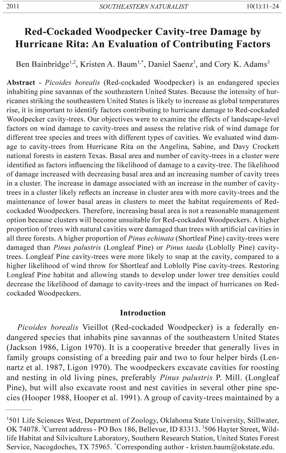
of the path of the eye of Hurricane Rita (Fig. 1).
The Sabine National Forest is a 65,015-ha pine forest located on the Texas
side of the Louisiana/Texas border in San Augustine, Shelby, and Sabine counties.
It is bordered on the eastern edge by Toledo Bend Reservoir and divided
into northern and southern portions by private lands. The northern portion is
composed predominantly of Shortleaf and Loblolly Pine, while the southern
portion is predominantly Longleaf Pine. The lake shore of Toledo Bend Reservoir
has not been developed to the extent of Sam Rayburn Reservoir. The eye
of Hurricane Rita passed approximately 19 km to the west of Sabine National
Forest (Fig. 1).
The Davy Crockett National Forest is a 65,564-ha pine forest located
in Houston and Trinity counties. Unlike the Angelina and Sabine national
forests, Davy Crockett National Forest is not bordered by a reservoir. Shortleaf
Pine is the dominant species. The Davy Crockett National Forest is the
most developed of the three national forests, with the towns of Kennard and
Groveton located adjacent to the national forest. The Davy Crockett National
Forest is located approximately 95 km west of the path of the eye of Hurricane
Rita (Fig. 1).
Methods
A large-scale damage assessment on the Angelina, Sabine, and Davy Crockett
national forests was undertaken by the United States Forest Service following
14 Southeastern Naturalist Vol. 10, No. 1
Hurricane Rita. For each damaged Red-cockaded Woodpecker cavity-tree, the
compartment, cluster, tree number, tree species (Longleaf, Shortleaf, or Loblolly
Pine), damage type (wind thrown or snapped), cavity type (artificial [Allen
1991], natural, or start [an incomplete cavity]), azimuth of fall, and diameter at
breast height (DBH) were recorded.
Figure 1. The locations of the Angelina, Sabine, and Davy Crockett national forests in
Texas in relation to the path of Hurricane Rita. The path of the eye of Hurricane Rita from
24 September 2005 is represented by the bold, dashed line.
2011 B. Bainbridge, K.A. Baum, D. Saenz, and C.K. Adams 15
The distance to the nearest windward clearing was measured in ArcView
9.1 (Environmental Systems Research Institute, Redlands, CA) using 2004
National Agricultural Imagery Program (NAIP) images with a 1- x 1-m resolution,
a GIS layer of all damaged clusters, and the direction of the wind based
on azimuth of tree fall (average of 202o [SSW] and 220o [SW] for cavity-trees
on the Angelina and Sabine national forests, respectively). Azimuth of fall
and geographic coordinates for downed cavity-trees on the Davy Crockett
National Forest were not available, so the average azimuth of fall for trees on
the Angelina National Forest was used for these clusters because the Angelina
National Forest is the closest national forest for which data were available.
An equal number of clusters not damaged by Hurricane Rita were randomly
chosen as control clusters. The average azimuth of fall of all damaged cavitytrees
for each national forest was used to determine the wind direction for the
undamaged clusters because variation in individual tree azimuths due to roads
or other clearings may have funneled the wind in slightly different directions
making the azimuth of fall for the nearest damaged cavity-tree inaccurate for
undamaged clusters.
We also obtained a GIS shape file (NOAA 2006) which denoted where the
storm changed index ratings on the Saffir-Simpson Scale, which is used to classify
hurricanes and tropical storms. Hurricane Rita became a category 1 storm
approximately 91 km after making landfall and remained a category 1 storm for
123 km. Taking into account that category 1 winds range from 119–153 km/h,
we developed a graded scale for the category 1 and tropical storm sections of the
storm based on the assumption that wind speed dropped at a constant rate of approximately
7 km/h with every 25 km the storm traveled north. The HURRECON
model, which was developed to model the winds of a hurricane given a specific
set of meteorological data (Boose et al. 1994), was used to estimate wind speed
at each damaged and undamaged cluster.
Basal area was estimated using a one-factor metric basal-area prism. All
measurements were made to the northeast of each damaged or undamaged control
cluster to account for the direction of the wind. One measurement was taken
at the northeastern-most cavity-tree in a cluster, and a second measurement was
taken 50 m to the northeast of that cavity-tree. The average of these two locations
was used to represent the basal area of the forest directly to the northeast
of each cluster.
Midstory density was visually estimated based on the northeastern-most
cavity-tree of each damaged and undamaged control cluster by categorizing the
midstory into 1 of 5 categories (Saenz et al. 2002). A cluster with a midstory
value of 5 had a thick, wall-like midstory to the northeast, and a cluster with a
midstory value of 1 had an open, savanna-like midstory. Categories 2, 3, and 4
ranged in between, with category 3 being a half-full midstory. Estimates were
made for a 60° wide section of midstory extending out 100 m from the northeastern-
most cavity-tree to account for small fluctuations in wind direction
during Hurricane Rita.
16 Southeastern Naturalist Vol. 10, No. 1
Elevation for each damaged and undamaged control cluster was obtained from
3-m (10-ft) interval digital topographic maps available from the Texas National
Resource Information System (2006). The DBH of each damaged cavity-tree was
measured in centimeters using a logger’s tape. The DBH of the closest undamaged
tree of the same species and cavity type also was recorded.
A multiple logistic regression analysis was performed to evaluate the effect
of landscape-level factors on wind damage to cavity-trees, including distance
to nearest windward clearing, wind speed, basal area, midstory density, number
of trees in a cluster, and elevation. A paired t-test was used to compare DBH
between damaged and undamaged cavity-trees on the Angelina National Forest.
A Wilcoxon signed rank test was used to compare DBH between damaged
and undamaged cavity-trees on the Davy Crockett National Forest and on the
Angelina and Davy Crockett national forests combined because the data were
not normally distributed. Diameter at breast height of downed cavity-trees on
the Sabine National Forest was not available for analysis. We used a chi-square
test to compare expected and observed values for presence/absence of damage
and cavity type (natural or artificial; starts were excluded because of the
small number of damaged starts; trees with both a cavity and start were included
based on cavity type), and presence/absence of damage and tree species
(Longleaf, Shortleaf, or Loblolly Pine). We also used a chi-square test to compare
expected and observed values for damage type (wind throw or snap) and
cavity type, and damage type and tree species. Analyses were performed using
SAS 9.1 (The SAS Institute, Carey, NC), and the significance level was set at α
= 0.05.
Results
A total of 122 of 1805 cavity-trees were damaged on the Angelina, Davy
Crockett, and Sabine national forests. On the Angelina National Forest, 59 cavity-
trees were downed by Hurricane Rita and 34 of 84 surveyed clusters had at
Table 1. Results of a multiple logistic regression model for the effect of landscape-level factors
on wind damage to Red-cockaded Woodpecker cavity-trees. Variables in bold were significant
factors.
Variable EstimateA SEB χ2 C P > χ2 D Odds ratio
Intercept 1.335 2.428
Midstory density -0.362 0.211 2.932 0.087 0.70
Basal area -0.108 0.043 6.347 0.012 0.90
Distance to clearing 0.001 0.001 0.023 0.880 1.00
Wind speed -0.006 0.010 0.383 0.536 1.03
Number of trees 0.215 0.051 17.464 less than 0.001 1.24
Elevation -0.004 0.015 0.055 0.815 0.99
AEstimate of explanatory slope (βx).
BStandard error of slope estimate.
Cχ2 statistic testing Ho: slope estimate = 0.
DProbability to reject Ho.
2011 B. Bainbridge, K.A. Baum, D. Saenz, and C.K. Adams 17
least one downed cavity-tree. Ten cavity-trees in 8 of 46 surveyed clusters were
damaged by Hurricane Rita on the Sabine National Forest. On the Davy Crockett
National Forest, 53 cavity-trees were damaged in 26 of 83 surveyed clusters.
Basal area and number of trees in a cluster were the only variables to significantly
influence the probability of wind damage (Table 1, Fig. 2). The probability of
damage in a cluster decreased 10% with each unit increase of basal area (m2/ha)
Figure 2. The number of damaged and undamaged cavity-trees per cluster (mean ± se)
in the Angelina, Sabine, and Davy Crockett national forests (part A). Basal area (m2/
ha; mean ± se) of damaged and undamaged clusters in the Angelina, Sabine, and Davy
Crockett national forests (part B). Data for damaged clusters are represented by shaded
bars and undamaged clusters by white bars.
18 Southeastern Naturalist Vol. 10, No. 1
and increased 24% with each additional tree in a cluster (see the odds ratio column
in Table 1). There was no difference in DBH between damaged and undamaged
cavity-trees on either the Angelina or Davy Crockett national forests (df =
40, t = -1.860, P = 0.070; Z = 0.210, P = 0.839, respectively), or for both forests
combined (Z = 1.354, P = 0.177).
A higher proportion of trees with natural cavities were damaged on the Angelina
(12.7% compared to 6.4% of trees with artificial cavities; df = 1, χ2 = 6.35,
P = 0.012), Sabine (7.7% compared to 2.3% of trees with artificial cavities; df =
1, χ2 = 4.164, P = 0.041), and Davy Crockett national forests (12.4% compared
to 6.3% of trees with artificial cavities; df = 1, χ2 = 6.586, P = 0.010), and for all
three forests combined (11.9% compared to 5.4% of trees with artificial cavities;
df = 1, χ2 = 20.506, P < 0.001).
A higher proportion of Shortleaf Pine cavity-trees (17.3%) were damaged, on
the Angelina National Forest, than Longleaf (4.7%) or Loblolly (8.1%) cavitytrees
(df = 2, χ2 = 19.988, P < 0.001). A higher proportion of Shortleaf Pine
cavity-trees (9.8%) were damaged than Loblolly cavity-trees (1.3%) on the Davy
Crockett National Forest (df = 1, χ2 = 11.905, P < 0.001; no cavities were located
in Longleaf Pine). There was no difference in damage among tree species on the
Sabine National Forest (df = 2, χ2 = 0.996, P = 0.318). When all three forests were
combined, a higher proportion of Shortleaf Pine cavity-trees (10.8%) were damaged
than Longleaf (4.2%) or Loblolly (4.9%) cavity-trees (df = 2, χ2 = 24.785,
P < 0.001).
There was no association between damage type (snap or wind throw) and cavity
type on the Angelina (df = 1, χ2 = 3.03, P = 0.082), Sabine (df = 1, χ2 = 0.104,
P = 0.747), or Davy Crockett national forests (df = 1, χ2 = 0.288, P = 0.592), or
for all three forests combined (df = 1, χ2 = 2.677, P = 0.102).
On the Angelina National Forest, Longleaf Pine cavity-trees predominantly
suffered a snap (69.6%), whereas Shortleaf Pine and Loblolly Pine cavity-trees
predominantly suffered wind throw events (85.7% and 60%, respectively; df = 2,
χ2 = 13.784, P = 0.001). Tree species did not differ with regards to damage type
on the Sabine or Davy Crockett national forests (df = 1, χ2 = 0.476, P = 0.490;
df = 1, χ2 = 1.26, P = 0.262, respectively), or for all three forests combined (df =
2, χ2 = 3.512, P = 0.173).
Discussion
Distance to the closest windward clearing was not an important factor influencing
which clusters were more likely to lose cavity-trees during a hurricane
(Table 1). However, numerous studies on wind damage to forests have shown that
trees on the windward edges of stands—where the wind enters the canopy—are
at greater risk of wind damage than trees located on the leeward edge of the stand
(Gordon 1973, Tang et al. 1997, Zeng et al. 2004). One possible explanation is
that the cluster itself may be open enough for wind to enter the canopy and damage
a cavity-tree. Wind may be funneled into clusters if the surrounding forest
possesses higher tree densities, and thinning may make trees not previously
2011 B. Bainbridge, K.A. Baum, D. Saenz, and C.K. Adams 19
exposed to high winds more vulnerable to damage (Conner and Rudolph 1995b,
Zeng et al. 2004). This explanation also may account for why the number of
trees in a cluster significantly influenced the probability of damage in a cluster
(Fig. 2A). Cluster area tends to increase with the number of cavity-trees, and
larger clusters may be more susceptible to wind damage because of the larger
cluster area (Table 1).
Basal area also significantly influenced the probability of damage in a cluster,
with the probability of damage decreasing with increasing basal area (Table 1,
Fig. 2B). Alexander (1964) showed that thinning of spruce-fir forests increased
the vulnerability of the entire stand to wind damage. Furthermore, stands of mature
trees which are thinned may be more susceptible to damaging winds (Zeng
et al. 2004) because of a decrease in lateral support provided by contact among
the crowns (Cucchi and Bert 2003). However, higher basal areas (i.e., higher
stand densities) are less suitable for Red-cockaded Woodpeckers and the 19 m2/
ha basal area observed on the Davy Crockett National Forest is approaching the
upper limit of suitable basal area for Red-cockaded Woodpeckers (James et al.
2001, Walters et al. 2002).
Wind speed, elevation, and midstory density did not affect the probability
of damage (Table 1). Midstory density may not protect against catastrophic
wind events because most of the stress incurred on mature pine trees occurs
from wind passing over the canopy, not moving through the boles of the trees
(Putz et al. 1983). Furthermore, increased hardwood midstory is detrimental
to Red-cockaded Woodpeckers (Ligon 1970) because of decreased arthropod
biomass (Collins et al. 2002), interference with foraging locations on pines
(Rudolph et al. 2002), and increased competition for cavities from other species
(Borgo et al. 2006, Conner and Rudolph 1989). Diameter at breast height
did not differ between damaged and undamaged cavity-trees, although one
might expect to find larger pine trees damaged by severe wind events (Oswalt
and Oswalt 2008) as well as larger cavity-trees, given the higher probability of
red heart disease in older trees (Hooper 1988, Hooper et al. 1991).
Trees with natural cavities were more likely to be damaged than trees with
artificial cavities on the Angelina, Sabine, and Davy Crockett national forests.
Red-cockaded Woodpeckers typically select pines with fungal heart rot for cavity
excavation (Conner and Locke 1982, Hooper 1988, Hooper et al. 1991, Jackson
1977), which may weaken the bole of a tree more than the addition of an artifi-
cial cavity. Artificial cavities are generally placed in trees with sound heartwood,
since decayed heartwood makes it more difficult to secure the artificial cavity into
the tree (Allen 1991).
There was no difference in presence/absence of damage among tree species
on the Sabine National Forest. Shortleaf Pine cavity-trees were more likely
to receive damage on the Angelina and Davy Crockett national forests. Given
the small sample size on the Sabine National Forest, and the dominance of
Shortleaf Pine on the Davy Crockett National Forest, the variation found on
the Angelina National Forest provides the best information about the relative
20 Southeastern Naturalist Vol. 10, No. 1
susceptibility of different tree species to hurricane damage. On the Angelina
National Forest, Shortleaf Pine cavity-trees had the highest incidence of damage.
Gresham et al. (1991) and Johnsen et al. (2009) evaluated the frequency
of damage to Longleaf and Loblolly Pines without cavities following Hurricanes
Hugo and Katrina, respectively, and found that Longleaf Pines were less
likely to suffer damage than Loblolly Pines. Longleaf Pines typically have a
tap root extending 2.4–3.7 m deep, which may make them more stable during
storms (Wahlenburg 1946). Loblolly and Shortleaf Pines grow on clay based
soils and do not have a large or deep root structure (Little and Somes 1964,
Wahlenburg 1960).
Longleaf Pine cavity-trees were more vulnerable to trunk snap as opposed to
wind throw than Loblolly and Shortleaf Pine cavity-trees on the Angelina National
Forest. The southern portion of the Angelina National Forest is dominated
by Longleaf Pines growing on deep, loamy sands (Conner and Rudolph 1995a).
The deep root structure of Longleaf Pines likely causes them to appear to be
more prone to snapping at the cavity because wind stress incurred on the trunk
will snap the trunk before the root structure gives way. Seventy-four percent of
snapped cavity-trees were snapped at the cavity, not at other heights on the trunk,
indicating the cavity creates a point of weakness in the tree trunk and increases
its vulnerability to snapping.
Loblolly and Shortleaf Pine cavity-trees were more likely to be wind thrown
than expected by chance on the Angelina National Forest. The northern half of
the Angelina National Forest is dominated by Shortleaf and Loblolly Pines growing
on shallow, mesic, shrink-swell clay soil types (Conner and Rudolph 1995a).
These types of soil causes them to have a shallow root system and may make
them more prone to wind throw. However, this may not always be the case, such
as with Loblolly Pines on the Congaree Swamp National Monument in South
Carolina which were equally likely to be snapped or wind thrown following Hurricane
Hugo (Putz and Sharitz 1991).
There was no association between cavity type and damage type. Artificialcavity
installation involves using a chainsaw to cut a rectangular portion out of
the bole of a mature, healthy tree and securing an artificial-cavity box (10.16 x
25.4 x 15.24 cm) into the space created (Allen 1991). Thus, despite the invasive
nature of artificial-cavity installation, the trees still can withstand catastrophic
wind events, as demonstrated by the roots yielding before the trunk snaps at the
cavity in Loblolly and Shortleaf Pines. The substantial root system of the Longleaf
Pine likely supports the tree past the breaking point, causing the tree to snap
at the cavity, regardless of the type of cavity present.
The HURISK model identified return intervals for hurricanes to specific
areas of the southeastern United States (Neuman 1987). However, these return
intervals may change as global temperatures continue to rise, and the intensity of
hurricanes striking the southeastern United States is likely to increase (Bengtsson
et al. 1996, Trenberth 2005, Webster et al. 2005). In 2005, two major hurricanes,
Katrina and Rita, struck the southeastern United States in one month, causing
damage to forest resources estimated between $2 and $3 billion (Stanturf et al.
2011 B. Bainbridge, K.A. Baum, D. Saenz, and C.K. Adams 21
2007). Thus, it is important to identify factors contributing to hurricane damage
in the southern pine savannah and to Red-cockaded Woodpecker cavity-trees.
However, predicting damage at the level of stands or individual trees can be difficult with heterogeneous environmental conditions, especially when attempting
to apply results at the landscape scale (Oswalt and Oswalt 2008).
Longleaf Pines were more resistant to strong winds than Loblolly and
Shortleaf Pines, with Longleaf Pines primarily being snapped at the cavity,
whereas Loblolly and Shortleaf Pines were wind thrown prior to the point of
snapping. Restoration of Longleaf Pine habitat and the establishment of Redcockaded
Woodpecker populations in restored areas could reduce cavity-tree
damage during hurricanes. Furthermore, allowing stands to develop under
lower tree densities would decrease the likelihood of damage to cavity-trees
compared to stands that are thinned once mature (Zeng et al. 2004). When
cavity losses do occur, artificial cavities can be installed to mitigate these
losses, as cavity-trees with artificial cavities are less susceptible to wind damage
than cavity-trees with natural cavities.
Acknowledgments
Financial assistance for this study was provided by the Wildlife Habitat and Silviculture
Lab, Southern Research Station, United States Forest Service, Nacogdoches, TX;
the Payne County Audubon Society; and the Department of Zoology, Oklahoma State
University, Stillwater, OK. We thank K. McBee, T. O’Connell, and two anonymous reviewers
for comments on an earlier draft of the manuscript. We thank J. Pierce for field
and technical assistance.
Literature Cited
Alexander, R.R. 1964. Minimizing windfall around clear-cuttings in spruce-fir forests.
Forest Science 10:130–142.
Allen, D.H. 1991. An insert technique for constructing artificial Red-cockaded Woodpecker
cavities. General Technical Report SE-73. Southeastern Forest Experiment
Station, Forest Service, US Department of Agriculture. Asheville, NC. 19 pp.
Bengtsson, L., M. Botzet, and M. Esch. 1996. Will greenhouse gas-induced warming
over the next 50 years lead to higher frequency and greater intensity of hurricanes?
Tellus 48:57–73.
Boose, E.R., D.R. Foster, and M. Fluet. 1994. Hurricane impacts of tropical and temperate
forest landscapes. Ecological Monographs 64:369–400.
Borgo, J.S., M.R. Conover, and L.M. Conner. 2006. Nest boxes reduce flying squirrel use
of Red-Cockaded Woodpecker cavities. Wildlife Society Bulletin 34:171–176.
Collins, C.S., R.N. Conner, and D. Saenz. 2002. Influence of hardwood midstory and pine
species on pine bole arthropods. Forest Ecology and Management 164:211–220.
Conner, R.N., and B.A. Locke. 1982. Fungi and Red-cockaded Woodpecker cavity-trees.
The Wilson Bulletin 94:64–70.
Conner, R.N., and D.C. Rudolph. 1989. Red-cockaded Woodpecker colony status and
trends on the Angelina, Davy Crockett, and Sabine national forests. Research Paper
SO-250. Southern Forest Experiment Station, Forest Service, US Department of Agriculture.
New Orleans, LA. 15 pp.
22 Southeastern Naturalist Vol. 10, No. 1
Conner, R.N., and D.C. Rudolph. 1995a. Red-cockaded Woodpecker population
trends and management on Texas national forests. Journal of Field Ornithology
66:140–151.
Conner, R.N., and D.C. Rudolph. 1995b. Wind damage to Red-Cockaded Woodpecker
cavity-trees on eastern Texas national forests. Pp. 183–190, In D.L. Kulhavy, R.G.
Hooper, and R. Costa (Eds.). Red-Cockaded Woodpecker: Recovery, Ecology, and
Management. Center for Applied Studies in Forestry, College of Forestry, Stephen F.
Austin State University. Nacogdoches, TX. 551 pp.
Cucchi, V., and D. Bert. 2003. Wind-firmness of Pinus pinaster Aїt. stands in southwest
France: Influence of stand density, fertilization, and breeding in two experimental
stands damaged during the 1999 storm. Annals of Forest Science 60:209–226.
Gordon, D.T. 1973. Damage from wind and other causes in mixed White Fir–Red Fir
stands adjacent to clearcuttings. Research Paper PSW-RP-90. Pacific Southwest Forest
and Range Experiment Station, Forest Service, US Department of Agriculture.
Berkeley, CA. 22 pp.
Gresham, C.A., T.M. Williams, and D.J. Lipscomb. 1991. Hurricane Huge wind damage
to southeastern US coastal forest tree species. Biotropica 23:420–426.
Hooper, R.G. 1988. Longleaf Pines used for cavities by Red-cockaded Woodpeckers.
Journal Wildlife Management 52:392–398.
Hooper, R.G. 1995. Hurricanes and the long-term management of the Red-cockaded
Woodpecker. Pp. 148–166, In D.L. Kulhavy, R.G. Hooper, and R. Costa (Eds.). Red-
Cockaded Woodpecker: Recovery, Ecology, and Management. Center for Applied
Studies in Forestry, College of Forestry, Stephen F. Austin State University. Nacogdoches,
TX. 551 pp.
Hooper, R.G., M.R. Lennartz, and H.D. Muse. 1991. Heart rot and cavity-tree selection
by Red-cockaded Woodpeckers. Journal of Wildlife Management 55:323–327.
Jackson, J.A. 1977. Red-cockaded Woodpecker and pine red heart disease. The Auk
94:160–163.
Jackson, J.A. 1986. Biopolitics, management of federal lands, and the conservation of the
Red-cockaded Woodpecker. American Birds 40:1162–1168.
James, F.C., C.A. Hess, B.C. Kicklighter, and R.A. Thum. 2001. Ecosystem management
and the niche gestalt of the Red-cockaded Woodpecker in Longleaf Pine forests. Ecological
Applications 11:854–870.
Johnsen, K.H., J.R. Butnor, J.S. Kush, R.C. Schmidtling, and C.D. Nelson. 2009. Hurricane
Katrina winds damaged Longleaf Pine less than Loblolly Pine. Southern Journal
of Applied Forestry 33:178–181.
Lennartz, M.R., R.G. Hooper, and R.F. Harlow. 1987. Sociality and cooperative breeding
of Red-cockaded Woodpeckers (Picoides borealis). Behavioral Ecology and Sociobiology
20:77–88.
Ligon, J.D. 1970. Behavior and breeding biology of the Red-cockaded Woodpecker. The
Auk 87:255–278.
Little, S., and H.A. Somes. 1964. Root systems of direct-seeded and variously planted
Loblolly, Shortleaf, and Pitch Pines. Research Paper NE-26. Northeastern Forest Experiment
Station, Forest Service, US Department of Agriculture. Upper Darby, PA.
13 pp.
Loope, L., M. Duever, A. Herndon, J. Snyder, and D. Jansen. 1994. Hurricane impact on
uplands and freshwater swamp forests. BioScience 44:238–246.
2011 B. Bainbridge, K.A. Baum, D. Saenz, and C.K. Adams 23
National Oceanic and Atmospheric Administration (NOAA), Tropical Prediction Center/
National Hurricane Center. 2006. Historical North Atlantic and east-central North
Pacific tropical cyclone tracks, 1851–2005. Available online at http://www.csc.noaa.
gov/hurricane_tracks. Accessed 5 December 2006.
Nuemann, C.J. 1987. The National Hurricane Center Risk Analysis Program (HURISK).
National Oceanic and Atmospheric Administration (NOAA) Technical Memorandum
NWS NHC 38. National Hurricane Center, National Weather Service, National Oceanic
and Atmospheric Administration. Coral Gables, fl. 56 pp.
Oswalt, S.N., and C.M. Oswalt. 2008. Relationships between common forest metrics and
realized impacts of Hurricane Katrina on forest resources in Mississippi. Forest Ecology
and Management. 255:1692–1700.
Putz, F.E., and R.R. Sharitz. 1991. Hurricane damage to old growth forests in Congaree
Swamp National Monument, South Carolina, USA. Canadian Journal of Forest Research
21:1765–1760.
Putz, F.E., P.D. Coley, K. Lu, A. Montalvo, and A. Aiello. 1983. Uprooting and snapping
of trees: Structural determinants and ecological consequences. Canadian Journal of
Forest Research 13:1011–1020.
Rudolph, D.C., R.N. Conner, and R.R. Schaefer. 2002. Red-cockaded Woodpecker
foraging behavior in relation to midstory vegetation. The Wilson Bulletin
114:235–242.
Saenz, D., R.N. Conner, and J.R. McCormick. 2002. Are Pileated Woodpeckers attracted
to Red-cockaded Woodpecker cavity-trees? The Wilson Bulletin 114:291–296.
Stanturf, J.A., S.L. Goodrick, and K.W. Outcalt. 2007. Disturbance and coastal forests:
A strategic approach to forest management in hurricane impact zones. Forest Ecology
and Management 250:119–135.
Tang, S.M., J.F. Franklin, and D.R. Montgomery. 1997. Forest-harvest patterns and
landscape-disturbance processes. Landscape Ecology 12:349–363.
Texas Natural Resource Information System. 2006 Interval Digital Topographic Maps.
Available online at http://www.tnris.state.tx.us/datadownload/download.jsp. Accessed
10 January 2007.
Torres, R.A., and P.L. Leberg. 1996. Initial changes in habitat and abundance of cavitynesting
birds and the Northern Parula following Hurricane Andrew. The Condor
98:483–490.
Trenberth, K. 2005. Uncertainty in hurricanes and global warming. Science
308:1753–1754.
Wahlenberg, W.G. 1946. Longleaf Pine: Its use, ecology, regeneration, protection,
growth, and management. Charles Lathrop Pack Forestry Foundation and Forest Service,
US Department of Agriculture. Washington, DC. 429 pp.
Wahlenberg, W.G. 1960. Loblolly Pine: Its use, ecology, regeneration, protection, growth,
and management. School of Forestry, Duke University. Durham, NC. 603 pp.
Walters, J.R., P.D. Doerr, and J.H. Carter III. 1988. The cooperative breeding system of
the Red-cockaded Woodpecker. Ethology 78:275–305.
Walters, J.R., S.J. Daniels, J.H. Carter III, and P.D. Doerr. 2002. Defining quality of Redcockaded
Woodpecker foraging habitat based on habitat use and fitness. Journal of
Wildlife Management 66:1064–1082.
24 Southeastern Naturalist Vol. 10, No. 1
Watson, J.C., D.L. Carlson, W.E. Taylor, and T.E. Milling. 1995. Restoration of the
Red-Cockaded Woodpecker population on the Francis Marion National Forest: Three
years post Hugo. Pp. 172–182, In D.L. Kulhavy, R.G. Hooper, and R. Costa (Eds.).
Red-Cockaded Woodpecker: Recovery, Ecology, and Management. Center for Applied
Studies in Forestry, College of Forestry, Stephen F. Austin State University.
Nacogdoches, TX. 551 pp.
Webster, P.J., G.J. Holland, J.A. Curry, and H.R. Chang. 2005. Changes in tropical
cyclone number, duration, and intensity in a warming environment. Science
309:1844–1846.
Zeng, H., H. Peltola, A. Talkkari, A. Venalainen, H. Strandman, S. Kellomaki, and K.
Wang. 2004. Influence of clear-cutting on the risk of wind damage at forest edges.
Forest Ecology and Management 203:77–88.


 The Southeastern Naturalist is a peer-reviewed journal that covers all aspects of natural history within the southeastern United States. We welcome research articles, summary review papers, and observational notes.